| Note: In technical sessions the author(s) presenting the paper have been marked in italic style. |
| Friday, 26 May |
Friday,
26 May
09:00–17:00
Bradford - FIG PRESIDENT OFFICE, Hilton/Waldorf
| FIG COUNCIL MEETING
Chair: Dr. Diane Dumashie, FIG President, United Kingdom
|
| Saturday, 27 May |
Saturday,
27 May
09:00–13:00
Taylor, Hilton/Waldorf
| APPAT GENERAL ASSEMBLY
APPAT promotes the different disciplines of surveying and stimulates research in all disciplines of surveying. APPAT consists of 25 member organizations from 15 countries throughout the Americas and Spain. https://colegiotopografoscr.com/appat/index.html
|
Saturday,
27 May
09:00–17:00
Brevard - FIG MEETING ROOM, Hilton/Waldorf
| ACCO MEETING
Chair: Mr. Mikael Lilje, FIG Vice President, Sweden
Rapporteur: Ms. Louise Friis-Hansen, FIG Director, Denmark
|
Saturday,
27 May
09:00–18:00
Citrus/Collier/Columbia, Hilton/Waldorf
| 1ST FIG YOUNG SURVEYORS AMERICAS MEETING
Chair: Ms. Shirley Chapunza, Zimbabwe
Rapporteur: Dr. Jacob Heck, United States
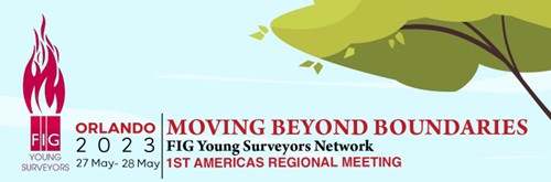
The Young Surveyors meeting will take place 27-28 May 2023
with the theme: “Moving Beyond Boundaries”
| Opening Ceremony |
|
Welcome by
- Winnie Shiu - FIG Vice President
- Tim Burch - NSPS Executive Director
- John Hohol - FIG Foundation President
- Shirley Chapunza and Jacob Heck
- FIG Young Surveyors Network
|
| Leveraging Technology to Move Beyond
Boundaries (10603) |
|
To begin with our 1st America’s Young Surveyors Meeting, join
our keynote speakers with their presentations about the
important role technology plays in solving key issues within the
Survey Community.
|
|
Updates from regional networks
|
|
Let’s take an opportunity to hear from colleagues from the
Americas and other places to see the kinds of interesting
activities that young surveyors are doing.
|
|
Diversity, Equity and Inclusion (10604)
|
|
Six different cultural backgrounds but one passion in common:
Survey. Join these Young Surveyors on their path of becoming
professionals, their work and personal experiences, boundaries &
challenges they have encountered, and how they managed to
overcome them and where it got them to be.
|
|
Charity Event (Sponsored by Trimble)
|
BINGO!
The proceeds from the Charity event will go to the FIG YSN’s
Volunteer Community Surveyor Program, and the FIG Foundation.
This year’s Charity Event is sponsored by Trimble Inc.!
Let’s gather and have some fun playing the classic game of
BINGO!
|
| VCSP: Volunteer Community Surveyor
Program |
|
The VCSP will take its turn to discuss the role and
responsibilities of young surveyors in addressing emerging
challenges within the surveying and land administration sector.
The discussion will explain to participants how the VCSP has
engaged tenure security and mentorship. It will also help
participants understand how they can get involved in addressing
tenure security challenges and mentoring.
|
|
What is GIS (Presented by Esri) (10605)
|
|
Who better than representatives from Esri to speak to us
about one of the most important pieces of the geospatial puzzle.
In this session we will learn about GIS and some of its
applications to the work that we do.
|
|
Wrap-up Day 1
|
|
Dinner/ Social Event - Splitsville - Bowling and
American Fare
|
|
Bowl down memory lane while enjoying an upscale spin on this
classic American pastime—with fun to spare! A dinner buffet,
drinks, and bowling are provided free of charge from our
wonderful sponsor Leica Geosystems.
|
|
Saturday,
27 May
13:00–16:30
Palm Beach, Hilton/Waldorf
| SCIENTIFIC WORKSHOP ON UNCERTAINTY AND QUALITY OF MULTI-SENSOR SYSTEMS
Commission: 5 & 6
Chair: Prof. Volker Schwieger, Germany
Theoretical and numerical developments as well as state-of-the-art best-practise examples (monitoring surveys: GNSS and total stations, terrestrial laser scanning, point-wise and area-wise monitoring, kinematic positioning, sensor fusion, mobile mapping) will be presented at the workshop.
SESSION 1: QUALITY OF TERRESTRIAL LASERSCANNING
Session Chair: Prof. Dr. Werner Lienhart, Chair FIG Commission 6, Austria
Corinna Harmening and Ramon Butzer (Germany):
Quality Investigations of Different Modelling Approaches for Laser Scanning Point Clouds Representing Natural Surfaces (12112)
[abstract] [paper]
[handouts] [video] Jens-André Paffenholz, Yu Lan and Alexander Dorndorf (Germany):
Direct Geo-Referencing of 3d Point Clouds in a Multi-Sensor System Approach (12256)
[abstract]
[paper] [handouts]
[video] Jan Hartmann, Ingo Neumann, Hamza Alkhatib and Dominik Ernst (Germany):
Improving Terrestrial Laser Scanning Accuracy: Modeling Distance Uncertainties with Machine Learning Techniques (12254)
[abstract] [paper]
[handouts] [video]
SESSION 2: QUALITY MODELS AND UNCERTAINTY OF MONITORING SENSORS
Session Chair: Prof. Corinna Harmening, Germany
Li Zhang, Laura Balangé and Volker Schwieger (Germany):
Geometric Quality Assurance within the Research Cluster IntCDC (12021)
[abstract] [paper]
[handouts] [video] Werner Lienhart (Austria):
Uncertainty Assessment of High Frequent Strain Measurements (12250)
[abstract] [paper]
[handouts] [video] Annette Scheider, Eike Barnefske and Harald Sternberg (Germany):
FOS-Based Monitoring of Underwater Port Structures (12160)
[abstract] [paper]
[handouts] [video]
Pre-event sponsors:
|
Saturday,
27 May
13:00–18:00
Orange, Hilton/Waldorf
| TECHNICAL SEMINAR ON REFERENCE FRAMES IN PRACTISE
Chair: Dr. Ryan Keenan, Chair FIG Commission 5, Australia
Rapporteur: Dr. Kevin Ahlgren, United States
WELCOME AND OPENING REMARKS
Dr. Ryan Keenan, Chair, FIG Commission 5;
Mr. Tim Burch, Executive Director, National
Society of Professional Surveyors
SESSION 1: INTERNATIONAL GEODESY INITIATIVES
1) ICG at UN
Ms. Sharafat Gadimova, United Nations Office for Outer Space
Affairs
2) UN-GGIM Subcommittee on Geodesy and Education, Training, and
Capacity Building Working Group
Dr. Daniel R. Roman, Chair for WG on Education, Training and
Capacity Building
3) The International GNSS Service and International Association of Geodesy: Serving Surveyors
Ms. Allison Craddock, IGS Bureau Director
SESSION 2: INTRODUCTION TO GEODETIC REFERENCE FRAMES
4) Introduction to Geodetic Reference Frame Theory
Dr. Chris Pearson, University of Otago, New Zealand
5) Introduction to Vertical Reference Frames
Dr. Kevin Ahlgren, National Geodetic Survey, USA
The organisers FIG, NSPS, UN ICG, IAG, & IGS would like to thank and acknowledge the following sponsor for their generous support of this event:

Pre-event supporter:
|
Saturday,
27 May
14:00–15:00
Citrus/Collier/Columbia, Hilton/Waldorf
| FIG YOUNG SURVEYOR CHARITY EVENT - BINGO

|
| Sunday, 28 May |
Sunday,
28 May
08:00–15:00
Orange, Hilton/Waldorf
| TECHNICAL SEMINAR ON REFERENCE FRAMES IN PRACTISE
Chair: Dr. Ryan Keenan, Chair FIG Commission 5, Australia
Rapporteur: Dr. Kevin Ahlgren, United States
SESSION 3: IGS AND OGC
6) Open Geospatial Consortium (OGC) Standards
Mr. Roger Lott, EPSG, USA; Mr. Keith
Ryden, ESRI, USA; and Mr. Chris Crook,
LINZ, New Zealand
7) Eldar Rubinov (Australia):
Ginan - Open Source Analysis Centre Software from Geoscience Australia (12120)
[abstract] [paper] [handouts] [video]
SESSION 4: CASE STUDIES I
8) One Pacific, One Map
Mr. Andrick Lal, South Pacific Communities,
Fiji
9) United States: Development of a modernized NSRS in the
U.S.
Dr. Michael Dennis, National Geodetic Survey, USA
SESSION 5: CASE STUDIES II
10) Taiwan
Prof.Peter T.Y. Shih, National Yang Ming
Chiao Tung University, Taiwan
11) Uruguay
Ms. Daniela Cuentas Lugan,
12) The Philippines: NAMRIA challenges in PGD2020
Ms. Hennesey Marohom, NAMRIA
13) Exploring the Lunar Reference Frame
Mr. Joshua Critchley-Marrows, University of
Sydney, Australia
PANEL DISCUSSION
Presenters from Session 4 & 5 CLOSING
Dr Ryan Keenan, FIG Commission 5 Chair
|
Sunday,
28 May
08:30–12:00
Citrus/Collier/Columbia, Hilton/Waldorf
| 1ST FIG YOUNG SURVEYORS AMERICAS MEETING
Chair: Ms. Shirley Chapunza, Zimbabwe
Rapporteur: Dr. Jacob Heck, United States
| Developing and
Engaging with the Next Generation (10606) |
|
The key to maintaining sustainability within the geospatial
industry lies in the engagement and making opportunities for the
next generation. In this session we will listen to and engage
with industry professionals who are going above and beyond to
not only provide career growth but are also marketing the
profession to new people.
Public Outreach and Awareness:
- Get Kids Into Survey: Trent & Heather Keenan
(Diamondback Land Surveying)
Workforce Development:
- Apprenticeship program for surveyors: Tim Murphy (SAM -
Surveying & Mapping, Inc.)
- Mentoring Mondays & Wisdom Wednesday:Trent Keenan
(Diamondback Land Surveying)
- Training the next generation of surveyors: Dr. Youssef
Kaddoura (University of Florida)
|
| Future of the Young Surveyors Network |
|
This session provides an open discussion on how the FIG Young
Surveyors Network and its affiliate members will continue to
grow and keep the geospatial industry relevant.
|
|
Closing and wrap-up
|
|
After two long days of discussion, we will look back on what
we learned and see what we can do to move forward together.
|
Sponsors:
Platinum
Silver
|
Sunday,
28 May
09:00–13:00
Palm Beach, Hilton/Waldorf
| SCIENTIFIC WORKSHOP ON UNCERTAINTY AND QUALITY OF MULTI-SENSOR SYSTEMS
Chair: Prof. Volker Schwieger, Germany
SESSION 3: MULTI-SENSOR-SYSTEMS FOR KINEMATIC POSITIONING
Session chair: Dr. Li Zhang, Germany
Lukas Klatt, Niklas-Maximilian Schild and Harald Sternberg (Germany):
Senses for Submarines: Concepts for Optical- and Acoustic-Based Odometry and SLAM for Underwater Navigation (12148)
[abstract] [paper]
[handouts] [video] Sören Vogel and Frederic Hake (Germany):
Development of GPS Time-Based Reference Trajectories for Quality Assessment of Multi-Sensor Systems (12253)
[abstract] [paper]
[handouts] [video] Mohamed Mostafa (Canada):
High-Definition Mapping for Autonomous Driving using Integrated Sensors - Part I (12191)
[abstract] [paper] [handouts] [video]
SESSION 4: UNCERTAINTY OF KINEMATIC POSITIONING AND MAPPING
Session chair: Dr.-Ing. Annette Scheider, Germany
Mohamed Mostafa (Canada):
High-Definition Mapping for Autonomous Driving using Integrated Sensors Part Il (12270)
[abstract] [paper] [handouts] [video] Dominik Ernst, Sören Vogel, Hamza Alkhatib and Ingo Neumann (Germany):
Uncertainty Evaluation for a Kinematic LiDAR-Based Multi-Sensor System (12255)
[abstract]
[paper] [handouts] [video]
Pre-event sponsors:
|
Sunday,
28 May
09:00–15:30
Bonnet Creek Ball Room, Hilton/Waldorf
| FIG GENERAL ASSEMBLY - DAY 1
Chair: Dr. Diane Dumashie, FIG President, United Kingdom
Rapporteur: Ms. Louise Friis-Hansen, FIG Director, Denmark
FIG General Assembly will be held on 28 May and 1 June in Orlando, USA at Signia by Hilton Orlando Bonnet Creek / Waldorf Astoria Orlando Convention Center. At the General Assembly the Council Work Plan will be presented by President Diane Dumashie, All Commission and network work plans will also be presented.
- For all FIG members
- Open for observers
- Read the agenda with its attachments
carefully
- PRESIDENT’S REPORT
[report]
- FIG COUNCIL WORK PLAN 2023-2026
[report]
- FIG ACCOUNTS FOR 2022 AND AUDITOR'S REPORT AND BUDGETS
2023-2026
[report]
- TASK FORCE ON FIG AND THE SUSTAINABLE DEVELOPMENT GOALS
[report]
- TASK FORCE ON THE ROLE OF FIG IN INTERNATIONAL TRENDS
AND
FUTURE GOESPATIAL INFORMATION ECOSYSTEM
[report]
- TASK FORCE ON DIVERSITY AND INCLUSION IN THE SURVEYING
PROFESSION
- TASK FORCE ON REIMAGINING THE CLIMATE ACTION AGENDA FOR
THE GLOBAL SURVEYOR COMMUNITY THROUGH FIG
[report]
- FIG COUNCIL WORKING GROUPS
- FIG Knowledge Assets and Infrastructure [report]
- A 50-year Perspective – the development of FIG from
1978 – 2028
- FIG PERMANENT INSTITUTIONS
- International Office of Cadastre and Land Records
OICRF
- International Institution for the History of
Surveying and Measurement
[report]
- FIG NETWORKS
- Young Surveyors Network [report]
- Standards Network
- FIG Regional Capacity Development Networks
- Africa Network [report]
- Asia/Pacific Network [report]
- FIG COMMISSIONS - WORK PLANS
[video - commission
1]
[video - commission
2]
[video - commission
3]
[video - commission
4]
[video - commission
5]
[video - commission
6]
[video - commission
7]
[video - commission
8]
[video - commission
9]
[video - commission
10]
- DECISION ON THE HOST FOR FIG WORKING WEEK 2027
- Kathmandu, Nepal [presentation]
- Stavanger, Norway [presentation]
|
Sunday,
28 May
16:30–18:00
Bonnet Creek Ball Room, Hilton/Waldorf
| OPENING CEREMONY
The opening ceremony will provide a spectacular introduction to the Working Week, its theme, and its unique location - a festive start of the Week.
During the opening all attendees will be met by the national and local culture and welcome addresses by our host from the US and locally from Florida.
Keynote presentations by
 |
Diane Dumashie, FIG President
Serving Society, Benefitting People
And The Planet:
TACKLING THE GLOBAL CHALLENGES
[handouts]
|
 |
Beverly Hart Jones, PSM
SURVEYING “PROJECT X”
The Boundary Survey for a secret land acquisition that became Walt
Disney World
[handouts]
|
|
Sunday,
28 May
18:00–20:00
Signature Island, Hilton/Waldorf
| WELCOME RECEPTION
All delegates, registered accompanying persons and exhibitors are invited to attend the official Welcome Reception. This is an excellent opportunity to renew old friendships and make new acquaintances as you are welcomed to Orlando.
|
| Monday, 29 May |
Monday,
29 May
08:00–08:45
Citrus/Collier/Columbia, Hilton/Waldorf
| NEWCOMERS SESSION
Chair: Mr. Mikael Lilje, FIG Vice President, Sweden
Rapporteur: Ms. Claudia Stormoen, FIG Event Manager
New to the FIG Working Week?
Join us at the session for newcomers to meet members of the council, the FIG Office and other participants who will experience the FIG Working Week for the first time. Do not miss this opportunity to learn more about FIG, on how to maximize your conference experience and making most of your attendance. First time attendees will be introduced to the programme, the keynote speakers, the session tracks, the roundtable discussions, the sponsors and social events.
The official Opening Ceremony of the conference will immediately follow the newcomers session. We look forward to seeing you there!
[handouts]
|
Monday,
29 May
08:00–08:50
Nassau, Hilton/Waldorf
| SIDS MORNING MEETING
Chair: Dr. Daniel Roman, United States
SMALL ISLAND DEVELOPING STATES(SIDS) WORKSHOP
Serving Society for the benefit of people and planet; Facing the global challenges in Small Island Developing States: The Role of Land Professionals
Welcome address, Amanda Allred, NSPS President
Welcome address: the Global Role of FIG, Diane Dumashie, FIG President
|
Monday,
29 May
09:00–11:00
Bonnet Creek Ball Room, Hilton/Waldorf
| PLENARY SESSION 1: PROTECTING OUR WORLD [10511]
Chair: Mr. Simon Ironside, New Zealand
This first plenary session will have the relationship between climate change and sustainable development on the agenda.The climate focus is now the foundation of sustainability and underpins everything we do in our professional work. Unpacked by key note speakers they will relate this to land and the role surveyor’s can lead in land management, land administration and geospatial context that enables us to understand how we can take urgent action on climate change, so that it can support the needs of the present and future generations.
 |
Dr. Clarissa Augustinus (Ireland):
The Global Land Outlook and Protecting Our Plane (12300)
[abstract] [paper] [handouts] [video] |
 |
Victoria Stanley (USA):
How Does the World Bank See Land as Integral to Addressing Climate Change (12301)
[abstract] [paper]
[handouts] [video] |
 |
Brent Jones (USA):
Mapping a Sustainable Future in This New Era of Understanding (12302)
[abstract]
[paper] [handouts] [video] |
|
Monday,
29 May
09:00–13:00
Sarasota - ESRI Room , Hilton/Waldorf

| ESRI HANDS-ON LEARNING LAB
Take a self-paced lesson at the Hands-On Learning Lab. The Hands-On Learning Lab is a dedicated space to take free lessons on a variety of GIS and ArcGIS topics. Each self-paced lesson takes about one hour to complete and includes conceptual information and step-by-step software exercises. We provide laptops and the ArcGIS software needed to complete each lesson. Esri instructors are available to assist with lesson selection and answer any questions you may have.
|
Monday,
29 May
11:00–11:30
Exhibit Hall, Hilton/Waldorf
| MORNING BREAK
Come by the FIG booth for a talk with
|
Monday,
29 May
11:30–12:15
Signature Island, Hilton/Waldorf
| UAV/GNSS Outdoor Demonstration: TRIMBLE |
Monday,
29 May
11:30–13:00
Lexington/Jade - FIG CINEMA, Hilton/Waldorf
| FIG CINEMA: PRESENTATIONS BY PEERS…
11.00-13.00: PRESENTATIONS BY PEERS
NEW! The FIG
Cinema is designed to serve as a unique and engaging space for
conference attendees. Through the power of storytelling, this
Cinema aims to inspire and empower people to envision a better
future for people and planet. The FIG Cinema room will be a
space that fosters an environment that looks at the world we
currently live in and help to create ideas and visions and
sparks our collective imagination for a better future. It offers
a one-of-a-kind opportunity for conference attendees to sit
back, relax and be inspired by the incredible work of their
peers.
We are in the midst of a new digital and technological era, in which the land surveyor is transforming its profession and activities to provide more complex and timely services and information about Earth and its processes. Cities are getting bigger, populations are growing larger, ubiquitous information technologies are evolving, and as such new perspectives of spatial data handling and spatial information management are sought and required. From climate change to green spaces, these presentations will lead you through current trends and cutting-edge approaches in which spatial data and information are used for various applications that aim to support our communities and environment.
Suman Manandhar, Habendra Prasad Dev and Bishal Dev (Nepal):
Multi-Hazard Risk Assessment for Developing Risk Sensitive Land Use Plan Using Geospatial Tools: a Pilot Project from Godawari Municipality, Sudur Paschim Province, Nepal (11864)
[abstract] [paper] [handouts] [video]
This is a peer reviewed paper. Udo Emmanuel Ahuchaogu, C. Ojinnaka Oliver and C Chukwuocha Akajiaku (Nigeria):
GIS and Remote Sensing Based Assessment of Hydro-Geomorphological
Parameters of Lower Niger Basing in Nigeria
(11811)
[abstract] [paper] [handouts] [video]
This is a peer reviewed paper.
Note: This paper was not presented at the conference. Chima Ogba and Jeremiah Richard (Nigeria):
Analyzing Flash Flood Risk in a Section of Ntawogba Creek, Port Harcourt City, Rivers State (11949)
[abstract] [paper] [handouts] [video]
Note: This paper was not presented at the conference. Godwill Tamunobiekiri Pepple (Nigeria), Adamu Bala (China, PR), Yusuf Agboola Aro-Lambo and Omirin Joel Ibukun (Nigeria):
Map Revision of Small Scaled Topographic Sheet 303 Abakaliki South-West (SW), Nigeria (11979)
[abstract] [paper] [handouts] [video]
Note: This paper was not presented at the conference. Viet-Hung Nguyen, Viet-Hung Nguyen, Van-Hau Nguyen and Tien-Hiep Nguyen (Vietnam):
Urban Transportation Policies for Governing Hanoi City (11982)
[abstract] [paper] [handouts] [video]
Note: This paper was not presented at the conference. Jemima Sackey, David Kow Saape Halm and James Benjamin Gaisie (Ghana):
Enhancing Port Reputation Through an Improved Environmental Governance: a Case Study of the Takoradi Port Infrastructure Expansion Project (12028)
[abstract] [paper] [handouts] [video]
Note: This paper was not presented at the conference. Enrico Davoli (Italy):
Be a Surveyor in Emergency Conditions Shipwreck Costa Concordia - Emilia Romagna Earthquake (12043)
[abstract] [paper] [handouts] [video]
Note: This paper was not presented at the conference. Olunloyo Olutosin, Areola Abiodun Ayooluwa, Aare Oluwasegun and Lawal Abayomi Wasiu (Nigeria):
Urban Green Spaces and Park Development in Ibadan Metropolis, Nigeria: Implication and Lessons for Surveying Profession (12082)
[abstract] [paper] [handouts] [video]
Note: This paper was not presented at the conference. Tharuka Nadeeka and Lareef Zubair (Sri Lanka):
Assessing Role of Climate and Land Use/land Cover on Flood Risk Using a Fusion of Ground Surveys and Remotely Sensed Imagery – the Case of Pinga Oya in Sri Lanka (12103)
[abstract] [paper] [handouts] [video]
Note: This paper was not presented at the conference. Lakshmi KantaKumar Neelamsetti and Sunil S. Fatehpur (India):
Pluvial Flooding Hazard Vulnerability Assessment in an Urban Environment: a Case Study of Margao, Goa (12137)
[abstract] [paper] [handouts] [video]
Note: This paper was not presented at the conference. Ayubella Anggraini Leksono, Lintang Ambar Pramesti, Muhammad Ibnu Fadlin Syah, Aufa Qoulan Karima, Dwiputra Sam Mulia and Naffisa Adyan Fekranie (Indonesia):
“GEOLOKA”: Urban Heat Island Participatory Mapping Using Dynamic Web-GIS for Urban Strategic Planning (Study Case: Cirebon City, Indonesia) (12140)
[abstract] [paper] [handouts] [video]
Note: This paper was not presented at the conference. Chryssy Potsiou, Charalabos Ioannidis, Thanos Vlastos, Sofia Soile, Konstantinos Apostolopoulos, Argyro-Maria Boutsi and Maria Gkeli (Greece):
A Geospatial Integrated Tool for Historic Walking Trails in the Holy Site of Meteora, Greece (12171)
[abstract] [paper] [handouts] [video]
Note: This paper was not presented at the conference. Hassan Chtouki (Morocco):
Suburbanization of Casablanca: Emergence and Actors of the Informal Industrial Fabric. (12178)
[abstract] [paper] [handouts] [video]
Note: This paper was not presented at the conference. Oluwole Adeniran, Saheed Olaniyi and Ogbebor Osaretin (Nigeria):
Nexus of Geospatial Problems, Emerging Geospatial Technologies, Applications and Sustainable Survey Practice in Nigeria (12184)
[abstract] [paper] [handouts] [video]
Note: This paper was not presented at the conference. Oluwasegun Temitope Samuel Oluwasegun Temitope, Babatunde Alabi, Nkechi Ceciliar Baywood and Anthony Chibuzor Okoroji Anthony Chibuzor (Nigeria):
Geospatial Analysis of Land Use/land Cover Impact on Soil Heat Influx (12219)
[abstract] [paper] [handouts] [video]
Note: This paper was not presented at the conference. Tofan R. Wijaya, Obed Agtapura, Syamhadi Ahmad and Bambang Edhi Leksono (Indonesia):
Reclamation/Rehabilitation of the Former Sea Tin Mine of PT TIMAH TBK (12257)
[abstract] [paper] [handouts] [video]
Note: This paper was not presented at the conference. Ha Hoang (Vietnam):
Monitoring the Displacement of the Ba River Fault Zone of Vietnam Using GNSS Technology (11881)
[abstract] [paper] [handouts] [video]
Note: This paper was not presented at the conference. |
Monday,
29 May
11:30–13:00
Citrus/Collier/Columbia, Hilton/Waldorf
| TS01A: FIG MEMBER ASSOCIATION FORUM
Chair: Mr. Timothy Burch, Chair FIG Commission 1, United States
Rapporteur: Ms. Dijkstra Paula, Chair TF on SGD, Netherlands
FIG Member Association Presidents and representatives are invited to this Forum to discuss issues of relevance and importance to member associations, to network and to exchange. Attendees can raise issues relevant to their association or discuss FIG matters and this meeting will be held prior to the Presidents meeting, so that if needed, messages can be brought to FIG President and council.
Suggested topics are related to council theme ‘Tackling the global challenges’ and the three key objectives of Planet, People, and Partnership and the more inward focussing objective governance and communication:
- Building professional capacity for our members to stay technically up to date, to ensure that surveyors fulfil their role for sustainable development
- Effective membership engagement to ensure everyone gets the benefits of being a member at national, regional and global level.
- Conducting modern, successful, innovative conferences
Guiding Questions for Discussions:
- Building professional capacity:
- How can surveyors increase their response at local, national
and global level to the 2030 Agenda?
- Effective membership engagement:
- What are your needs and recommendations to increase the
benefits of being a FIG Member?
- Modern, successful, innovative conferences
- Your recommendations for future FIG Conferences
[handouts]
|
Monday,
29 May
11:30–13:00
Flagler/Gilchrist, Hilton/Waldorf
| TS01B: FIG PLATINUM MEMBER SESSION - ESRI
Chair: Mr. Brent Jones, United States
ENTERPRISE LAND ADMINISTRATION SYSTEMS
OFF-THE-SHELF GIS TECHNOLOGY FOR MAPPING AND CADASTRAL SYSTEMS
With ongoing security risks, unpredictable revenue models, increasing technical debt, and costly support of highly customized bespoke systems, land administration authorities are increasingly turning to sustainable solutions. ArcGIS is a complete, secure, interoperable, open, purpose-built geospatial platform for cadastral and mapping operations that enables you to improve efficiency, manage data integrity, and share data across your organization. Attend and learn from land administration experts on how ArcGIS can improve your organization.
Presenters:
- Nick Land
- Kees De Zeeuw
- Linda Foster
- Tim Fella
- Mark Cygan
- Brent Jones
FIG Platinum Member:

|
Monday,
29 May
11:30–13:00
Hamilton/Indian River, Hilton/Waldorf

| TS01C: REIMAGINING THE CLIMATE ACTION AGENDA FOR THE GLOBAL SURVEYOR COMMUNITY THROUGH FIG
Commission: TF on Climate
Chair: Ms. Roshni Sharma, Australia
Rapporteur: Mr. Charles Atakora, Germany
Combat climate change and its impacts! Continue the discussion of the keynote session and turn your inspiration into action. We need your energy and ideas to move forward and to provide leadership. Be the change & join us!
Programme:
- Introduction and opening remark by Diane Dumashie, FIG President
- Presentation of the Task Force and its Communication Strategy by Roshni Sharma
[handouts]
Presentation by Enrico Rispoli, Members of the Task Force
[handouts]
- Panel discussion on key climate-related surveying issues
Panelists:
- Simon Ironside, New Zealand
[handouts]
- Claire Buxton, Canada (YSN)
- Ronald Ssengendo, Uganda (SDG TF)
- Discussion lead by Roshni Sharma
- Moving Forward
|
Monday,
29 May
11:30–13:00
Nassau, Hilton/Waldorf

| TS01D: SIDS - INTRODUCTIONS OF GLOBAL AND REGIONAL SUPPORTING PARTNERS - SESSION 1 [10533]
Chair: Dr. Daniel Roman, United States
SMALL ISLAND DEVELOPING STATES(SIDS) WORKSHOP
Serving Society for the benefit of people and planet; Facing the global challenges in Small Island Developing States: The Role of Land Professionals
FIG regional and sub-regional capacity development, Rob Sarib, FIG CDN
[handouts]
FIG and Pacific SIDS support, Andrick Lal, PGSC
[handouts]
UN-GGIM-Americas Regional Committee, John Nyberg, Vice-President
[handouts]
CARIGEO Initiative, Simone Lloyd, CARIGEO
[handouts]
Disaster Relief Support for the Caribbean, Martha Villagómez St. Maarten, WG on Disasters
[handouts]
UN-GGIM-Americas Academic Network, Rosario Casanova, President
[handouts]
Geodetic Reference Frame for the Americas, Dana Caccamise II, SIRGAS US Rep.
[handouts]
|
Monday,
29 May
11:30–13:00
Orange, Hilton/Waldorf
| TS01E: HISTORY SESSION [10540]
Chair: Mr. John Brock, Australia
Crazy about history? Don't miss this event - An afternoon of History, where the FIG Permanent Institution of History of Surveying will highlight the achievements of surveyors, the evolution of knowledge and methodology of measuring, as well as the development of surveying instrumentation.
John Brock (Australia):
Surveyors of Arabia (12098)
[abstract] [paper] [handouts] [video] Leikny Gammelmo (Norway):
Mapping Norway for 250 Years - Maps Give Power (11933)
[abstract] [paper] [handouts] [video]
John Brock (Australia):
SSurveyor -
Pirate of Caribbean
[abstract] [paper] [handouts] [video] |
Monday,
29 May
11:30–13:00
Palm Beach, Hilton/Waldorf
| TS01F: SURVEYING BY DRONES - SESSION 1: THEORY, PRACTICE, AND STANDARDS [10556]
Commission: 5, 6 & Standards Network
Chair: Dr. Mohamed Mostafa, Trimble Applanix, Canada
Rapporteur: Mr. Ryan Keenan, Chair FIG Commission 5, Australia
FIG would like to create a Standard for Surveying by Drones. This, and a second session will investigate the scope of this standards initiative. There are three key considerations. First technical details such as site and mission planning, data acquisition and processing, and map production must be considered. Second, operational best practices for surveying by drones such as payload and sensor choice for different applications, georeferencing of imaging sensors, data processing and map production best practices should be identified. The third key component is outreach and communication. The standard itself could take one of at least three possible forms: a FIG publication, a consortium of interested parties producing an ad-hoc standard, or an ISO standard. This first session will introduce the subject: Surveying by Drones - Theory, Practice, and Standards. A second session is organised around a panel discussion with experts.
Mohamed Mostafa (Canada):
FIG Standards for Surveying by Drones (12185)
[abstract] [paper] [handouts] [video] Tian Zhao and Ayman Habib (USA):
Unified Multi–sensor Advanced Triangulation (UMSAT) for System Calibration and Trajectory Enhancement of Imaging and Ranging Sensors Onboard Mobile Mapping Systems (12226)
[abstract] [paper] [handouts] [video] David Martin (France):
Possible Ways to FIG Standards for Surveying by Drones (12299)
[abstract] [paper] [handouts] [video] |
Monday,
29 May
11:30–13:00
Taylor, Hilton/Waldorf

| TS01G: DYNAMIC DATUMS AND WORKING WITH RESULTANT DATA - FOR BOTH SURVEYORS AND GEOSPATIAL EXPERTS [10563]
Commission: 5
Chair: Dr. Chris Pearson, New Zealand
Rapporteur: Dr. Kevin Ahlgren, United States
3D Datums are the foundation for reference frames – both global and national. Now the 4th dimension is coming into play, and the surveying and geospatial community wants to understand more about how reference frames – of all types – are suited for which applications.
Guiding Questions for Discussions:
- What is the typical response to dynamic datums?
- Are they understood and accepted?
- Will static datums become a thing of the past?
Brian Donahue, Catherine Robin and Michael Craymer (Canada):
Reference System Modernization in Canada (12000)
[abstract] [paper] [handouts] [video] Mohammed Aljafar (Saudi Arabia):
Coordinates Trajectory Models: Basics and Implementation (11884)
[abstract] [paper] [handouts] [video]
This is a peer reviewed paper. Davey Edwards and Ibraheem Ali (USA):
Southeast Texas Subsidence Adjustment Project (12029)
[abstract] [paper] [handouts] [video] Ryan Hippenstiel, John May, Jacob Heck (USA), Michael Craymer and Rachel van Herpt (Canada):
The 2022 GNSS Survey for a New International Great Lakes Datum: Overcoming Challenges with International Planning and Digital Tools (12007)
[abstract] [paper] [handouts] [video] Christopher Pearson (New Zealand) and Sebastien Vielliard (France):
Plans to Support Modernized CSRS and NSRS Datums in Trimble Software (11920)
[abstract] [paper] [handouts] [video] Further Reading: Bernard Kumi-Boateng and Joseph Edem Vigbedor (Ghana):
Assessing the Integration of Total Least Squares and Radial Basis Function Neural Network for Coordinate Transformation (11905)
[abstract] [paper] [handouts] [video]
Note: This paper was not presented at the conference. |
Monday,
29 May
11:30–13:00
Vesey, Hilton/Waldorf

| TS01I: FRAMEWORK FOR EFFECTIVE LAND ADMINISTRATION (FELA) [10520]
Commission: 7 & UN-GGIM EG-LAM
Chair: Mr. Victor Khoo, Singapore
Rapporteur: Mr. Kean Huat Soon, Singapore
FELA was endorsed by UN-GGIM in August 2020. It seeks to demonstrate, in tangible ways, how land administration systems can directly support the 2030 Agenda and achievement of the SDGs. This session unpacks what has happened since 2020, in terms of FELA translations, country-level programs, and implementation tools.
Guiding Questions for discussions:
- Is the global agenda on track?
- What is the role of FELA?
- What is the role of FIG and UN-GGIM?
Kean Huat Soon and Victor Khoo (Singapore):
Implementing the Framework for Effective Land Administration (FELA): New Workplan and Developments (12061)
[abstract] [paper] [handouts] [video] Mikael Lilje (Sweden):
The UN-GGIM Integrated Geospatial Information Framework and the status of the High-Level Group of the IGIF (11937)
[abstract] [paper] [handouts] [video] Jean-Philippe Lestang (France):
Improved Land Management, a Key Factor for a Stable and Protective Social Economic Development (12041)
[abstract] [paper] [handouts] [video] Charisse Griffith-Charles (Trinidad And Tobago):
Land Registration for Conquering New SDG Frontiers (12099)
[abstract] [paper] [handouts] [video] Brandon Tourtelotte, Katie Pickett (USA) and Kees de Zeeuw (Netherlands):
FELA-based Geospatial Knowledge Infrastructure (12127)
[abstract] [paper] [handouts] [video] Eva-Maria Unger, Rohan Bennett (Netherlands), Mahamat Abdoulaye Malloum (Chad), Christelle van den Berg (Netherlands), Claudia Stöcker (Germany), Kaspar Kundert (Rwanda), Dina Naguib (Egypt), Markus Koper (Germany), Divyani Kohli and Mila Koeva (Netherlands):
Fit-For-Purpose Land Administration and the Framework for Effective Land Administration in Chad (12242)
[abstract] [paper] [handouts] [video] |
Monday,
29 May
11:30–13:00
Broadway/Carnegie, Hilton/Waldorf

| TS01J: OPEN DATA INITIATIVES AND PERSPECTIVES IN SIM [10589]
Commission: 3
Chair: Prof. Yerach Doytsher, Israel
Rapporteur: Prof. Pietro Grimaldi, Italy
Cities and people - mainly those who live in developing countries - are increasingly looking for ways to innovate to make their cities more livable. Among the strategies that are becoming ever common is the sharing of anonymized open data and leveraging open-source software as low-cost alternatives in contributing to increased economic development, as well as resilience in planning and service provision. While there have been various efforts in leveraging open data, this has largely been on experimental basis in the developing economies and mainly in the land administration sector only. This technical session will focus on open data initiatives, open-source software and community-based initiatives and contributions within SIM to address urbanization problems.
Guiding Questions for Discussions:
- Open data and SDG - what else is required?
- Is open data open?
- Future trends in providing and using open data?
Franz Okyere (Ghana), Thea Minnich and Ansgar Brunn (Germany):
Analyses of Implementation Data from a Low-Cost Ambulance Service in Ghana (11912)
[abstract] [paper] [handouts] [video] Dony Erwan, Albertus Yogo and Sheilla Ramadhani (Indonesia):
Web Geoportal 'BHUMI' for Easy Access to Land Information and Community Participation-Based Mapping (12011)
[abstract] [paper] [handouts] [video] Lopang Maphale, Kabelo Mokwena, Bagadzi Michael Manisa, Mooketsi Segobye and Keleboga kaizer Moreri (Botswana):
A Strategy for Virtually Sharing of Geographic Information by Botswana National Mapping Agency (12060)
[abstract] [paper] [handouts] [video] Lorenz Jenni (Switzerland), Moisés Poyatos (Spain), Jan Schulz (Germany) and Ronald Ssengendo (Uganda):
Data Governance Strategy in Lesotho Based on Integrated Geospatial Information Framework (IGIF) (12177)
[abstract] [paper] [handouts] [video] Halima Alnaqbi (United Arab Emirates):
The Status of Implementation of an Integrated Geospatial Data Management Framework in Dubai (12204)
[abstract] [paper] [handouts] [video] Mark Cygan and Brent Jones (USA):
The Fall and Rise of Survey & Mapping in Government and Its Societal Impacts (12206)
[abstract] [paper] [handouts] [video] Jennifer Triana (USA):
Data Quality Considerations that Allow Automated Modeling of UAS Point Clouds. (12233)
[abstract] [paper] [handouts] [video] |
Monday,
29 May
11:30–13:00
Madison, Hilton/Waldorf
| TS01H: FRENCH SESSION [10545]
Chair: Mr. Marc Vanderschueren, Belgium
This session is in French to permit an active participation for the non-English speaking members of FGF (Federation of the French Speaking Surveyors ) and give the possibility to the FIG members to dialogue in French.
Bernard Flaceliere (France):
Mistakes to Be Avoided in Positioning (12258)
Erreurs à éviter en positionnement
[abstract] [paper] [handouts] [video] Blandine Ganivet (France):
Surveyor: Guarantor of a Sustainable Living Environment (12260)
[abstract] [paper] [handouts] [video] Etienne Aveline (France):
Surveyor: a Profession Facing the Challenges of Society (12261)
[abstract] [paper] [handouts] [video] Jean-Yves Bourguignon (France):
Prospective Property Valuations in the Context of Sustainable Environmental Development for Future Generations and Energy Renovation of Real Estate (12262)
[abstract] [paper] [handouts] [video]
Godelive PHANZU VANGU (Congo, Democratic
Republic of the)
PROTEGEONS NOTRE MONDE: CONQUERIR DES NOUVELLES FRONTIERES
[handouts] Further Reading: Bertin Mwanambuka Mafine (Democratic Republic of Congo):
Le bornage et la délimitation des terres des communautés
locales en RDC.
(12145)
[abstract] [paper] [handouts] [video]
Note: This paper was not presented at the conference. Marc Vanderschueren (Belgium):
Etat de la situation "2023" de la FGF au sein de ses "pays membres"
Perspectives pour le futur. (12155)
Statuts of the situation "2023"of FGF among its members
Perspectives for the future
[abstract] [paper] [handouts] [video]
Note: This paper was not presented at the conference. |
Monday,
29 May
12:30–13:15
Signature Island, Hilton/Waldorf
| UAV/GNSS Outdoor Demonstration: LEICA GEOSYSTEMS |
Monday,
29 May
13:00–14:30
Center Foyer/Lunch Area, Hilton/Waldorf
| LUNCH
Come by the FIG booth for a talk with
- Ms Ferah Pirlanta K�ksal, Chair FIG Young Surveyors Network, T�rkiye
- Ms. Paula Dijkstra, Chair Task Force on FIG and the SDGs, Netherlands
- Dr. David Martin, Chair FIG Standard Network France
|
Monday,
29 May
13:00–14:30
Lexington/Jade - FIG CINEMA, Hilton/Waldorf
| FIG CINEMA: SURVEYING SUPERSTAR MOVIE MINI-MARATHON
Chair: Credit: John Brock
Cinematic Superstar Surveying Spectacular!!!
Come and marvel at this amazing World Premiere compilation of over 50 movies, TV shows and TV commercials masterly webbed together by Surveying Movie Mogul John Brock, who has collected his eclectic mix of Hollywood style productions featuring all-things surveying. With movie scouts all over the planet including US colleagues Dave Ingram, Matty Loser, Mary Root, Kim Buchheit, Denny Demeyer and Todd Babcock as well as German friend Mario Heuts, Brocky has been successful in assembling the single greatest collection of Hollywood Surveyor films ever seen in history! Amongst the super show you will be witness to some of the greatest celebrity megastars proudly portraying the roles of hero surveyors in a host of films, one even winning an Oscar for his starring character as an oil surveyor. Rub your eyes in disbelief as John Wayne, Randolph Scott, James Mason, Brad Pitt, Hugh Grant, Cary Grant, Charles Bronson and Australia’s own (born in Hawaii?), Nicole Kidman, put surveyors onto the big screen. You will not be able to get Surveyor flicks out of your head when you are privileged to be in the audience at the FIG Working Week in Orlando, Florida.
SURVEYING SUPERSTAR MOVIE MINI-MARATHON Program!
13.00-13.35: SUPERSTAR SURVEYING: HOLLYWOOD STYLE! – Over 35 movies and TV shows with even commercials featuring surveying and A-list movie icons playing surveyors
13.35-14.05: HOLLYWOOD MOVIE SURVEYORS - THE R- RATED VERSION – More top celebrities line up to play surveyors while some come to gruesomely grisly ends while others engage in other behind the blinds activities to give this pot pourri of mensors a justifiable adults-only rating.
14.05-14.25: FILM SURVEYORS REACH THE TOP! – Just when you thought that it couldn’t get any better, you are treated to an oscar winning movie in which legendary character actor, Daniel Day Lewis wins an Academy award for his role as an oil surveyor in the very violent production “There Will Be Blood!”
14.25-14.30: THE ROAD TO OBSESSION! – To put a memorable finale onto this unbelievable marathon of movie measurers you will find out what motivated John Brock to embark on his more than 35 year ongoing quest to obtain all of the Hollywood films and TV series which include surveying in their plots, so be delighted to see Smurfette in The Smurfs and an episode of the cult comedy classic “Get Smart” weave in quirky surveying content into their plots.
|
Monday,
29 May
13:00–16:00
Sarasota - ESRI Room , Hilton/Waldorf
| ESRI HANDS-ON LEARNING LAB
Take a self-paced lesson at the Hands-On Learning Lab. The Hands-On Learning Lab is a dedicated space to take free lessons on a variety of GIS and ArcGIS topics. Each self-paced lesson takes about one hour to complete and includes conceptual information and step-by-step software exercises. We provide laptops and the ArcGIS software needed to complete each lesson. Esri instructors are available to assist with lesson selection and answer any questions you may have.
|
Monday,
29 May
13:30–14:15
Signature Island, Hilton/Waldorf
| UAV/GNSS Outdoor Demonstration: TERSUS GNSS |
Monday,
29 May
14:30–15:00
Signature Island, Hilton/Waldorf
| MEMORIAL DAY OBSERVATION
Join us for the time-honored tradition of Memorial Day and the celebration for those who gave their lives while in military service. The National Society of Professional Surveyors (NSPS) welcomes all Working Week participants to witness a short program featuring a military honor guard and proclamations by NSPS leadership.
Memorial Day honors America’s military men and women who lost their lives in service to their country.
The holiday is observed on the last Monday of May, a time of year when weather is turning warmer, and schools and universities are adjourning for summer break. To Americans, Memorial Day weekend marks the unofficial beginning of summer. But at its heart, Memorial Day, originally called Decoration Day, is a day when Americans reflect on the sacrifice of those who have given their lives in military service.
|
Monday,
29 May
14:30–15:40
Lexington/Jade - FIG CINEMA, Hilton/Waldorf
| FIG CINEMA: PRESENTATIONS BY PEERS...
14:30-15:30: PRESENTATIONS BY PEERS...
Join us to learn how Positioning and Measurement techniques and technologies continue to support humanity and its developments between the ground and the stars. From the fundamentals of coordinates and survey markers, learning about how our senses help us in geospatial activities, considering how metadata and time affect them, to the latest techniques in measuring the land and surveying using the stars. We’ll even learn about plans for positioning and mapping on the Moon!
Jeon Hyeon Seok (Republic of Korea):
Geospatial Information Linkage of Five Senses (12059)
[abstract] [paper] [handouts] [video]
Note: This paper was not presented at the conference. Kengo Okada (Japan):
Importance of the Survey Marker (12248)
[abstract] [paper] [handouts] [video]
Note: This paper was not presented at the conference. Sam Knight (USA):
The Need for Time Standards in Geospatial Metadata (12046)
[abstract] [paper] [handouts] [video]
Note: This paper was not presented at the conference. Cornel Paunescu, Valentin Mihalcea and Vlad Paunescu (Romania):
Considerations Regarding Romania's Leveling Network (12070)
[abstract] [paper] [handouts] [video]
Note: This paper was not presented at the conference. Michael Dennis (USA):
The Future Is Here: Introducing the State Plane Coordinate System of 2022 (12044)
[abstract] [paper] [handouts] [video]
Note: This paper was not presented at the conference. Khalil Al-Manasir (United Arab Emirates) and Eldar Rubinov (Australia):
ARABREF - A Vision for its Design and Implementation (11941)
[abstract] [paper] [handouts] [video]
Note: This paper was not presented at the conference. Philipp Hummel (USA):
Accurate Global Georeference (12222)
[abstract] [paper] [handouts] [video]
Note: This paper was not presented at the conference. Joshua Critchley-Marrows (Australia):
An Exploration of the Lunar Reference Frame (12064)
[abstract] [paper] [handouts] [video]
Note: This paper was not presented at the conference. |
Monday,
29 May
14:30–16:00
Citrus/Collier/Columbia, Hilton/Waldorf
| TS02A: FIG MENTORING PROGRAM
Commission: YSN
Chair: Ms. Shirley Chapunza, Zimbabwe
Rapporteur: Dr. Jacob Heck, United States
The session will give an update on the status of the FIG Mentoring Program drawing from the key learnings on the outcome of the Pilot and the planned future trajectory. It will also include an interactive segment of rotational 5 minute one on one mentoring sessions of the session’s participants.
Programme:
15 min Introduction of the session and status of the FIG Mentoring Program
15 min Key learnings from the Pilot
30 min Interactive segment of “mentee” and “mentor” pairings (rotational)
15 min Group discussion with everyone sharing their mentee and mentor experiences.
15 min Future of the Program
|
Monday,
29 May
14:30–16:00
Flagler/Gilchrist, Hilton/Waldorf

| TS02B: ENHANCING WOMEN’S ACCESS (TO LAND AND SURVEYING) - 1 [10528]
Commission: 1, 7 & TF on SDG
Chair: Ms. Kate Fairlie, Australia
Rapporteur: Ms. Claire Buxton, Canada
In 2001, FIG published the FIG Guidelines on the Principles for Equitable Gender Inclusion in Land Administration (FIG Publication 24). In this publication, FIG contributed to the global push to recognise the importance women’s land rights and land access for social justice, economic sustainability, and environmental protection. In the two decades since, efforts have continued by NGOs, CSOs, national governments, development partners and multilaterals. In particular, the Stand for Her Land (S4HL) campaign was established to close the implementation gap for women’s land rights, with support from a global steering committee including GLTN, Habitat for Humanity, Huairou Commission, International Land Coalition, Landesa, Rights and Resources Initiative and the World Bank.
This session updates on the latest developments and current practice of surveyors in promoting and mainstreaming the land rights of women, drawing also on efforts to promote indigenous land rights and rights of the urban poor.
Attendees are asked to consider: what is the role of surveyors alongside other actors in achieving women’s land rights? What should FIG seek to achieve in this Commission 7 Working Group, in collaboration with Commission 1 and the Task Force on the SDGs.
Marisa Balas (Mozambique), Christiaan Lemmen (Netherlands), Rosana Albuquerque (Portugal) and Eva-Maria Unger (Austria):
Promoting Women's Land Rights in SubSaharan Africa: Potential Mitigation Measures to Gender Inequality in Land Access and Land Tenure Security
A Literature Review (12221)
[abstract] [paper] [handouts] [video] Monica Lengoiboni (Netherlands), Dora Dadey (Ghana), Wytske Chamberlain-van der Werf, Ajay Bailey and Jaap Zevenbergen (Netherlands):
A Review of Long-Term Impacts of Land Registration on Women’s Land Rights (11984)
[abstract] [paper] [handouts] [video] Basirata Abudu-Akindali and Jemmima Adi Agyekum (Ghana):
Women in Cadastral Surveying -Its Challenges and Prospects In Ghana (11887)
[abstract] [paper] [handouts] [video] Jimmy Alani, Godfrey Toko, Ibrahim Magemeso, Richard Oput and Joseph Mivule (Uganda):
Securing Gender Sensitive Systems for Land Surveys and Registration in Uganda (12126)
[abstract] [paper] [handouts] [video] Jonathan Zinzi Ayitey, Mustapha Okyere and Frank Gyamfi Yeboah (Ghana):
Understanding the Effects of Commoditization of Land on the Indigenes’ Land Tenure Security in Peri-Urban Ghana. (11862)
[abstract] [paper] [handouts] [video] Raja Ram Chhatkuli (Nepal), Danilo Antonio, Hellen Ndungu (Kenya), Ranjita Kattel, Jagat Deuja (Nepal) and John Gitau (Kenya):
Securing Land Rights of the Landless and Urban Poor from Policy to Practice: The Case of Kankai Municipality, Nepal (12015)
[abstract] [paper] [handouts] [video] |
Monday,
29 May
14:30–16:00
Hamilton/Indian River, Hilton/Waldorf
| TS02C: FIG/GLTN WORKING TOGETHER ON LAND AND CLIMATE [10549]
Commission: GLTN
Chair: Ms. Roshni Sharma, Australia
Rapporteur: Ms. Hilda Steen, Sweden
The purpose of the session is to engage with professionals and gain their further thinking on Land and Climate for this GLTN activity.
- FIG has a long history of developing land tools within the GLTN context. How can these experiences and tools be adapted to engage with the land and climate agenda?
- What land tools do FIG members need to advance their climate engagement and work?
- How can FIG professionals contribute within the context of GLTN on the land and climate agenda?
John Gitau, GLTN
GLTN overview
[handouts]
David Mitchell, FIG
Land and Climate
Eugene Chigbu, NUST
Urban and Rural Linkages and Climate
Open discussion
|
Monday,
29 May
14:30–16:00
Nassau, Hilton/Waldorf

| TS02D: AVM, DIGITAL TWINS AND BIM FOR INCREASING TRANSPARENCY ON REAL ESTATE MARKETS [10608]
Commission: 9 & 10
Chair: Ms. Mercy Iyortyer, Chair FIG Commission 10, Nigeria
Rapporteur: Mr. Peter R. Ache, Chair FIG Commission 9, Germany
Planning, building and valuing real estate can be simplified today with the help of the use of computer technology. The keywords here are artificial intelligence, automated valuation, digital twins and Building Information Model. What role do they play in planning, building and valuing faster, better and smarter?
Guiding Questions for discussions:
- What exactly is the difference between BIM and digital twin?
- Can BIM be part of the digital twin?
- What hinders the implementation of Digital Twins?
- Can the Digital Twin or/ and BIM help in the valuation of real estate?
Wafula Luasi Nabutola (Kenya):
The Role of Building Surveyors in Construction & Maintenance Value Chain in Light of Misadventure of COVID-19 (11942)
[abstract] [paper] [handouts] [video] Christina Mauer and Schlachter Maximilian (Germany):
The Potential of AVM and AI – Opportunities and Risks for Appraisers (12081)
[abstract] [paper] [handouts] [video] Luke Jorgensen and Joshua Jorgensen (USA):
Using Machine Learning to Create High Performance Models for AVM Without Linearity Constraints (12092)
[abstract] [paper] [handouts] [video] Further Reading: Vassena Giorgio Paolo Maria (Italy):
Indoor MMS and Digital Twin to Get the Spatial Data of a Large Real Estate Asset (12176)
[abstract] [paper] [handouts] [video]
Note: This paper was not presented at the conference. |
Monday,
29 May
14:30–16:00
Orange, Hilton/Waldorf

| TS02E: BLUE SURVEYING - CLGE SEVILLE DECLARATION - THE PLANET IS THIRSTY FOR CONCRETE ACTIONS [10541]
Commission: 3, 4 & CLGE
Chair: Dr. Enrico Rispoli, Italy
Rapporteur: Mr. Jean-Yves Pirlot, Belgium
The Seville Declaration on Blue Surveying summarises the issues relating to the sustainable management of the finite water resources across Europe and worldwide. It makes clear the responsibility of all surveyors to be ambassadors for the promotion and implementation of its sustainability principles across, our profession, our activities, our education, our youth and at all levels of government throughout Europe and the World. Call to action.
Vladimir Krupa (Croatia), Enrico Rispoli (Italy) and Jean-Yves Pirlot (Belgium):
BLUE SURVEYING - CLGE Seville Declaration - The Planet is Thirsty for Concrete Action - Introduction (12289)
[abstract] [paper] [handouts] [video] Enrico Rispoli and Maria Grazia Scorza (Italy):
"BLUE SURVEYING” and the Environmental Goals of Sustainable Development
(12287)
[abstract] [paper] [handouts] [video] Simon Ironside (New Zealand):
Mapping Plastic using UAV Multispectral Images (12309)
[abstract] [paper] [handouts] [video] Johnston Gordon (United Kingdom):
"Blue Surveying - Hydrography, ESG and the Blue Circular Economy" (12288)
[abstract] [paper] [handouts] [video] Denis Hains (Canada), Rafael Ponce (USA), Karen Cove (Canada), Maria Emanuela Mihailov (Romania) and Victoria Obura (Kenya):
Hydrospatial, the Blue Geospatial+! (12212)
[abstract] [paper] [handouts] [video] Kwaku Nyarko-Dokyi, Michael Nyoagbe and Maxwell Akosah-Kusi (Ghana):
The Ghana Water Company Transformation Journey (12290)
[abstract] [paper] [handouts] [video] Further Reading: Qin Yan, Chun Dong and Ai-Hua Cao (China, PR):
Coordinated Development of Economic Growth and Vegetation Cover in the Yangtze River Economic Belt, China (12292)
[abstract] [paper] [handouts] [video]
Note: This paper was not presented at the conference. Romanus Ayadiuno and Dominic Ndulue (Nigeria):
Marine Ecosystem Management: the Role of Geospatial Experts from Southern Nigeria's Perspective (11922)
[abstract] [paper] [handouts] [video]
Note: This paper was not presented at the conference. |
Monday,
29 May
14:30–16:00
Palm Beach, Hilton/Waldorf

| TS02F: SURVEYING BY DRONES - SESSION 2: PANEL DISCUSSION [10557]
Commission: 5, 6 & Standards Network
Chair: Dr. Mohamed Mostafa, Trimble Applanix, Canada
Rapporteur: Mr. David Martin, Chair FIG Standard Network, France
FIG would like to create a Standard for Surveying by Drones. This, is the second session investigating the scope of this standards initiative. There are three key considerations. First technical details such as site and mission planning, data acquisition and processing, and map production must be considered. Second, operational best practices for surveying by drones such as payload and sensor choice for different applications, georeferencing of imaging sensors, data processing and map production best practices should be identified. The third key component is outreach and communication. The standard itself could take one of at least three possible forms: a FIG publication, a consortium of interested parties producing an ad-hoc standard, or an ISO standard. This first session introduced the subject: Surveying by Drones - Theory, Practice, and Standards. This second session is a panel discussion with experts.
- Dr. M. Mostafa, Trimble Applanix, Canada. FIG Standards for Surveying by Drones: An Introduction (5 min)
- Dr. A. Habib, Professor, Purdue University, USA. Surveying by Drones: The Academic Perspective (15 min)
- Ms. My-Linh Truong, ULS Division Manager, RIEGL USA, Taking Flight with RIEGL LiDAR (15 min)
[handouts]
- Dr. Tristan Allouis, CTO, YellowScan, France (15 min)
- Panel Discussion including the audience (40 min)
|
Monday,
29 May
14:30–16:00
Taylor, Hilton/Waldorf

| TS02G: COMBINING POSITIONING AND SENSING SYSTEMS [10564]
Commission: 5 & 6
Chair: Dr. Werner Lienhart, Chair FIG Commission 6, Austria
Rapporteur: Dr. Ryan Keenan, Chair FIG Commission 5, Australia
The combination of positioning and sensing systems, and their software solutions, has created many new and exciting applications for these combined sensor systems. With reference to real-world projects and studies, this session will provides objective insights on these integration activities and how they are improving surveying efficiency and outputs.
Joseph Hutton, Nilesh Gopaul, Jau-Hsiung Wang, Mohamed Mostafa and Anna Jarvis (Canada):
Optimizing the Accuracy and Efficiency of Mobile Mapping and Surveying using the Latest GNSS Constellations and Frequencies and LiDAR Adjustment Technology (11947)
[abstract] [paper] [handouts] [video] Russell Hall (USA):
“Guiding the Course” Using Mobile Mapping and TopoDOT to Help Build a Formula 1 Track (12232)
[abstract] [paper] [handouts] [video] Lidija Špiranec (Switzerland):
Protecting Railway Transport: Advancements in Autonomous and Automated Geodetic Deformation Monitoring (11908)
[abstract] [paper] [handouts] [video] Krzysztof Bakuła, Paulina Zachar, Radosław Palak, Mateusz Buda, Maksymilian Foltyn and Konrad Sosnowicz (Poland):
The Possibility of Using AI Tools to the Inventory of Technical and Transportation Infrastructure Using Uav Data (12259)
[abstract] [paper] [handouts] [video] Puttipol Dumrongchai, Chawis Srimanee, Boonyarit Keawaram, Thanatepol Boonprakob and Teeradon Thongkam (Thailand):
Development of Landslide Monitoring System by Real-Time Kinematic Survey: Experimentation and Application in Mae Moh Mine, Thailand (11973)
[abstract] [paper] [handouts] [video] Ralf Becker, Benjamin Eberhardt, Christoph Effkemann, Thomas Gattung, Issa Hansen, Louis Makiello, Enrico Neumann, Juan Ramirez, Raimund Schwermann, Julian Teege and Jörg Blankenbach (Germany):
RiverCloud – A Multi-sensor UAV/USV Tandem System for High Resolution Data Acquisition of Water Bodies (11874)
[abstract] [paper] [handouts] [video]
This is a peer reviewed paper. Pratikshya Regmi, Michael Starek and Jacob Beryhill (USA):
Overview of the Uncrewed Aircraft System (UAS) Campus Survey Project at Texas A&M University-Corpus Christi (12196)
[abstract] [paper] [handouts] [video] Further Reading: Iwan Hermawan, Idwan Suhendra, Ragil Wahyu Tasyrifin Karim, Darmawan Eka Wicaksono and Halim Wiranata (Indonesia):
Evaluation of Precision and Accuracy of Mobile Mapping System (MMS) Leica Pegasus Two Ultimate for Road Monitoring (12158)
[abstract] [paper] [handouts] [video]
Note: This paper was not presented at the conference. |
Monday,
29 May
14:30–16:00
Vesey, Hilton/Waldorf

| TS02I: 3D LAND ADMINISTRATION [10521]
Commission: 3, 7. ISO & OGC
Chair: Prof. Peter van Oosterom, Netherlands
Rapporteur: Dr. Anna Shnaidman, Israel
3D land administration systems are coming online. The area continues to attract R&D (including the long-standing 3D LA questionnaire), as the focus moves towards scaled implementations. Many technical and institutional challenges still remain, and this session looks into current developments, and emerging solutions.
Guiding Questions for Discussions:
- Are we seeing 3D land administration systems at scale yet?
- Are there still key roadblocks?
- What are best practices?
- What is the current R&D focus?
Eftychia Kalogianni, Peter van Oosterom, Christiaan Lemmen, Hendrik Ploeger (Netherlands) and Rod Thompson (Australia):
3D Land Administration: Current Status (2022) and Expectation for the Near Future (2026) (12246)
[abstract] [paper] [handouts] [video] Matthew Woodlief (USA):
Technical Considerations for Implementing 3D Cadastre (12004)
[abstract] [paper] [handouts] [video] Matjaz Grilc (Slovenia), Nicolas Smith (France), Vladimir Krupa (Croatia) and Jean-Yves Pirlot (Belgium):
Condominium as Seen by Surveyors a Compendium of National Approaches on Condominium Surveying and Their Best Practices (12119)
[abstract] [paper] [handouts] [video] Jing Sun and Jenny Paulsson (Sweden):
Towards 3D Cadastral Level of Detail (12035)
[abstract] [paper] [handouts] [video] Shan-Ju Yang and Jung-Hong Hong (Chinese Taipei):
A Multi-Level Space Unit Framework for 3d Buildings to Facilitate the Development of Digital Twin (11960)
[abstract] [paper] [handouts] [video] Further Reading: Shen Ying, Meng Wang, Chengpeng Li, Wenting Zhang, Ye Wang, Yong Zhan and Yu Zhang (China, PR):
3D Cadastral Practice in Different Cities in China (12217)
[abstract] [paper] [handouts] [video]
Note: This paper was not presented at the conference. |
Monday,
29 May
14:30–16:00
Broadway/Carnegie, Hilton/Waldorf
| TS02J: SIDS - TOP CONCERNS OF THE CARIBBEAN SIDS - SESSION 2 [10534]
Chair: Mr. Rob Sarib, Australia
SMALL ISLAND DEVELOPING STATES(SIDS) WORKSHOP
Serving Society for the benefit of people and planet; Facing the global challenges in Small Island Developing States: The Role of Land Professionals
UN-GGIM Americas Private Networks, Valrie Grant, Private Networks
GIS Support to the Caribbean, Linda Foster, ESRI
[handouts]
U.N SDG’s, Søren Brandt Pedersen, Task Force on FIG and the SDGs
[handouts]
Summary of questionnaire responses, Steven Nystrom, FIG Commission 9
[handouts]
Short presentations expressing top five concerns (5-10 minutes each)
Presentations include:
- Ruth L. Trujillo-Rodriguez, professional surveyor, Puerto Rica
[handouts]
- Darren Kelly, Chief Surveyor, Cayman Islands Government Lands & Survey Department
[handouts]
- Wayneworth Hamilton, Director of Surveys, Turks and Caicos Islands
[handouts]
Discussion
|
Monday,
29 May
15:40–16:00
Lexington/Jade - FIG CINEMA, Hilton/Waldorf
| FIG CINEMA: LEICA GEOSYSTEMS PRESENTS
15:40-16:00: LEICA GEOSYSTEMS PRESENTS:
FLORENCE AS IT WAS: A DIGITAL RECONSTRUCTION OF A MEDIEVAL CITY
In a world where digital humanities are transforming the way we explore history, universities, scholars, and institutions are collaborating to revolutionise 3D laser scanning. Dr George Bent, Professor of Art History at Washington and Lee University, takes centre stage as he pioneers the next chapter in this ground-breaking field.
Together with a team of scholars and students, Professor Bent embarks on a remarkable project: “Florence As It Was: A Digital Reconstruction of a Medieval City.” Armed with cutting-edge Leica Geosystems reality capture solutions, they set out to create a breath-taking digital guide to 15th-century Florence. This ambitious endeavour combines intricate point clouds of the city’s historic architecture with captivating artwork and annotations, enabling virtual visitors to travel through time and immerse themselves in the past.
In this captivating documentary, Professor Bent extends an invitation to join him on his laser scanning journey. Witness the remarkable moments he captures with the Leica RTC360 3D Laser Scanner as he fearlessly scales ancient domes, teeters on treacherous ledges, and navigates labyrinthine staircases. Along the way, he unveils profound insights, unearths hidden discoveries, and shares the valuable lessons learned throughout this extraordinary adventure.
Prepare to be transported to the awe-inspiring city of Florence, where history merges seamlessly with cutting-edge technology. Professor Bent’s passion and expertise bring the past to life as he pushes the boundaries of what’s possible in the world of digital humanities.
|
Monday,
29 May
16:00–16:30
Exhibit Hall, Hilton/Waldorf
| AFTERNOON BREAK
Come by the FIG booth for a chat with
- Dr. Malavige Don Eranda Kanchana Gunathilaka, Chair FIG Commission 4, Sri Lanka
- Dr. Rohan Bennett, Chair FIG Commission 7, Australia
|
Monday,
29 May
16:00–16:30
Bradford - FIG PRESIDENT OFFICE, Hilton/Waldorf
| SPECIAL MEETING ON PHASE 4 [10581]
Commission: GLTN
GLTN and FIG are inviting to a meeting with a discussion on the way forward and GLTN Phase 4.
|
Monday,
29 May
16:00–18:00
Lexington/Jade - FIG CINEMA, Hilton/Waldorf
| FIG CINEMA: PROTECTING OUR WORLD
Ladies and gentlemen, good afternoon and welcome to this eagerly awaited replay of the captivating keynote session on Protecting our World that unfolded this morning. For those of you who may have missed the earlier presentation, fear not, for you are about to embark on an extraordinary journey of knowledge, insight, and inspiration.
Sit back, relax and enjoy the plenary session featuring Clarissa Augustinus, Victoria Stanley and Brent Jones.
|
Monday,
29 May
16:00–18:00
Sarasota - ESRI Room , Hilton/Waldorf
| ESRI HANDS-ON LEARNING LAB
Take a self-paced lesson at the Hands-On Learning Lab. The Hands-On Learning Lab is a dedicated space to take free lessons on a variety of GIS and ArcGIS topics. Each self-paced lesson takes about one hour to complete and includes conceptual information and step-by-step software exercises. We provide laptops and the ArcGIS software needed to complete each lesson. Esri instructors are available to assist with lesson selection and answer any questions you may have.
|
Monday,
29 May
16:30–18:00
Citrus/Collier/Columbia, Hilton/Waldorf

| TS03A: FUTURE OF THE FIG YOUNG SURVEYORS NETWORK
Chair: Ms. Shirley Chapunza, Zimbabwe
Rapporteur: Mr. Zifceac Iaroslav, Romania
The session will give an update on the YSN plans and activities from across the globe. It will also include an interactive segment of group discussions of the young surveyor’s role in serving the community for people and planet.
The group discussion will invoke conversation in mentoring and climate sensitive professional development, partnerships and young surveyors’ engagement in FIG commissions and Task Forces as well as promotion of inclusion, diversity and equity within the network and profession at large.
|
Monday,
29 May
16:30–18:00
Flagler/Gilchrist, Hilton/Waldorf
| TS03B: ENHANCING WOMEN’S ACCESS (TO LAND AND SURVEYING) - 2 [10529]
Commission: 1, 7 & TF on SDG
Chair: Ms. Kate Fairlie, Australia
Rapporteur: Ms. Claire Buxton, Canada
FIG’s Commission 7 Working Group on Women’s Land Rights has developed a preliminary project plan to revisit and build on FIG Publication 24, to clearly document and articulate the role and responsibilities of surveyors in promoting and mainstreaming women’s land rights in practice and to grow FIG’s contributions to the Stand for Her Land (SH4L) initiative, in particularly supporting FIG members to support SH4L activities on the ground.
This session commences with a brief introduction to the WG and the aims and intent of the session. This is followed by a panel drawn from representatives from multilaterals and development partners, NGOs and the private sector. Two key questions are asked of the panel:
- What are your experiences of successes and barriers to achieving women’s land rights, especially in the ‘Americas’ region?
- How best can FIG and surveyors impact the WLR space, including through linkages with S4HL?
The final half hour of the session will be devoted to an ‘inputs session’ (rather than a Q+A) – meaning that opportunity will be provided to the audience to provide input into the Working Group workplan, to guide the direction that FIG might take and to ultimately volunteer for a role in the Working Group. Attendees are particularly asked to consider the role of surveyors – both individuals and representative bodies – in achieving women’s land rights.
[handouts]
|
Monday,
29 May
16:30–18:00
Hamilton/Indian River, Hilton/Waldorf

| TS03C: OPPORTUNITIES AND CHALLENGES FOR CLIMATE CHANGE ADAPTIVE STRATEGIES [10550]
Commission: 8 & YSN
Chair: Mr. Charles Atakora, Germany
Climate change is one of the global challenges of our time. However, with many spatial planning and land management tools at disposal, the severe effects regarding changing rainfall patterns, sea level rise, or global warming be stalled or adapted.
Inma Gutierrez and Edi Meier (Switzerland):
GRIMONIT (Groundriskmonitor) Fully Automatic and Remote-Controllable Deformation Early Warning System for Difficult Measurement Conditions (11868)
[abstract] [paper] [handouts] [video]
This is a peer reviewed paper. Tien-Yin Chou, Chen-Yang Lee, Hsiao-Yuan Yin, Yi-Chia Lin and Mei-Ling Yeh (Chinese Taipei):
The Disaster Management of Large Scale Landslide: a Case Study of Debris Flow Early Responding Systems (12016)
[abstract] [paper] [handouts] [video] Further Reading: Obianinulu Oduwegwu, David Elegbede and Priscilla Vambe (Nigeria):
Flooding in Nigeria: Surveying Approach to Mitigating The Risk and Disaster. (11829)
[abstract] [paper] [handouts] [video]
Note: This paper was not presented at the conference. Rumbidzai Chivizhe, Juliana Useya and Reason Mlambo (Zimbabwe):
Damage and Loss Assessment Due to Tropical Cyclone Idai’s Flooding Events in Chimanimani District, Zimbabwe (12031)
[abstract] [paper] [handouts] [video]
Note: This paper was not presented at the conference. |
Monday,
29 May
16:30–18:00
Nassau, Hilton/Waldorf
| TS03D: SIDS - TOP CONCERNS OF THE CARIBBEAN SIDS - SESSION 3 [10535]
Chair: Dr. Daniel Roman, United States
SMALL ISLAND DEVELOPING STATES(SIDS) WORKSHOP
Serving Society for the benefit of people and planet; Facing the global challenges in Small Island Developing States: The Role of Land Professionals
Short presentations expressing top five concerns (5-10 minutes each) continued
Presentations include:
- Trich Loctor-Polius (President) St. Lucia Association of Surveyors
[handouts]
- Charisse Griffith-Charles, University of the West Indies
[handouts]
Discussion
|
Monday,
29 May
16:30–18:00
Orange, Hilton/Waldorf
| TS03E: VALUATION OF UNREGISTERED LAND MANUAL [10542]
Commission: 9 & GLTN
Chair: Dr. Michael McDermott, Australia
Rapporteur: Mr. James Kavanagh, United Kingdom
The ground-breaking
Valuation of Unregistered Land–A Practice Manual – Global Land Tool
Network (gltn.net) is gaining significant momentum and recognition in the land sector, especially in the land acquisition/compensation sector. The manual has started an important conversation on the recognition of non-market values and their relevant to tribal and communally held land and has been presented at several recent conferences to audiences outside of our (FIG) usual remit. This session will seek to explore recent work by the expert group on:
- The evolution of non-market value
- Ensuring fairness in unregistered and customary land acquisition (IAIA)
- Recent case studies from Indonesia, Ghana, Uganda, Nepal and Sri Lanka
- The principle of equivalence - Livelihood restoration, monetary compensation for acquired land and regulatory frameworks
- The future – update from UN GLTN
[Update]
[handouts]
|
Monday,
29 May
16:30–18:00
Palm Beach, Hilton/Waldorf
| TS03F: FIG ACADEMIC FORUM
Chair: Mr. Kwame Tenadu, FIG Vice President, Ghana
The FIG Academic Members Forum is the platform where the Academic Members of FIG and other academics gather to discuss about academic responsibilities and prepare actions.
[handouts]
|
Monday,
29 May
16:30–18:00
Taylor, Hilton/Waldorf

| TS03G: NOVEL LOW-COST POSITIONING SENSOR SYSTEMS AND THEIR APPLICATIONS [10565]
Commission: 5
Chair: Dr. Li Zhang, Germany
Rapporteur: Mr. David Mulindwa, Uganda
Maurice Barbieri (Switzerland):
GISCAD-OV : Galileo High Accuracy Service : a Contribution of Surveyors to GNSS (12293)
[abstract] [paper] [handouts] [video] Lee Hellen, Jun Wang, Charles Wang, Yanming Feng and Ryan Keenan (Australia):
Development of Australian Automated Internet of Things Monitoring Sensor (AAIMS) – Kurloo (12311)
[abstract] [paper] [handouts] [video] David Mulindwa, Ronald Ssengendo and Arthur Andrew Kumbu (Uganda):
Adoption of Low-Cost Gnss Unit and Raspberry Pi 4 for CORS Network in Africa: a Viable Solution for Reliable and Accurate Positioning (12149)
[abstract] [paper] [handouts] [video]  AWARD WINNER AWARD WINNER
Johnson Oguntuase, Uchenna Nwankwo and Stephan Howden (USA):
Affordable GNSS PPP Results as Constraints for Pressure Time Series Offshore (11890)
[abstract] [paper] [handouts] [video]
This is a peer reviewed paper.
Rui Fernandes (Portugal):
EPOS-GNSS - Improving the Access to GNSS data and Products from CORS Stations in Europe (12183)
[abstract] [paper] [handouts] [video] |
Monday,
29 May
16:30–18:00
Madison, Hilton/Waldorf
| TS03H: FIG PLATINUM MEMBER SESSION - LEICA GEOSYSTEMS
Chair: Dr. Craig Hill, Switzerland
MAKING THE WORLD A BETTER AND SAFER PLACE, STEP BY STEP, WITH LEICA GEOSYSTEMS
The wide-ranging solutions Leica Geosystems, part of Hexagon, provides are created with sustainability as a priority. We deliver scalable innovations across a vast array of industries. Step by step, our solutions help customers to optimise the use of raw materials and components, improve energy efficiency and productivity, extend product life, and predict and prevent harm.
This presentation will provide insights into the many areas Leica Geosystems helps customers move progressively towards sustainability, including a special focus on how deformation monitoring protects people and the environment to make the world a safer place.
Presenters:
- Dr. Craig Hill, VP Marketing & Services, Leica Geosystems AG, Heerbrugg, Switzerland
- Dr. Lidija Špiranec, Senior Product Engineer, Leica Geosystems AG, Heerbrugg Switzerland
FIG Corporate Platinum Member:

|
Monday,
29 May
16:30–18:00
Vesey, Hilton/Waldorf

| TS03I: FUTURE OF LADM [10522]
Commission: 3 & 7
Chair: Prof. Peter van Oosterom, Netherlands
Rapporteur: Mr. Mulyadi Mulyadi, Indonesia
LADM ISO 19152 has been an ISO standard since 2012. FIG C7 and C3 played leading roles in its development. The standard is in the process of review and renewal. This session explores these developments, the state-of-play, and asks what is needed to complete the work – and get more widespread awareness and use of LADM.
Guiding Questions for Discussions:
- How is the ISO renewal process tracking?
- What are the challenges around adding spatial planning, marine, valuation, and exchange formats to the standard?
Solomon Njogu, John Gitau (Kenya) and Danilo Antonio (Philippines):
The Social Tenure Domain Model Framework: Lessons and Opportunities from a Decade of Experiences in the Country Applications (12165)
[abstract] [paper] [handouts] [video] Christiaan Lemmen, Peter Van Oosterom, Abdullah Kara (Netherlands), Eftychia Kalogianni (Greece), Abdullah Alattas (Saudi Arabia) and Agung Indrajit (Indonesia):
Overview of Developments of Edition II of the Land Administration Domain Model (12245)
[abstract] [paper] [handouts] [video] Golgi Alvarez, Leidy Bernal Vargas and Jonathan Albarracín (Colombia):
Interaction of Land Objects from LADM Models to Improve Citizen Services (12084)
[abstract] [paper] [handouts] [video] Kambugu William (Uganda) and Juan Pablo Soliz (USA):
Securing Community Land Rights Using a Simplified Land Community Data Model (SLCDM): a Uganda Case Study (12100)
[abstract] [paper] [handouts] [video] Further Reading: Eftychia Kalogianni, Edward Verbree, Peter van Oosterom (Netherlands), Ivars Neudiens (Latvia) and Roberto Capua (Italy):
Galileo High Accuracy Services Support Through ISO 19162 Ladm Edition II (12251)
[abstract] [paper] [handouts] [video]
Note: This paper was not presented at the conference. |
Monday,
29 May
16:30–18:00
Broadway/Carnegie, Hilton/Waldorf
| TS03J: ADVANCES IN GEOAI [10590]
Commission: 3
Chair: Dr. Sagi Dalyot, chair FIG Commission 3, Israel
Rapporteur: Dr. Anna Shnaidman, Israel
Geospatial artificial intelligence (geoAI) combines innovations in spatial science and computational methods in AI and big data. The aim of this technical session is to bring together scholars from interdisciplinary scientific fields, among others, geography, geosciences, computer science, and engineering. In this session, cutting edge research related to machine learning, deep learning, data mining, and high-end computing will be presented, which aims to solve future challenges associated with disaster management, climate change, land, agriculture, health – and more.
- Open data and GeoAI – how to promote?
- Can GeoAI solve real-world problems?
- What to make a good GeoAI research?
Markus Schaffert and Michael Müller (Germany):
Combining GIS with Fuzzy Logic and Scenario Planning to Deal with Demographic Change. A Case Study on Medical Supply in Rural Germany (11925)
[abstract] [paper] [handouts] [video] Hassan Musa, Samuel Sule Garba, Ibrahim Kurfi Ahmed and Yakubu Yazeed (Nigeria):
Leveraging Deep Learning to Improve UAV Image Matching for On-Demand Mapping (12079)
[abstract] [paper] [handouts] [video] Darion Mahadeo and Raid Al-Tahir (Trinidad And Tobago):
Artificial Intelligence Techniques for Extracting Impervious Surface Areas from Satellite Imagery (12090)
[abstract] [paper] [handouts] [video] Michael Nyoagbe, John Ayer, Lily Lisa Yevugah and Yaw Mensah Asare (Ghana):
Flood Prediction Using Machine Learning and GIS as an Early
Warning System (12205)
[abstract] [paper] [handouts] [video] Hartmut Mueller (Germany):
Some Considerations on the Potential Impact of Artificial Intelligence for Surveyors’ Work (12213)
[abstract] [paper] [handouts] [video] |
Monday,
29 May
19:00–20:30
Venue to be announced at the TS01C session
| INFORMAL DRINKS AND MINGLING - CONVERSATIONS FOR SURVEYORS ABOUT CLIMATE |
| Tuesday, 30 May |
Tuesday,
30 May
07:00–08:50
Bradford - FIG PRESIDENT OFFICE, Hilton/Waldorf
| FIG FOUNDATION MEETING
Chair: Mr. John Hohol, FIG Foundation President, United States
|
Tuesday,
30 May
08:00–08:50
Nassau, Hilton/Waldorf
| SIDS MORNING MEETING
Chair: Dr. Daniel Roman, United States
SMALL ISLAND DEVELOPING STATES(SIDS) WORKSHOP
Serving Society for the benefit of people and planet; Facing the global challenges in Small Island Developing States: The Role of Land Professionals
Follow-ups, discussion and any further presentations on Top Concerns
|
Tuesday,
30 May
09:00–11:00
Bonnet Creek Ball Room, Hilton/Waldorf
| PLENARY SESSION 2: CONQUERING NEW FRONTIERS [10512]
Chair: Mr. Kwame Tenadu, FIG Vice President, Ghana
Mankind has forever embarked on progressing through and finding new frontiers. Our professional members throughout the generations are no different- we were all the future at one time. Interpretations of the new frontiers from our key note speakers are considering smarter working in digital transformation and impact of geospatial infrastructure, space research and development In addition, hearing perspectives from our young surveyors in relation to what this means them, and what it means to be at the forefront of the current generational frontier as well as upcoming generations yet to choose surveying as their profession.
 |
Russell Romanella (USA):
Asa – Exploration for Our Future (12303)
[abstract]
[paper] [handouts] [video] |
 |
Mr. Bryn Fosburgh (USA):
Is the New Frontier Ai, Digital Twins, and the Metaverse? (12304)
[abstract] [paper] [handouts] [video] |
 |
Mickey Ng Nok Hang (Hong Kong SAR, China):
Smarter Working in Digital Transformation (12305)
[abstract]
[paper] [handouts] [video] |
 |
Inspirational talk by
GET KIDS INTO SURVEY |
|
Tuesday,
30 May
09:00–13:00
Sarasota - ESRI Room , Hilton/Waldorf
| ESRI HANDS-ON LEARNING LAB
Take a self-paced lesson at the Hands-On Learning Lab. The Hands-On Learning Lab is a dedicated space to take free lessons on a variety of GIS and ArcGIS topics. Each self-paced lesson takes about one hour to complete and includes conceptual information and step-by-step software exercises. We provide laptops and the ArcGIS software needed to complete each lesson. Esri instructors are available to assist with lesson selection and answer any questions you may have.
|
Tuesday,
30 May
11:00–11:30
Exhibit Hall, Hilton/Waldorf
| MORNING BREAK
Come by the FIG booth for a talk with
- Dr. Sagi Dalyot, Chair FIG Commission 3, Israel
- Dr. Kwabena Obeng Asiama, Chair FIG Commission 8, Ghana
|
Tuesday,
30 May
11:00–12:25
Lexington/Jade - FIG CINEMA, Hilton/Waldorf
| FIG CINEMA: PRESENTATIONS BY PEERS…
11:00-12:25: PRESENTATIONS BY PEERS…
Sit back, relax, and let the stories of dedication, passion, and impact unfold before your eyes.
Michelle Blicavs (Australia):
Finding, Creating and Educating the Next Generation of Surveyors (11927)
[abstract] [paper] [handouts] [video]
Note: This paper was not presented at the conference. Angela Omamuyovwi Anyakora (Nigeria), Samuel Mboh Manyo (Cameroon) and Belinda Mwabvu (Zimbabwe):
Developing Leadership Skills in Young Surveyors - the Young Surveyors African Network - West African Young Surveyors (wysan) Team (11943)
[abstract] [paper] [handouts] [video]
Note: This paper was not presented at the conference. Eva Mensah-Boafo and Matthew Boafo Kwabena (Ghana):
Web Application for Field Accident Reporting: a Case Study of Land Surveyors in Ghana (11968)
[abstract] [paper] [handouts] [video]
Note: This paper was not presented at the conference. Sebastian Senyo Botsyo, Isaac Bleboo, Musah Damba Iddirisu Abu, Abdulai Yakubu and Ibrahim Mohammed Pilo (Ghana):
Bathymetric Mapping to Support Ecological Restoration and Management of the Korle Lagoon (11977)
[abstract] [paper] [handouts] [video]
Note: This paper was not presented at the conference. Raudlah Ayani and Astrid Calista (Indonesia):
A Comparison of Deep Learning Methodology for Predicting Palm Oil Trees (11999)
[abstract] [paper] [handouts] [video]
Note: This paper was not presented at the conference. Nirmala Rajaure (Nepal):
Understanding Biodiversity Conservation: Buffer Zone Resources and Land Use Change in Argayuli VDC of Chitwan National Park, Nepal. (12017)
[abstract] [paper] [handouts] [video]
Note: This paper was not presented at the conference. Niki Budhathoki (Nepal):
Integrated Development of Bagmati Civilization, Nepal (12022)
[abstract] [paper] [handouts] [video]
Note: This paper was not presented at the conference. Njike Chigbu, Ebele Josephine Emengini, Clinton Chimgozirim Chigbu and Samuel Ukanwa Ogwo (Nigeria):
Exploring the Potentials of Geospatial Technologies in Food Security Challenges of Eastern-Nigeria Through Education (12030)
[abstract] [paper] [handouts] [video]
Note: This paper was not presented at the conference. Olumide Adenaiya and Theophilus Eguh (Nigeria):
Influences Contractors Tendering on Building Project in Nigeria (12052)
[abstract] [paper] [handouts] [video]
Note: This paper was not presented at the conference. Robert Radovanovic (Canada):
Development of Sustainability Professionals from a Geomatics Context : Experiences at the University of Calgary (12056)
[abstract] [paper] [handouts] [video]
Note: This paper was not presented at the conference. Alison Adams, Deb Barry, Amr Abd-Elrahman, Henry Hochmair and Benjamin Wilkinson (USA):
Assessing Barriers to Pursing a Degree in Geomatics Technology among Geomatics Students at the University of Florida (12154)
[abstract] [paper] [handouts] [video]
Note: This paper was not presented at the conference. Esther Oluwafolakemi Ola-Ade, Modupe Oluwaseyi Ajayi and Adetayo Onososen (Nigeria):
Benefits & Challenges of 5D BIM Adoption: Perception of Quantity Surveyors (12244)
[abstract] [paper] [handouts] [video]
Note: This paper was not presented at the conference. |
Tuesday,
30 May
11:30–12:15
Signature Island, Hilton/Waldorf
| UAV/GNSS Outdoor Demonstration: FRONTIER PRECISION UNMANNED |
Tuesday,
30 May
11:30–13:00
Citrus/Collier/Columbia, Hilton/Waldorf
| TS04A: FIG DIRECTOR GENERALS FORUM
Chair: Dr. Daniel Steudler, FIG Vice President, Switzerland
Rapporteur: Prof. Abbas Rajabifard, Chair FIG Task Force on Geospatial trends, Australia
The annual FIG Director Generals Forum brings together Chief Executives or Director Generals of national (or provincial) agencies and FIG Affiliate Members that have responsibility over mapping, cadastre, valuation, planning and development, land administration and management from around the world. The Forum allows peer-to-peer engagement to address the present challenges and opportunities, including the responsibility of national agencies to stay relevant and effective.
This year’s Director Generals Forum will be contested by the new FIG-Task Force on “The Role of FIG in International Trends and Future Geospatial Information Ecosystem”. Members of the Task Force will provide background information, followed by a moderated panel discussion, which aims to seek opinions and input from the attending Director Generals.
Opening and Welcome by Daniel Steudler and
Abbas Rajabifard
[handouts]
UN-GGIM Perspective on Geospatial Information Trends by
Greg Scott
[handouts]
Task Force on “The Role of FIG in International Trends and the
Future Geospatial Information Ecosystem” by Hartmut
Müller
[handouts]
Scenario Study on Future Land Administration by Fredrik
Zetterquist
Strategy Drivers of Land Administration Authorities in Europe by
Kirsikka Riekkinen
[handouts]
Moderated Panel Discussion
|
Tuesday,
30 May
11:30–13:00
Flagler/Gilchrist, Hilton/Waldorf
| TS04B: FIG PLATINUM MEMBER SESSION -TRIMBLE
Enabling Geospatial Professionals to Conquer New Frontiers
Speakers: Stephanie Michaud and Anna Jarvis
As a market leader and technology innovator in the geospatial industry, Trimble Inc realizes it takes more than just a cool new product to transform the way the world works and create lasting change. It takes investment in the people who are leading and driving that change, and supporting the way they want to work with entirely new disruptive solutions.
Democratization of positioning solutions has been a persistent goal within the Trimble Survey and Mapping sector, especially for addressing Land Administration needs of mapping cadastre and people’s relationship to the land, all while maintaining data integrity and quality. Over the past year, several localized pilots have been launched in select markets worldwide (India, Brazil, and South Africa) to test the validity of a low cost, software based GNSS solution, paired with attribute rich survey software. In this session, we are excited to share the results and lessons learned while deploying these pilots.
As the cost of commercially available imaging sensors (LiDARs, cameras, etc.) continues to decrease, so has the cost of mobile mapping systems that use them, meaning there is more geospatial data available than ever which can be harnessed to make faster, safer, and greener decisions. Applications range from real-time detection of foreign objects on runways (FOD), high accuracy mapping for telecommunication companies planning locations for new fiber-optic cables, or contributing to real-time efficiency in a railyard.
Accuracy of the geospatial data and its collection efficiency are of utmost importance, and without the proper tools challenges can arise, especially in dense urban environments. The hardware and software solutions from Trimble Applanix provide the highest accuracy positioning and orientation measurements for mobile georeferencing in all environments, whether mapping from an aircraft, a UAV, land vehicle, or a ship.
Join the Trimble and Applanix teams as we share the many ways in which we are protecting our world, while simultaneously striving to enable geospatial professionals to conquer new frontiers.

|
Tuesday,
30 May
11:30–13:00
Hamilton/Indian River, Hilton/Waldorf

| TS04C: LEGAL REGULATIONS FOR VALUATION AND TRANSPARENCY ON THE REAL ESTATE MARKET IN COUNTRIES AND STATES [10551]
Commission: 7 & 9
Chair: Dipl.-Ing. Peter Ache, Chair FIG Commission 9, Germany
Rapporteur: Mr. Luc Hermans, Netherlands
Transparency in the real estate market is the foundation for a well-functioning development of the market. What legal regulations are necessary for this and what role does the valuation of real estate play?
Guiding Questions for discussions:
- Why legal regulations are necessary?
- What should be the key points of regulation?
- Are voluntary standards sufficient?
- What could a "competition" for more transparency look like?
Kahilu Kajimo-Shakantu and Allen Dzuda (South Africa):
Challenges of Private Capital Investments in the Former Transkei Area in South Africa: Effects of Property Laws on Real Estate Development (12190)
[abstract] [paper] [handouts] [video] Wolfgang Glunz (Germany):
IPMS: All Buildings - a Tool to Compare Building Areas and Property Values (11894)
[abstract] [paper] [handouts] [video] Felician Komu and Evelyne Mugasha (Tanzania):
Legal Regulations for Valuation and Transparency in the Real Estate Market in Tanzania (12124)
[abstract] [paper] [handouts] [video] Nino Raymond Alvina (USA):
Making Property Valuation and Taxation Work Better: a Brief Review of Policy and Program Interventions in the Philippines (12197)
[abstract] [paper] [handouts] [video] Kevin Barthel and Jill Pike (USA):
Land-Based Revenues to Support Improved Services and Increased Land Productivity (12273)
[abstract] [paper] [handouts] [video] |
Tuesday,
30 May
11:30–13:00
Nassau, Hilton/Waldorf
| TS04D: SIDS - SUMMARY SESSION AND DEVELOPMENT OF DRAFT DECLARATION - SESSION 4
Chair: Dr. Daniel Roman, United States
SMALL ISLAND DEVELOPING STATES(SIDS) WORKSHOP
Serving Society for the benefit of people and planet; Facing the global challenges in Small Island Developing States: The Role of Land Professionals
Summary of Top Concerns and Draft Declaration, Steven Nystrom
Discussion led by Rob Sarib and Andrick Lal
Next Steps, Daniel Roman and James Kavanaugh
Closing remarks by Daniel Roman
|
Tuesday,
30 May
11:30–13:00
Orange, Hilton/Waldorf

| TS04E: HYDROGRAPHIC APPLICATIONS IN BLOOMING THE BLUE ECONOMY & MARINE ADMINISTRATION [10544]
Commission: 4
Chair: Prof. Mohd Razali Mahmud, Malaysia
Rapporteur: Mr. Geoff Lawes, Australia
This session is on the various applications in hydrography and how they are linked with blooming the blue economy and effective marine spatial administration.
Guiding Questions for Discussions:
- How the various hydrographic applications helps to bloom the blue economy and efficient marine spatial administration?
Oladunni Opatoyinbo, Ifeanyi Onuigbo, Ahmed Musa and Yusuf Opaluwa (Nigeria):
Derivation of Seawater Depth from Atmospheric Pressure in the Near-Shore Zone of Barrier-Lagoon Complex, Lagos State, Nigeria (12077)
[abstract] [paper] [handouts] [video] Dhono Nugroho, Ardhian Zulkhy Rokhmany, Audita Widya Astuti and Blly Silaen (Indonesia):
Hydrographic Survey in Basic Design Stage of Immersed Tunnel Planning for the New Capital City of Indonesia (12156)
[abstract] [paper] [handouts] [video] Muhammad Algaamdi (Saudi Arabia):
Coastline Length Effects on Area Calculation (12214)
[abstract] [paper] [handouts] [video] |
Tuesday,
30 May
11:30–13:00
Palm Beach, Hilton/Waldorf

| TS04F: LEGAL, POLICY AND REFORM ISSUES IN LAND ADMINISTRATION [10558]
Commission: 7
Chair: Dr. Jaap Zevenbergen, Netherlands
Rapporteur: Ms. Magdalena Grus, Netherlands
A look at contemporary legal, policy and reforms, in land administration, and how they have been implemented and have impacted.
Guiding Questions for Discussions:
- Which countries are in the midst of land reform?
- How are minority groups, youth, and the private sector being involved?
- Are there successes?
- What about failures?
Elena Busch (Norway) and Maria Ovdii (Moldova):
Norwegian Support to Geospatial Sector in the Republic of Moldova: Sixteen Years of Capacity Development (11914)
[abstract] [paper] [handouts] [video] Teimuraz Gabriadze and Elene Grigolia (Georgia):
Land Registration Reform in Georgia – Innovative Solutions and Approaches (12027)
[abstract] [paper] [handouts] [video] Eric Yeboah, James Dadson, Jones Ofori-Boadu and Benjamin Arthur (Ghana):
Reforming Land Administration Through Market-Oriented Interventions- Mapping out Emerging Lessons from Ghana’s Journey Towards Private Sector Participation (11995)
[abstract] [paper] [handouts] [video] Hellen Ndungu, John Gitau (Kenya), Lunalyn Cagan (Philippines) and Danilo Antonio (Kenya):
Land Tenure Security Innovations in the Philippines – the Case of ‘Good Enough Land Governance’ in Muntinlupa City (12036)
[abstract] [paper] [handouts] [video] |
Tuesday,
30 May
11:30–13:00
Taylor, Hilton/Waldorf

| TS04G: GNSS REFERENCE STATIONS AND NETWORKS [10566]
Commission: 5
Chair: Dr. Ryan Keenan, Chair FIG Commission 5, Australia
Rapporteur: Dr. Eldar Rubinov, Australia
GNSS Reference Stations (aka CORS) are now commonplace in in nearly every nation on Earth – either as standalone stations or part of a networked solution. No longer are governments the only ones installing and operating these infrastructures, commercial organisations, regional communities and more recently global associations are evolving into infrastructure owners as well as service providers.
Guiding Question for Discussion:
- Has high-precision positioning finally become a must-have utility?
Saad Al-Qahtani, Abdulwasiu Salawu, Abdullah Al-Qahtani and Abdullah Al-Thawwad (Saudi Arabia):
Establishment of KSA-CORS Network, Its Performance and Future Plans (12208)
[abstract] [paper] [handouts] [video] Milan Horemuž, Amin Alizadeh-Khameneh, Johan Vium Andersson and Sara Wahlund (Sweden):
Geometry of Reference Stations in Network RTK (11870)
[abstract] [paper] [handouts] [video]
This is a peer reviewed paper. Peter T.Y. Shih (Chinese Taipei):
A Performance Analysis of Real Time Kinematic GNSS Services in Taiwan (11990)
[abstract] [paper] [handouts] [video] John Galetzka, Ira Sellars, Francine Coloma, Lijuan Sun and Don Haw (USA):
The NOAA CORS Network (NCN): a Brief History and Current Status (12101)
[abstract] [paper] [handouts] [video] Luis Elneser, Xiaohua Wen (Australia), Garrett Seepersad (Canada), Mike Horton and Yudan Yi (USA):
Can Co-Location and Community CORS Add Value to GNSS Data? (12063)
[abstract] [paper] [handouts] [video] |
Tuesday,
30 May
11:30–13:00
Madison, Hilton/Waldorf
| TS04H: DIVERSITY AND INCLUSION IN THE SURVEYING PROFESSION
Commission: TF on diversity/inclusion
Chair: Mr. Stephen Djaba, Chair TF on Diversity & Inclusion, Ghana
Generational sustainability is an important aspect of The Surveyor's Profession: Evolutionary Diversity task force. The task force aims to promote diversity and inclusion within the surveying profession, not only in terms of race, gender, and ethnicity, but also in terms of age and generational diversity, including Gen X, Y, and Z. This is important because it ensures that the surveying profession is sustainable and can continue to thrive in the long term.
To achieve this goal, the task force can focus on a number of initiatives, such as promoting mentorship and knowledge transfer between different generations of surveyors, from Gen X to Gen Y, and Z. They can also work to address issues related to age discrimination and ensure that older surveyors are not excluded from opportunities for professional development or advancement.
Additionally, the task force can work to attract Gen Y, Z and Gen Alpha to the profession by highlighting the exciting and innovative technologies and tools used in surveying and by emphasizing the importance of sustainability and environmental stewardship in the field. This can help to ensure that the surveying profession continues to evolve and adapt to changing needs and technologies, while also remaining diverse and inclusive across all generations.
Malinowski Tomasz (Poland):
Success in Life. (12229)
[abstract] [paper] [handouts] [video] |
Tuesday,
30 May
11:30–13:00
Vesey, Hilton/Waldorf

| TS04I: FIT-FOR-PURPOSE LAND ADMINISTRATION: MAKING IT HAPPEN [10523]
Commission: 7
Chair: Ms. Paula Dijkstra, Netherlands
Rapporteur: Mr. Mario Siukuta, Namibia
Fit for Purpose Land Administration (FFPLA) has been driven and supported by FIG C7, UN-Habitat, and the World Bank for over a decade. There are policy guides, implementation support, and academic publications. There also remains resistance within the land administration community. The state-of-play, best practices, and new developments will be shared and captured.
Guiding Questions for Discussions:
- Why is FFPLA still considered controversial? Is it?
- What are the latest country-level examples and technological developments?
Wambayi Wabwire (Kenya), Coughenour Amy and Kemper Rudo (USA):
Empowering Communities in the Global South with Geospatial Technology for Sustainable Development (12173)
[abstract] [paper] [handouts] [video] Claudia Stöcker, Auriol Degbelo, Gergely Vassanyi (Germany) and Kaspar Kundert (Rwanda):
Community-Based Mapping with Smartlandmaps: Versatile, Simple and Inclusive (12116)
[abstract] [paper] [handouts] [video] Leiv Bjarte Mjøs, Helge Nysæter and Per Ove Røkke (Norway):
Locating Property Boundaries by Use of Low-cost Technology and Available Public Datasets (12161)
[abstract] [paper] [handouts] [video] Helge Nysæter and Arve Leiknes (Norway):
Fit-For-Purpose Boundary Mapping with Low-Cost Gnss Receivers and Opensource Software (12024)
[abstract] [paper] [handouts] [video] Ibrahim Magemeso, Godfrey Toko, Richard Oput, Jimmy Alani and Johnson Mukaga (Uganda):
Registration of Customary Certificates of Ownership Using Accurate Data in Uganda (12131)
[abstract] [paper] [handouts] [video] Abdul Khaliq Bujang (Brunei Darussalam):
Land Survey Methodology Research Project ‘Fit for Purpose’for Brunei Darussalam (12252)
[abstract] [paper] [handouts] [video] Further Reading: Israel Taiwo, Sunday Oladejo and David Elegbede (Nigeria):
Limitations of Fit-For-Purpose Land Administration Implementations in Africa (12186)
[abstract] [paper] [handouts] [video]
Note: This paper was not presented at the conference. |
Tuesday,
30 May
11:30–13:00
Broadway/Carnegie, Hilton/Waldorf

| TS04J: TECHNOLOGICAL ADVANCES IN SPATIAL DATA HANDLING [10591]
Commission: 3
Chair: Mr. Markus Schaffert, Germany
Rapporteur: Dr. Sagi Dalyot, chair FIG Commission 3, Israel
Spatial data plays an important role in the transformation towards a more sustainable and resilient future. However, data alone is not enough, and it must be integrated with fit-for-purpose operative application-oriented for the respective target group. Experts from other sectors often do not have sufficient knowledge on how geospatial data can be transformative in their profession to initiate sustainable transformation. This technical session purpose is to disseminate geospatial/SDI knowledge, skills and know-hows to expert domains inside and outside the geospatial realm to support sustainability, data management and socio-technical systems.
Guiding Questions for Discussions:
- What existing technological trends are out there?
- What expert domains can make use of geospatial data handling?
- What are the future technological gaps?
Ho Sin-Yi (Chinese Taipei):
Temporal Modelling Consideration for Geospatial Data to Support Time-Aware Operations (11938)
[abstract] [paper] [handouts] [video] Alvaro Ortiz and Luz Angela Rocha (Colombia):
Spatial Clustering for Generation of Routes Adjusted to the Vehicle Fleet in Spatial Databases (11992)
[abstract] [paper] [handouts] [video] Anna Shnaidman, Or Aleksandrowicz, Dariel Renn-Pony, Medad Hoze, Moshe Yaniv and Morel WEISTHAL (Israel):
Geo Data-Based Policymaking: National Tree Canopy Cover Example (12002)
[abstract] [paper] [handouts] [video] Naa Dedei Tagoe (Ghana), Francesco Holecz (Switzerland) and Alexander Ayettey (Ghana):
An Early Warning Earth Observation System to Detect and Map Forest Disturbances (12215)
[abstract] [paper] [handouts] [video] Further Reading: Jean Abdoulaye Morand, Gabriel Jaffrain, Christophe Sannier, Jean Louis Weber and Jean Philippe Lestang (France):
From Land Use & Land Cover Data to the First Ecosystem Natural Capital Accounting Experimentation in the Republic of Guinea (12050)
[abstract] [paper] [handouts] [video]
Note: This paper was not presented at the conference. |
Tuesday,
30 May
12:25–13:00
Lexington/Jade - FIG CINEMA, Hilton/Waldorf
| FIG CINEMA: ESRI PRESENTS
12:25-13:00: ESRI PRESENTS:
A Comprehensive Geospatial System. Presented by Jack Dangermond, Esri Founder.
Take a tour of ArcGIS and its powerful capabilities for developing rich content, conducting spatial analysis, collecting data in the field, and sharing across an organization.
|
Tuesday,
30 May
12:30–13:15
Signature Island, Hilton/Waldorf
| UAV/GNSS Outdoor Demonstration: GEODNET |
Tuesday,
30 May
13:00–14:30
Center Foyer/Lunch Area, Hilton/Waldorf
| LUNCH
Chair: Dr. Daniel Roman, United States
Come by the FIG booth for a talk with
- Mr. Mohammed Mamman Kabir, Chair Africa CDN, Nigeria
- Mr. Rob Sarib, Chair Asia/pacific CDN, Australia
- Dr. Daniel Roman, Representative Americas CDN, United States
|
Tuesday,
30 May
13:00–14:30
Lexington/Jade - FIG CINEMA, Hilton/Waldorf
| FIG CINEMA: SURVEYING SUPERSTAR MOVIE MINI-MARATHON
Chair: Credit: John Brock
Cinematic Superstar Surveying Spectacular!!!
Come and marvel at this amazing World Premiere compilation of over 50 movies, TV shows and TV commercials masterly webbed together by Surveying Movie Mogul John Brock, who has collected his eclectic mix of Hollywood style productions featuring all-things surveying. With movie scouts all over the planet including US colleagues Dave Ingram, Matty Loser, Mary Root, Kim Buchheit, Denny Demeyer and Todd Babcock as well as German friend Mario Heuts, Brocky has been successful in assembling the single greatest collection of Hollywood Surveyor films ever seen in history! Amongst the super show you will be witness to some of the greatest celebrity megastars proudly portraying the roles of hero surveyors in a host of films, one even winning an Oscar for his starring character as an oil surveyor. Rub your eyes in disbelief as John Wayne, Randolph Scott, James Mason, Brad Pitt, Hugh Grant, Cary Grant, Charles Bronson and Australia’s own (born in Hawaii?), Nicole Kidman, put surveyors onto the big screen. You will not be able to get Surveyor flicks out of your head when you are privileged to be in the audience at the FIG Working Week in Orlando, Florida.
SURVEYING SUPERSTAR MOVIE MINI-MARATHON Program!
13.00-13.35: SUPERSTAR SURVEYING: HOLLYWOOD STYLE! – Over 35 movies and TV shows with even commercials featuring surveying and A-list movie icons playing surveyors
13.35-14.05: HOLLYWOOD MOVIE SURVEYORS - THE R- RATED VERSION – More top celebrities line up to play surveyors while some come to gruesomely grisly ends while others engage in other behind the blinds activities to give this pot pourri of mensors a justifiable adults-only rating.
14.05-14.25: FILM SURVEYORS REACH THE TOP! – Just when you thought that it couldn’t get any better, you are treated to an oscar winning movie in which legendary character actor, Daniel Day Lewis wins an Academy award for his role as an oil surveyor in the very violent production “There Will Be Blood!”
14.25-14.30: THE ROAD TO OBSESSION! – To put a memorable finale onto this unbelievable marathon of movie measurers you will find out what motivated John Brock to embark on his more than 35 year ongoing quest to obtain all of the Hollywood films and TV series which include surveying in their plots, so be delighted to see Smurfette in The Smurfs and an episode of the cult comedy classic “Get Smart” weave in quirky surveying content into their plots.
|
Tuesday,
30 May
13:00–16:00
Sarasota - ESRI Room , Hilton/Waldorf
| ESRI HANDS-ON LEARNING LAB
Take a self-paced lesson at the Hands-On Learning Lab. The Hands-On Learning Lab is a dedicated space to take free lessons on a variety of GIS and ArcGIS topics. Each self-paced lesson takes about one hour to complete and includes conceptual information and step-by-step software exercises. We provide laptops and the ArcGIS software needed to complete each lesson. Esri instructors are available to assist with lesson selection and answer any questions you may have.
|
Tuesday,
30 May
13:00–18:00
Place
| NATIONAL OCEANIC AND ATMOSPHERIC ADMINISTRATION (NOAA) [10517]
The NOAA Aircraft Operations Center serves as the main base for NOAA’s fleet of nine specialized environmental data-gathering aircraft, including the agency’s three “hurricane hunter” planes. NOAA Corp officers use many tools familiar to surveyors including photogrammetry, LIDAR, and UAV technology.
|
Tuesday,
30 May
13:00–18:00
Place
| SOUTHEASTERN SURVEYING AND MAPPING CORPORATION (SSMC) [10518]
Founded in Orlando in 1972, Southeastern Surveying and Mapping Corporation (SSMC) is an independent, employee-owned surveying and mapping, subsurface utility engineering (SUE), and geographic information systems (GIS) firm serving the southeastern United States. It is the largest surveying and mapping company in Florida.
|
Tuesday,
30 May
13:00–18:00
Place
| ORLANDO WETLANDS PARK [10519]
The Orlando Wetlands Park is a man-made wetland designed to provide advanced treatment for reclaimed water from the City of Orlando and other local cities. The Park is 1650 acres (668 hectares) in size and located in Christmas, Florida.
|
Tuesday,
30 May
13:30–14:15
Signature Island, Hilton/Waldorf
| UAV/GNSS Outdoor Demonstration: TRIMBLE |
Tuesday,
30 May
14:30–15:15
Signature Island, Hilton/Waldorf
| UAV/GNSS Outdoor Demonstration: CHC NAVIGATION |
Tuesday,
30 May
14:30–15:30
Lexington/Jade - FIG CINEMA, Hilton/Waldorf
| FIG CINEMA: SPOTLIGHT ON SURVEYING
14:30-15:30: SPOTLIGHT ON SURVEYING
Enjoy the videos from the American assocations.
California Land Surveyors Association: Career in Land Surveying
Indiana Society of Professional Land Surveyors : Be A Surveyor, Map the World!
Oklahoma Society of Land Surveyors
Tennessee Association of Professional Surveyors
National Society of Professional Surveyors (NSPS): Spotlight on Surveying
|
Tuesday,
30 May
14:30–16:00
Citrus/Collier/Columbia, Hilton/Waldorf
| TS05A: EVALUATION OF LAND ADMINISTRATION SYSTEMS [10524]
Commission: 7
Chair: Dr. Rohan Bennett, Chair FIG Commission 7, Australia
Rapporteur: Ms. Carmen Femenia Ribera, Spain
Every country is unique, and so are its land administration systems. This makes developing evaluation systems, for use by all, highly challenging. FIG has a strong track record in seeking to help fill this gap, and this session will uncover new developments, new theories, and emerging tools.
Guiding Questions for Discussions:
- What tools are out there?
- What approaches are used?
- Which ones work well? Which don’t?
- What are the gaps that need to be filled?
Charl-Thom Bayer (Denmark), Wambayi Wabwire (Kenya), Laura Meggiolaro (Italy) and Marzatico Francesca (New Zealand):
Re-Imagining Comparative Land Administration Data for the Next
Decade (12133)
[abstract] [paper] [handouts] [video] Michael Barry (Canada) and Rosalie Kingwill (South Africa):
Land Titling Suitability Classification Theory (11966)
[abstract] [paper] [handouts] [video] Jaap Zevenbergen and Guus van Westen (Netherlands):
Land Tenure Security as the Holy Grail – Do Mapping and Registration Bring What Is Often Assumed? (12020)
[abstract] [paper] [handouts] [video] Ken Lyons (Australia):
Simulation Models to Test Improvement Proposals in Land Administration Before Investing
[Special reference to Developing Countries] (11911)
[abstract] [paper] [handouts] [video] Tony Burns, Kate Fairlie (Australia), Neil Pullar (New Zealand), Stevan Dobrilovic and Jill Pike (USA):
New Assessment Tool for Identifying Appropriate Technology Investments in Land Administration Records and Transaction Systems (12274)
[abstract] [paper] [handouts] [video] Fatemeh Jahani Chehrehbargh, Abbas Rajabifard, Behnam Atazadeh (Australia) and Daniel Steudler (Switzerland):
Performance Evaluation of Land Administration Systems - Implications of Global Initiatives (11921)
[abstract] [paper] [handouts] [video] |
Tuesday,
30 May
14:30–16:00
Flagler/Gilchrist, Hilton/Waldorf

| TS05B: RURAL-URBAN LINKAGES [10530]
Commission: 8
Chair: Mr. Kwame Tenadu, FIG Vice President, Ghana
Reducing rural population and low infrastructure, as well as rapid urbanization and social segregation have put pressure of land and human settlements. This session seeks to discuss various socio-economic planning responses to such developments in order to revitalize rural and urban areas to support each other.
Guiding Questions for Discussions:
- How do rural urban linkage manifest between regions?
- How is sustainability addressed in planning efforts?
Ronald Eyeson (Ghana):
The Effects of Poor Settlement Layouts and Rapid Population Growth in Ghana (11931)
[abstract] [paper] [handouts] [video] Magdalena Grus, Erwin Folmer and Alexandra Rowland (Netherlands):
The First Results of User Experience Experiment with Accessing Geospatial Information in the Kadaster Knowledge Graph with Augmented Reality (12034)
[abstract] [paper] [handouts] [video] Further Reading: Raymond Peter Lubwama (Uganda):
Impact of Mining Induced Urbanisation on Land Cover in Gold Mining Areas in Uganda: a Case Study of Gold Mines Mawero Parish, Busia District (12162)
[abstract] [paper] [handouts] [video]
Note: This paper was not presented at the conference. Mitchelle Chao Mtwanguo and Collins Mwange (Kenya):
Use of Geographic Information Systems (GIS) to Assess Literacy in Rural Communities in Kenya (12181)
[abstract] [paper] [handouts] [video]
Note: This paper was not presented at the conference. |
Tuesday,
30 May
14:30–16:00
Hamilton/Indian River, Hilton/Waldorf
| TS05C: EXAMPLES OF TRANSPARENT REAL ESTATE MARKETS THROUGH GOOD DATA AVAILABILITY [10552]
Commission: 9
Chair: Dr. Christina Mauer, Germany
Rapporteur: Mr. Wolfgang Glunz, Germany
Transparency in markets is a nice and popular term. But what about the implementation of transparency in the real world? Is the purchase price data kept secret? Is market information available? What exactly makes a market transparent and are there any examples? These topics will be discussed and examples for approaches of transparency are presented in this session.
Guiding Questions for discussions:
- How difficult it is to implement this approach?
- How great was the resistance and what were the arguments against implementation?
- What exactly is the success of the approach and where is it used?
- Could the opponents be convinced?
Luc Hermans, Ruud Kathmann and Marco Kuijper (Netherlands):
Transparency Through the Use of International Standards (11946)
[abstract] [paper] [handouts] [video] Eva Katharina Neubrand, Sabine Georgi, Michael Hellwig and Peter Ache (Germany):
Taxonomy of Commercial Real Estate - Structuring the Substantive Submarket of Commercially Used Real Estate in Germany for the Purpose of Market Observation and Valuation (12118)
[abstract] [paper] [handouts] [video] Frank Harleman and Marion Plegt (Netherlands):
Making the Housing Market Transparent with Land Registry Data: the Role of Buy-To-Let in the Dutch Housing Market (12037)
[abstract] [paper] [handouts] [video] |
Tuesday,
30 May
14:30–16:00
Nassau, Hilton/Waldorf
| TS05D: DIGITAL TECHNOLOGIES IN CONSTRUCTION [10536]
Commission: 10
Chair: Prof. Christian Clemen, Germany
Rapporteur: Dr. Robert Kaden, Germany
Constant improvements in technological solutions of construction projects necessitate regular updating of knowledge to achieve global best practices.
Guiding Questions for Discussions:
- What are the benefits and challenges of using BIM and other technologies on construction projects?
- What lessons can we learn for future vision of BIM?
- How effective has digital technology been in conquering new frontiers in construction?
Sebastian Schilling and Christian Clemen (Germany):
Terraintwin - Microservice Architecture for the Integration of Geodata (GIS) and Building Models (BIM) Using Link Models (11873)
[abstract] [paper] [handouts] [video]
This is a peer reviewed paper. Christoph Blut, Tristan Kinnen, Felix Schellong, Dirk Heidermann, Guenter Bleimann-Gather and Joerg Blankenbach (Germany):
X-Reality for Intuitive BIM-Based As-Built Documentation (11918)
[abstract] [paper] [handouts] [video] Michael Koterba (USA):
MJ4D, An Agile and Platform Agnostic Digital Twin (12053)
[abstract] [paper] [handouts] [video] Felix Gruner, Enrico Romanschek, Daniel Wunjanz and Christian Clemen (Germany):
Scan Vs. BIM: Patch-Based Construction Progress Monitoring Using BIM and 3D Laser Scanning (ProgressPatch) (12203)
[abstract] [paper] [handouts] [video] Vincent Agie de Selsaten (Belgium):
The Application of Robotics in Construction (12243)
[abstract] [paper] [handouts] [video] Further Reading: Alojz Kopacik, Jan Erdelyi and Richard Honti (Slovakia):
Point Cloud and BIM-based Quality Check of Building Structures (11983)
[abstract] [paper] [handouts] [video]
Note: This paper was not presented at the conference. |
Tuesday,
30 May
14:30–16:00
Orange, Hilton/Waldorf

| TS05E: CONQUERING NEW FRONTIERS OF HYDROGRAPHY [10543]
Commission: 4
Chair: Dr. Malavige Don Eranda Kanchana Gunathilaka, Chair FIG Commission 4, Sri Lanka
Rapporteur: Mr. Gordon Johnston, United Kingdom
This session covers the latest advancements of the hydrographic surveying field and refers to the importance of looking ahead and discovering what will be needed in the future.
Guiding Questions for Discussions:
- What are the challenges and what would be the future of the hydrographic profession?
- How we are going to solve the related problems in a more efficient way?
Daniel Roman (USA) and John Crowley (Canada):
Dynamic Heights for the International Great Lakes Datum of 2020 (11980)
[abstract] [paper] [handouts] [video] Prosper Basommi Laari (Ghana):
Prediction of Piezometric Water Level Using Artificial Neural Network Optimized with Particle Swarm Optimization (12023)
[abstract] [paper] [handouts] [video] Mohd Razali Mahmud and Kelvin Kang Wee Tang (Malaysia):
Challenges of Nearshore Bathymetric Mapping Using Satellite Derived Bathymetry in Malaysia (12045)
[abstract] [paper] [handouts] [video] Niklas-Maximilian Schild, Lukas Klatt and Markus Kraft (Germany):
Subsea Pipeline Tracking Using a Forward-Looking Imaging Sonar for Autonomous Underwater Vehicle (12121)
[abstract] [paper] [handouts] [video] Further Reading: Caleb Oluwadare and Emmanuel Sanyaolu (Nigeria):
Cost-Efficient Bathymetric Mapping Using Sentinel Data (11888)
[abstract] [paper] [handouts] [video]
This is a peer reviewed paper.
Note: This paper was not presented at the conference. |
Tuesday,
30 May
14:30–16:00
Palm Beach, Hilton/Waldorf

| TS05F: INNOVATIONS IN SURVEYING EDUCATION [10559]
Commission: 2
Chair: Prof. Rosario Casanova, Uruguay
Rapporteur: Dr. Bolkas Dimitrios, United States
Innovations in Surveying education is always an exciting FIG session in all the events so far. Here, surveying academicians and professionals in education are eager to present their innovations in regard implementing technology in education (like: AI, digital twins, programming, VR etc.) but also a inclusion of trendy topics like ethics in education.
Guiding Questions for Discussions:
- Which are the latest innovations in education using technology?
Yanli Zhang, Daniel Unger and Matthew McBroom (USA):
Visual Traverse: an Open Source Python Program for Traverse Computation (11840)
[abstract] [paper] [handouts] [video] Dimitrios Bolkas, Matthew O’Banion, Jeffrey Chiampi and Jordan Laughlin (USA):
Collaborative Virtual Reality for Surveying Education (11844)
[abstract] [paper] [handouts] [video]
This is a peer reviewed paper. Emmanuel Stefanakis (Canada):
Enhancing Geomatics Engineering Education with Software Engineering Attributes (11954)
[abstract] [paper] [handouts] [video] Rosario Casanova (Uruguay):
Professional Education in Ethics? (11965)
[abstract] [paper] [handouts] [video] Ugonna Nkwunonwo, Elijah Ebinne and Ndukwe Chiemelu (Nigeria):
Exploring Professional Rejuvenation for Land Surveying Theory and Praxis from a Critical Management Perspective (11981)
[abstract] [paper] [handouts] [video] Pietro Grimaldi (Italy):
International Training Summer School by Coifa (12086)
[abstract] [paper] [handouts] [video] Georgia Giannopoulou and Monika Przybilla (Germany):
Mentoring Measures as Promoter of Career Planning in the Surveying World with a Special Focus on DVW in Germany (12179)
[abstract] [paper] [handouts] [video] Peta Cox and Fairlie Kate (Australia):
Use of AI in Education and the Surveying Profession (12192)
[abstract] [paper] [handouts] [video] Further Reading: Ifeanyi Okezie (Nigeria):
Innovation in Surveying Education: a Tale from Two Regions (11843)
[abstract] [paper] [handouts] [video]
Note: This paper was not presented at the conference. |
Tuesday,
30 May
14:30–16:00
Taylor, Hilton/Waldorf

| TS05G: BUILDING CAPACITY IN GEODETIC COMPETENCY [10567]
Commission: 5
Chair: Mr. Mikael Lilje, FIG Vice President, Sweden
Rapporteur: Dr. Ryan Keenan, Chair FIG Commission 5, Australia
The challenge of Building capacity is an ongoing one which requires a fine balance between educating and learning, training and practising, whilst being aware of the current needs and future aspirations. This session provides insights into a number of capacity building initiatives and experiences.
Rudolf Staiger (Germany):
The Validation of Geodetic Measurements (11929)
[abstract] [paper] [handouts] [video] Masaki Murakami (Japan):
Study on Modernizing the General Standard of Operation Specifications for Public Surveys (12009)
[abstract] [paper] [handouts] [video] Nicholas Hazelton (USA) and Yitong Wu (China, PR):
The Future of Ground Marks for Geomatics: Stability and Utility (12088)
[abstract] [paper] [handouts] [video] James Kavanagh and Pearson Chris (United Kingdom):
RICS - GNSS - Guidelines for the Use of Gnss in Land Surveying and Mapping 3rd Ed - an Operational Best Practice Standard (12048)
[abstract] [paper] [handouts] [video] Yitong Wu (China, PR) and Nicholas Hazelton (USA):
Evolving Computational and Data Collection Needs in Geomatics: Field Requirements and Capabilities. (12089)
[abstract] [paper] [handouts] [video] Ryan Keenan (Australia), Allison Craddock (USA), Mikael Lilje (Sweden), Rob Sarib (Australia) and Demian Gomez (USA):
A Global Survey of Reference Frame Competency in terms of Education, Training and Capacity Building (ETCB): Results, Analysis and Update (12230)
[abstract] [paper] [handouts] [video] Xiaopeng Li, Kevin Ahlgren, Yan Ming Wang, Jordan Krcmaric and Ryan Hardy (USA):
An Entire Spectrum Modernization of the Geoid Model ------------------------ from data collection to modeling and customer services
(12006)
[abstract] [paper] [handouts] [video] |
Tuesday,
30 May
14:30–16:00
Madison, Hilton/Waldorf
| TS05H: PROFESSIONAL STANDARDS [10582]
Commission: 1
Chair: Mr. Timothy Burch, Chair FIG Commission 1, United States
Rapporteur: Mr. Craig Amey, United States
Nigel Sellars (United Kingdom):
The Case for Consistent Property Measurement Standards – the Dawn of a New Era (12096)
[abstract] [paper] [handouts] [video] |
Tuesday,
30 May
14:30–16:00
Vesey, Hilton/Waldorf

| TS05I: APPLICATIONS OF LIDAR IN ENGINEERING GEODESY [10587]
Commission: 6
Chair: Prof. Corinna Harmening, Germany
The technology of static and mobile laser scanning has reached a mature state. The challenge is now to derive interpretable and reliable information from the vast amount of data. This session shows current progress in a wide variety of LiDAR applications ranging from pavement condition monitoring, tree surveys or classification of LiDAR data.
Guiding Questions for Discussions:
- How does the future of LiDAR look like, e.g. utilization of low cost LiDAR of cars, integration of Machine Learning, …?
Junwei Hoang (China, PR):
Application of Laser Scanner Based on SLAM Technology in Urban 3D Digitization (12078)
[abstract] [paper] [handouts] [video] Rob Kundrick (USA):
Scan-to-BIM of the UCF Rosen Center: Combing NavVis SLAM Data with TopoDOT Feature Extraction Tools (12271)
[abstract] [paper] [handouts] [video] Jean Paul Hernandez (USA):
Latest Developments in Pavement Condition Analysis using Mobile LiDAR (12234)
[abstract] [paper] [handouts] [video] Jens-André Paffenholz, Corinna Harmening, Mathias Martin and Norbert Meyer (Germany):
Derivation of Displacements of Soil Layer Compositions Induced by Means of Wheel Overruns Using Laser Scanning Point Clouds (12188)
[abstract] [paper] [handouts] [video] Coleen Johnson and Scott Jones (USA):
The Use of Remote Sensing Technologies to Perform Tree Surveys (12147)
[abstract] [paper] [handouts] [video] Benjamin Erickson (USA):
Review of International Standard ISO 17123-4:2012 for Electro-Optical Distance Meters (12001)
[abstract] [paper] [handouts] [video] Audrey Alajouanine and Khalil Masmoudi (France):
Implementation and Optimization of a Complete Process of Collection, Classification and Exploitation of LIDAR Data (11826)
[abstract] [paper] [handouts] [video] Nabila Rahmawati, Yudo Prasetyo, Firman Hadi, Elisya Febriana and Joy Arsyad Natabraja (Indonesia):
Augmented Reality Application Using 3D Model of TLS (Terrestrial Laser Scanner) (Case Study: Plaosan Lor Temple, Klaten Regency) (11997)
[abstract] [paper] [handouts] [video] |
Tuesday,
30 May
14:30–16:00
Broadway/Carnegie, Hilton/Waldorf

| TS05J: GIS FOR SUSTAINABLE (GEO-)SPATIAL PLANNING [10592]
Commission: 3 & 8
Chair: Geom. Cromwell Manaloto, Italy
Rapporteur: Mr. Markus Schaffert, Germany
In a constantly changing society, it is advisable to interpret the data of the territory, and to identify the challenges of balances economic growth that should be addressed, considering the needs and preferences of the inhabitants. This technical session will focus on the study of current and future GIS - and other digital tools - for geospatial planning, services, applications, and standards to ensure a future that supports a sustainable world..
Guiding Questions for Discussions:
- Are the current fit for purpose approaches to spatial planning fit for purpose?
- How can these approaches to transferred across regions?
Tingneyuc Sekac (Papua New Guinea), Jana Sujoy Kumar (India), Nosare Maika and Sammy Aiau (Papua New Guinea):
Geospatial Technology for Hydropower Site Selection and Rural Electrification Supply-Demand Analysis - A Case Study in the Yabem/Mape Rural of Finschhafen District, Papua New Guinea (11822)
[abstract] [paper] [handouts] [video]
This is a peer reviewed paper. Leonardo Franchi (Italy):
Real-Time Mapping of the Waterways Network (11978)
[abstract] [paper] [handouts] [video] Priscilla Djaba and Stephen Djaba (Ghana):
A Geo-Spatial Approach to Resolving Illegal Mining Activities in Ghana (12157)
[abstract] [paper] [handouts] [video] Godfred Owusu Amoako (Ghana):
Impact of Surface Mining on Food Security in Amansie West and South Districts of Ghana (12195)
[abstract] [paper] [handouts] [video] Further Reading: Leonard Anyan-Darko and Priscilla Djaba (Ghana):
Analysing the Aftermath of the Weija Dam Spillage Using Geographic Information Systems (11807)
[abstract] [paper] [handouts] [video]
Note: This paper was not presented at the conference. Mirian Nzoputachi Marshall, Njike Chigbu, Raphael Ike Ndukwu, Samuel Ogwo Ukangwa and Maduabughichi Divine Okezie (Nigeria):
Urban Land-Use Change Detection Using Multi-Temporal Satellite Imageries: a Case Study of Isuikwuato Local Government Area in Abia State. (11893)
[abstract] [paper] [handouts] [video]
This is a peer reviewed paper.
Note: This paper was not presented at the conference. Nander Yang (China, PR):
GIS Spatial Analysis Based Solutions for the Electricity Industry (11993)
[abstract] [paper] [handouts] [video]
Note: This paper was not presented at the conference. |
Tuesday,
30 May
15:30–16:30
Lexington/Jade - FIG CINEMA, Hilton/Waldorf
| FIG CINEMA: FIG AND THE NEXT FOUR YEARS
Today, we have the privilege of introducing you to the visionary chairs of the ten commissions and networks, as they take center stage to present their work plans for the next four years.
In this immersive cinematic experience, we invite you to delve into the heart of FIG, as we explore its direction and future trajectory. Where is FIG heading?
|
Tuesday,
30 May
16:00–16:30
Exhibit Hall, Hilton/Waldorf
| AFTERNOON BREAK
Come by the FIG booth for a talk with
- Dr. Ryan Keenan, Chair FIG Commission 5, Australia
- Prof. Dr. Werner Lienhart, Austria
|
Tuesday,
30 May
16:00–18:00
Sarasota - ESRI Room , Hilton/Waldorf
| ESRI HANDS-ON LEARNING LAB
Take a self-paced lesson at the Hands-On Learning Lab. The Hands-On Learning Lab is a dedicated space to take free lessons on a variety of GIS and ArcGIS topics. Each self-paced lesson takes about one hour to complete and includes conceptual information and step-by-step software exercises. We provide laptops and the ArcGIS software needed to complete each lesson. Esri instructors are available to assist with lesson selection and answer any questions you may have.
|
Tuesday,
30 May
16:30–18:00
Madison, Hilton/Waldorf
| ANNUAL MEETING - FIG COMMISSION 1
Commission: 1
Chair: Mr. Timothy Burch, Chair FIG Commission1, United States
FIG COMMISSION 1 - PROFESSIONAL STANDARDS AND PRACTICE
Working Groups:
WG 1 - International Ethics Standards
WG 2 - Women in Surveying
WG 3 - International Boundary Settlement and Demarcation
|
Tuesday,
30 May
16:30–18:00
Palm Beach, Hilton/Waldorf
| ANNUAL MEETING - FIG COMMISSION 2
Commission: 2
Chair: Dr. Dimo Todorovski, Chair FIG Commission 2, Netherlands
FIG COMMISSION 2 - PROFESSIONAL EDUCATION
This will be the FIG Commission 2 Annual Meeting within FIG Working Week 2023. We will be happy to meet you all in person and of course present our 2023-26 workplan.
Working groups:
WG 1 - Developing and strengthening academic networks
WG 2 - Innovation in Curriculum development implementation
WG 3 - Young surveyors in Education - Learning styles in surveying education
WG 4 - Land Administration Education
|
Tuesday,
30 May
16:30–18:00
Broadway/Carnegie, Hilton/Waldorf
| ANNUAL MEETING - FIG COMMISSION 3
Commission: 3
Chair: Dr. Sagi Dalyot, Chair FIG Commission 3, Israel
FIG COMMISSION 3 - SPATIAL INFORMATION MANAGEMENT
[handouts]
Working Groups:
WG 1 - Geospatial data: professionalism, technology, and services [handouts]
WG 2 - Urban challenges in developing countries
WG 3 - GIS for sustainable (geo-)spatial planning [handouts]
WG 4 - LADM and 3D LA
WG 5 - Geospatial next [handouts]
|
Tuesday,
30 May
16:30–18:00
Orange, Hilton/Waldorf
| ANNUAL MEETING - FIG COMMISSION 4
Commission: 4
Chair: Dr. Malavige Don Eranda Kanchana Gunathilaka, Chair FIG Commission 4, Sri Lanka
FIG COMMISSION 4 - HYDROGRAPHY
Agenda:
- Welcome by the commission chair (5 min)
- Introduction to the C4 work plan 2023-2026 and its WGs – by chair (15 min)
- Remarks by the WG chairs (20 min)
- Comments, suggestions and discussion (30 min)
Working Groups:
WG 4.1 – Hydrographic Standards and Guidelines.
WG 4.2 – Sustainable Oceans and Hydrography.
WG 4.3 – Mapping the Plastic.
WG 4.4 – Hydrospatial Domain and Marine Administration.
WG 4.5 – Climate Change induced Sea Level Rise and Adaptation.
|
Tuesday,
30 May
16:30–18:00
Taylor, Hilton/Waldorf
| ANNUAL MEETING - FIG COMMISSION 5
Commission: 5
Chair: Dr. Ryan Keenan, Chair FIG Commission 5, Australia
FIG COMMISSION 5 – POSITIONING AND MEASUREMENT
This will be the annual meeting of Commission 5, include a presentation of the Commission 5 WorkPlan for the Term 2023-2026, and include a carousel session where each Working Group presents a summary of their key objectives and planned activities for the term. This is the ideal opportunity to learn about Commission 5, network with its People, and for anyone to get involved in promoting Positioning and Measurement!
Working Groups:
WG 1 – Standards, Quality Assurance and Calibration
WG 2 – 3D Reference Frames
WG 3 – Vertical Reference Frames
WG 4 – GNSS
WG 5 – Multi-Sensor Systems
WG 6 – Cost-Effective Positioning
|
Tuesday,
30 May
16:30–18:00
Vesey, Hilton/Waldorf
| ANNUAL MEETING - FIG COMMISSION 6
Commission: 6
Chair: Prof. Dr. Werner Lienhart, Chair FIG Commission 6, Austria
FIG COMMISSION 6 - ENGINEERING SURVEYS
Shape the future of engineering surveys and discuss the activities of WG6 with the chairs and co-chairs
Agenda:
- Introduction of WG6 [handouts]
- Presentation and discussion of the individual working groups
- Involvement opportunities
Working groups:
WG 1 - Deformation Monitoring and Analysis
WG 2 - Dynamic Structural Monitoring
WG 3 - Applications of immersive technologies in Engineering Geodesy
WG 4 - Engineering Surveying Outreach
|
Tuesday,
30 May
16:30–18:00
Citrus/Collier/Columbia, Hilton/Waldorf
| ANNUAL MEETING - FIG COMMISSION 7
Commission: 7
Chair: Dr. Rohan Bennett, Chair FIG Commission 7, Australia
FIG COMMISSION 7 - LAND MANAGEMENT AND CADASTRE
What more needs to be said?! It’s the C7 Annual Meeting, Orlando Working Week edition. Don’t be fooled this is not the extended meeting, happening later in the year in the Netherlands, but, do come along for a catchup, and a more detailed overview of the 2023-26 workplan.
Working groups:
WG 7.1 - Framework for Effective Land Administration (FELA)
WG 7.2 - Fit for Purpose Land Administration (FFPLA)
WG 7.3 - 3D and LADM (3D/LADM)
WG 7.4 - Artificial Intelligence 4 Land Administration (AI4LA)
WG 7.5 - Women’s Access to Land and S4HL
WG 7.6 - Integrated Land Management
WG 7.7 - Education in Land Administration
WG 7.8 - Comparative Land Administration
Rohan Bennett (Australia):
Renewing, Reimagining, and Recommitting Land Management and Cadastre for Global and Local Relevance (11991)
[abstract] [paper] [handouts] [video] |
Tuesday,
30 May
16:30–18:00
Flagler/Gilchrist, Hilton/Waldorf
| ANNUAL MEETING - FIG COMMISSION 8
Commission: 8
Chair: Dr. Kwabena Obeng Asiama, Chair Fig Commission 8, Ghana
FIG COMMISSION 8 - SPATIAL PLANNING AND DEVELOPMENT
Working Groups:
WG 1 - Urban-rural land linkages
WG 2 - Unregistered Land and large-scale acquisition/compensation
WG 3 - Spatial Planning Instruments and Climate Change
WG 4 - Digital Transformation for Land Management and Spatial Governance
WG 5 - Spatial Plan and Valuation Information in LADM Context
|
Tuesday,
30 May
16:30–18:00
Hamilton/Indian River, Hilton/Waldorf
| ANNUAL MEETING - FIG COMMISSION 9
Commission: 9
Chair: Mr. Peter R. Ache, Chair FIG Commission 9, Germany
FIG COMMISSION 9 - VALUATION AND THE MANAGEMENT OF REAL ESTATE
Agenda:
- Welcome and short round of introductions
- Election of a vice-chair
- Presentation of the basic orientation of the work of the Commission 9
- Presentation of the working plan
- Presentation of the work of the Working Groups
- Automated Valuation Models
- The Definition of Transparency
- Confirmation of the chairs of the working groups
- Discussion of the Working plan
- Feedback and further interests of the meeting participants
Working Groups:
WG 1 - Definition of Transparency on Real Estate Markets
WG 2 - Best practice Cases on Transparent Real estate Markets
WG 3 - Automated Valuation Modeling (AVM) with machine learning and artificial
intelligence
|
Tuesday,
30 May
16:30–18:00
Nassau, Hilton/Waldorf
| ANNUAL MEETING - FIG COMMISSION 10
Commission: 10
Chair: Ms. Mercy Iyortyer, Chair FIG Commission 10, Nigeria
FIG COMMISSION 10 - CONSTRUCTION ECONOMICS AND MANAGEMENT
Agenda:
- Welcome and Opening
- Introduction/Attendance
- Election of Commission Secretary/Vice Chair Admin
- Review and Approval of Agenda
- Meeting Rules
- Previous Meeting Minutes
- Presentation of Commission 10 Work Plan
- Discussions on the Work Plan
- Nominations/Confirmations
- Working Group 1 Vice Chair
- Working Group 2 Vice Chair
- Working Group 3 Vice Chair
- Working Group 4 Vice Chair
- Strategic Programs for Commission 10
- Other Matters
- Next Meeting
- Adjournment
Working Groups:
WG 1 - Digital Technologies in Construction
WG 2 - Sustainable Developments in the Built Environment
WG 3 - Cost Information Management
WG 4 - Commercial /Project Management
Christian Clemen (Germany):
Current Standardization Efforts to Achieve BIM and GIS Interoperability (12201)
[abstract] [paper] [handouts] [video] |
Tuesday,
30 May
16:30–18:30
Lexington/Jade - FIG CINEMA, Hilton/Waldorf
| FIG CINEMA: CONQUERING NEW FRONTIERS
Whether you were preoccupied this morning or simply desire to relive the magic, now is the time to savor the unparalleled experience of this remarkable keynote session. Prepare to be captivated, inspired, and enlightened as we present to you the replay of the morning's plenary session.
Sit back, relax and enjoy the plenary session Conquering New Frontiers featuring Russell Romanella, Bryn Fosburgh and Mickey Ng Nok Hang, as well as an inspirational talk by Get Kids Into Survey..
|
Tuesday,
30 May
19:00–23:00
Place
| FIG COMMISSION DINNERS
Commission chairs invite you to join their dinners.
Please find information regarding the different commissions
below. It is possible to sign up at the registration desk.
Commission 1, 2 and 10
Time: 19.00
Venue: Cafe Tu Tu Tango
Address: 8625 International Drive Orlando
Fee: Individual payment
Registration: at the registration desk
Commission 4, 5, 6 and 7
Time: 19.00
Venue: Lisbon
Address: 7600 Dr. Phillips Boulevard, Suite 12
Orlando
Fee: Individual payment
Registration: at the reigstration desk
Commission 3, 8 and 9
Time: 19.00
Venue: Millers Ale House
Address: 12371 Winter Garden Vineland Rd
Orlando
Fee: Individual payment
Registration: at the registration desk
|
| Wednesday, 31 May |
Wednesday,
31 May
07:45–08:45
Nassau, Hilton/Waldorf
| ASIA & THE PACIFIC CAPACITY DEVELOPMENT NETWORK - MORNING MEETING
Chair: Mr. Rob Sarib, Chair Asia/the Pacific Network, Australia
This is an open meeting for participants who are interested in the capacity and capability development, and would like to discover, as well as share, information on related FIG activities in the Asia and the Pacific region. It is also an opportunity to have a chat about the work plans of the FIG Asia Pacific Capacity Development Network (AP CDN) and also meet like minded individuals from affiliated organisations.
|
Wednesday,
31 May
09:00–11:00
Bonnet Creek Ball Room, Hilton/Waldorf
| PLENARY SESSION 3: TACKLING THE GLOBAL CHALLENGES [10513]
Chair: Mr. Mikael Lilje, FIG Vice President, Sweden
Surveyors have much to contribute in society and to highlight, advocate and above all act to ensure change that builds on a sustainability agenda. In this plenary our key note speakers will elaborate further on selected challenges that is at the forefront of thinking and highlighted in some of the FIG commission working groups. Driven by the need for sustainable development and fit for the future, this includes: an introduction to the new Reference Frame system/Datum that is being introduced in the US and which is leading up to a special National Geodetic Survey Day/Track (NGS); Disaster responsiveness highlighting the sustainability of island states given the challenges that the Small Islands are facing (which will also be a special topic in the technical sessions); and technological sustainable applications for the development of urban areas.
 |
Juliana Blackwell (USA):
The Modernized U.s. National Spatial Reference System – Aligning National Geospatial Data to the Globe (12306)
[abstract]
[paper] [handouts] [video] |
 |
Simone Lloyd (Jamaica):
LAND ADMINISTRATION AND LAND MANAGEMENT ROLE IN TACKLING DISASTER MANAGEMENT / SEA LEVEL RISE
with a special focus on sustainability of island states (SIDS) (12310)
[abstract] [paper] [handouts] [video] |
 |
Dustin Parkman (USA):
Challenges in Cities, Transportation and Reality Modeling Contribution to Land Management (12307)
[abstract] [paper]
[handouts] [video] |
 |
Andrew Hurley (USA):
Is Our Wider Community Taking Esg on Board? (12308)
[abstract] [paper]
[handouts] [video] |
|
Wednesday,
31 May
09:00–12:00
Sarasota - ESRI Room , Hilton/Waldorf
| ESRI HANDS-ON LEARNING LAB
Take a self-paced lesson at the Hands-On Learning Lab. The Hands-On Learning Lab is a dedicated space to take free lessons on a variety of GIS and ArcGIS topics. Each self-paced lesson takes about one hour to complete and includes conceptual information and step-by-step software exercises. We provide laptops and the ArcGIS software needed to complete each lesson. Esri instructors are available to assist with lesson selection and answer any questions you may have.
|
Wednesday,
31 May
11:00–11:30
Exhibit Hall, Hilton/Waldorf
| MORNING BREAK
ome by the FIG booth for a talk with
|
Wednesday,
31 May
11:00–11:30
Lexington/Jade - FIG CINEMA, Hilton/Waldorf
| FIG CINEMA: TRIMBLE PRESENTS
11:00-11:30: TRIMBLE PRESENTS: An Introduction to Trimble Applanix Solutions for Mobile Mapping and Aerial Survey
Welcome on a journey into the world of Direct Georeferencing and mobile mapping with Trimble Applanix. In this 30-minute video, we will explore the Trimble Applanix approach and cutting-edge technology that has revolutionized the way we map and understand our world. This journey includes a detailed discussion of what Applanix Direct Georeferencing is and why you should use it for your survey and mapping projects.
|
Wednesday,
31 May
11:30–12:15
Signature Island, Hilton/Waldorf
| UAV/GNSS Outdoor Demonstration: TRIMBLE |
Wednesday,
31 May
11:30–12:45
Lexington/Jade - FIG CINEMA, Hilton/Waldorf
| FIG CINEMA
11:30-12:45: THE FOUNDATION OF GEOMATICS
Episode 1: Presentation of the historical context and of Delambre & Méchain
by Michel Kasser (Switzerland), Geographic Engineer and University Professor, Honorary President of the Association francophone de topographie (AFT) and President of the Ingénieurs Géomètres de Suisse Occidentale (IGSO)
In the midst of a political and scientific revolution in France at the end of the 18th century, how did the Académie des Sciences choose Delambre and Méchain? Why the choice of the meridian? Why the name "meter"?
Episode 2: The story of the Delambre & Méchain expedition from Dunkirk to Barcelona
by Bernard Flacelière (France), Vice-president of the Association francophone de topographie (AFT), editor-in-chief of the journal XYZ
On June 25, 1792, two astronomers, Jean-Baptiste Delambre and Pierre Méchain, left Paris. They were charged with measuring the length of the meridian between Dunkirk and Barcelona in order to establish a universal standard of measurement.
Episode 3: From the digital chain to the dynamic chain
by SAS Géofoncier
The reconstruction of the chain of triangles measured by Delambre and Méchain and dynamic presentation in the Géofoncier.fr portal. A tour of the chain and a pictorial and commented discovery of some remarkable or symbolic points.
Episode 4: Meridian of Delambre and Méchain: Principle, measurements, calculations and precisions
by Françoise Duquenne (France), Engineer Geographer, President of the Association francophone de topographie (AFT)
What methods, calculations and instruments were used? What was the quality of the data obtained?
Episode 5: After the measurement: past and present resistance to the metric system
by Bertrand Juompan (France), Surveyor
The introduction of the new units, which sometimes overturned centuries-old habits, came up against cultural as well as political and economic obstacles. Today, despite the unification of systems of weights and measures, some singularities remain in certain countries or fields of activity.
|
Wednesday,
31 May
11:30–13:00
Baker, Hilton/Waldorf
| FORUM OF REGIONAL BODIES (FoRB)
|
Wednesday,
31 May
11:30–13:00
Citrus/Collier/Columbia, Hilton/Waldorf

| TS07A: DESIGNING FFP LAND TENURE RECORDATION TOOLS: VCSP IN-COUNTRY DEPLOYMENT IN SIERRA LEONE [10593]
Commission: YSN & VCSP
Chair: Ms. Claire Buxton, Canada
Moderators: Claudia Stoecker, SmartLandMaps, Markus Koper, Trimble Land Administration & Angela Anyakora
As a first for the FIG YSN Volunteer Community Surveyor Program, an in-Country deployment with land administration experts (Trimble and SmartLandMaps) was held in engagement with a Sierra Leonean community to assist the Sierra Leone Government in its land reform policies and helping the Young Surveyors to build capacity through the appropriate technology. Come to learn more in an engaging and inspiring session.
Guiding Questions for Discussions:
- How can different means of land tenure recordation be meaningfully applied and complemented to create fit-for-purpose solutions for different areas in Sierra Leone?
- What is needed to create capacity, especially among young surveyors and para-surveyors, to assist in the documentation and registration of land tenure data?
|
Wednesday,
31 May
11:30–13:00
Flagler/Gilchrist, Hilton/Waldorf

| TS07B: SPATIAL PLANNING AND SOCIO-ECONOMIC INFLUENCES [10531]
Commission: 8 & 9
Chair: Dr. Eugene Chigbu, Namibia
Spatial planning is limited to the spatial dimension in many contexts. This session will bring to the fore the socio-economic influences on spatial planning and how these can be better incorporated into spatial planning tools.
Guiding Questions for Discussions:
- What lessons have been learnt in the past few years on rural and urban land values and planning?
- How do non-market land values influence spatial planning?
Dony Erwan Brilianto, Wahyu Sari Sabekti, Ayu Nadiariyani and Slamet Riswanto (Indonesia):
Spatial and Land Thematic Map in the Relocation Project of Indonesia's National Capital City (12012)
[abstract] [paper] [handouts] [video] Torben Juulsager (Denmark):
Transformation of Rural Areas into Sustainable Energy Landscapes (12138)
[abstract] [paper] [handouts] [video] Cromwell Manaloto, Luca Dal Buono and Daniele Brancato (Italy):
Geometra 2030: Challenges and Insights in Spatial Planning for the Italian Surveyors (12172)
[abstract] [paper] [handouts] [video] Further Reading: Tochukwu Blessed Enyinna and Oduwegwu Obianinulu (Nigeria):
Employing Cost Modelling Tools in Land Management and Development (11805)
[abstract] [paper] [handouts] [video]
Note: This paper was not presented at the conference. Oluwagbenga Orimoogunje and Benjamin Adeleke (Nigeria):
Forces Engendering Land Use Dynamics in Abeokuta Metropolis, Southwestern Nigeria: The GIS Perspective (11815)
[abstract] [paper] [handouts] [video]
This is a peer reviewed paper.
Note: This paper was not presented at the conference. Bernard Kumi-Boateng and Irene Asante Sakyi (Ghana):
Where Are the Poor? A GIS-Multidimensional Non-Monetary Poverty Index Approach for Ghana (11906)
[abstract] [paper] [handouts] [video]
Note: This paper was not presented at the conference. Dony Erwan Brilianto, Hendro Prastowo, Vito Haga Mursa, Valentina Ingradiarini and Rendra Ady Wijaya (Indonesia):
The Acceleration of Agrarian Reform Through the Provision of Lands Redistribution Object from the Released Forest Area Using Land and Spatial Thematic Map (12014)
[abstract] [paper] [handouts] [video]
Note: This paper was not presented at the conference. |
Wednesday,
31 May
11:30–13:00
Hamilton/Indian River, Hilton/Waldorf

| TS07C: FINDING THE PRICE OF LAND – A CASE OF REGISTRATION AND GOOD DATA [10609]
Commission: 3 & 9
Chair: Dr. Enrico Rispoli, Italy
Rapporteur: Dr. Felician Komu, Tanzania, United Republic of
The price of land and real estate depends not only on supply and demand – risk related to unclear information also has an influence. For example, knowing for certain whether the seller is really the landowner, or where exactly the piece of land begins and ends promotes high risk, and hence influence the price. Reducing such risks by diminishing uncertainties should encourage the buyer to pay more. “Purchase risks” are therefore dead capital for the owner.
Guiding Questions for Discussions:
- What are the ways to minimize the risks associated with purchases of real estate?
- Is it true that good registration of real estate property has a price effect?
- What approaches exist for the valuation of unregistered land?
- Is it possible to measure risk effects when SDG measures have been taken for land?
Jean-Yves Bourguignon (France):
Prospective Property Valuations in the Context of Sustainable Environmental Development for Future Generations and Energy Renovation of Real Estate (11891)
[abstract] [paper] [handouts] [video] James Kavanagh and Ben Elder (United Kingdom):
Valuation and Compulsory Acquisition of Unregistered and Customary Land: How to Ensure Fairness? (11944)
[abstract] [paper] [handouts] [video] Further Reading: Vahid Khatami (Denmark):
Open Data on Geospatial Information for Urban Planning (12275)
[abstract] [paper] [handouts] [video]
Note: This paper was not presented at the conference. |
Wednesday,
31 May
11:30–13:00
Nassau, Hilton/Waldorf
| TS07D: SUSTAINABLE CONSTRUCTION IN THE BUILT ENVIRONMENT [10537]
Commission: 10
Chair: Mr. Jörg Blankenbach, Germany
Rapporteur: Mr. Bolaji Sotunde, Nigeria
It is good for FIG to explore the possibilities of integrating sustainable construction through provision of accessible infrastructure and suitable housing. This will enhance transformation of lives for present and future generations.
[handouts]
Guiding Questions for Discussions:
- Why is sustainability in construction significant in the Built Environment?
- Who is responsible for implementation of sustainability?
- What are the challenges that developing countries face in implementing sustainability in construction?
- How far has the SDG impacted households, cities and communities?
Chille Humphrey Anyawata and Abdulganiyu Adebayo Oke (Nigeria):
Effects of Non-Adoption of Contract Auditing on Construction Project Delivery in Port Harcourt, Rivers State (11899)
[abstract] [paper] [handouts] [video] Diana Ahiaku (Ghana):
The Effect of Infrastructural Development on Urban Growth: a Case Study of Pokuase Interchange, Ghana (12042)
[abstract] [paper] [handouts] [video] Frank Friesecke (Germany):
Policy Actions for Affordable Housing in Germany (12134)
[abstract] [paper] [handouts] [video] Ted Knaak (USA):
Integrating Geospatial Operations into Next Generation Design Processes (12235)
[abstract] [paper] [handouts] [video] Michael Cook (USA):
New Efficient Solutions for Distribution Powerline Extraction and Utility Pole Survey (12236)
[abstract] [paper] [handouts] [video] Further Reading: Olufisayo Adedokun, Temitope Egbelakin (Australia) and Olusola Festus Akinradewo (Nigeria):
Analysis of Risk Triggers in Public Tertiary Education Building Projects (11816)
[abstract] [paper] [handouts] [video]
This is a peer reviewed paper.
Note: This paper was not presented at the conference. Fosu Brempong and Paa Kwasi Akuffo - Ensaw (Ghana):
Drone Technology, a Game Changer in Construction Project Communication During COVID-19 Pandemic – a Case Study at Asanko Gold Mine – Tetrem Full Resettlement Project, Ghana. (12095)
[abstract] [paper] [handouts] [video]
Note: This paper was not presented at the conference. |
Wednesday,
31 May
11:30–13:00
Orange, Hilton/Waldorf
| TS07E: MODERN PARCEL MANAGEMENT FOR SURVEYORS (ESRI) [10539]
Chair: Mr. Tim Hodson, United States
ArcGIS Parcel Fabric for Modern Cadastral Operations
With increasing uses of parcel data, accuracy and completeness are critical. There is a demand for a parcel management and cadastral system capable of improving efficiency, managing data integrity, and sharing data across your organization and with the public. Come learn how the ArcGIS Parcel Fabric delivers a survey-based solution incorporating high-accuracy data, storing survey record information, and maintaining parcel history. Fully scalable from a few hundred parcels on a single workstation to hundreds of thousands in an enterprise, it will accommodate. Finally, a parcel system built by surveyors for surveyors.
|
Wednesday,
31 May
11:30–13:00
Palm Beach, Hilton/Waldorf
| TS07F: SPANISH SESSION - 1 [10579]
Chair: Prof. Rosario Casanova, Uruguay
Rapporteur: Ms. Ana Julia Herrera Gonzalez, Costa Rica
Sharing experiences and learning from different areas of application of our profession will enhance the FIG community in general and the Hispanic community in particular. Especially, we will have a first space to interact in Spanish, which will contribute to strengthening the Hispanic community.
Here, surveying academicians and professionals are eager to present their innovations and experiences in different thematic areas (like: land administration, valuation, topography, three-dimensional models, etc.).
Carmen Femenia Ribera, Gaspar Mora-Navarro and Inmaculada Marques-Perez (Spain):
The Situation of the Academy in Land Administration in Spain and Iberoamerican (11930)
La situación de la academia en la administración del territorio en España e Iberoamérica
[abstract] [paper] [handouts] [video] Daniela Cuentas Lujan (Uruguay):
Incidence of a Public Work on Land Value (12146)
incidencia de una obra pública sobre el valor del suelo
[abstract] [paper] [handouts] [video] Ana Julia Herrera (Costa Rica) and Marshall Rosenberg (USA):
La Comunicación No Violenta (CNV) como Herramienta para la Enseñanza, Aprendizaje y Desarrollo de las Habilidades Blandas en la Ingeniería (12216)
[abstract] [paper] [handouts] [video] Rodolfo Méndez-Baillo and Rosario Casanova (Uruguay):
Influence of Altimetric Errors in the Determination of Hydraulic Parameters for Structure Sizing. Case of Study in Uruguay (11883)
[abstract] [paper] [handouts] [video] Further Reading: Angelica Leon (Colombia):
Implementation of Three-Dimensional Geological Models in Photogrammetric Projects (12220)
Implantación de modelos geológicos tridimensionales en proyectos fotogramétricos
[abstract] [paper] [handouts] [video]
Note: This paper was not presented at the conference. |
Wednesday,
31 May
11:30–13:00
Taylor, Hilton/Waldorf

| TS07G: LAND ADMINISTRATION EDUCATION [10568]
Commission: 2, 7 & GLTN
Chair: Dr. Dimo Todorovski, Chair FIG Commission 2, Netherlands
Rapporteur: Prof. Fernandez-Gomez Wilmar, Colombia
Land Administration education is at the cross-roads. In more developed contexts, renewal is needed, as associations struggle to attract and train professionals. In emerging contexts, the challenge is lack of available resources and staff to do the training. One challenge is that education and training pathways vary greatly across countries. There is high fragmentation. This means less visibility for school leavers. This session looks at these issues in more depth, uncovering opportunities and challenges.
Guiding Questions for Discussions:
- How are education and R&D working together?
- What is the experience with regional education networks?
- How can awareness and uptake in courses be improved?
Dimo Todorovski, Bastiaan Reydon (Netherlands), Rodolfo Salazar, Ginella Jacome (Ecuador), Gabriel Pansani (Brazil), Femenia Carmen (Spain), Wilmar Fernandez (Colombia) and Rocha Luz Angela:
Latin America Land Administration Network – LAlAN; Current Status and Planed New Activities (11819)
[abstract] [paper] [handouts] [video] Maria Amalia Florez Huertas and Luis Molina (Colombia):
Flexible and Innovative Learning Pathways in the Context of Land Administration in Colombia: Microcredentials and Macrocredentials (12008)
[abstract] [paper] [handouts] [video] Jang Chan Woo (Republic of Korea):
An Educational Cadastral Surveying Simulator Applying a Metaverse Platform (12058)
[abstract] [paper] [handouts] [video] Wilmar Fernandez-Gomez, Luz Angela Rocha-Salamanca, Alvaro Ortiz-Davila, Cesar Rojas-Jimenez (Colombia) and Rolf de By (Netherlands):
A Research Agenda on Geoinformation Sciences Towards Responsible Land Administration in Colombia (11882)
[abstract] [paper] [handouts] [video]
This is a peer reviewed paper. |
Wednesday,
31 May
11:30–13:00
Madison, Hilton/Waldorf
| TS07H: THE LAND ADMINISTRATION AND MANAGEMENT IN GHANA: EMERGING TRENDS [10610]
Chair: Mr Stephen Djaba, Ghana
Land administration and management systems are crucial for
sustainable economic growth and development. In Ghana, land is
a vital asset for individuals, communities, and the government,
and its proper management is essential for social stability,
economic growth, and poverty reduction. However, weak land
administration and management systems have been a long-standing
challenge in Ghana, leading to various issues, including
multiple land sales, encroachment, and weak compensation
systems. [SYNOPSIS]
|
Wednesday,
31 May
11:30–13:00
Vesey, Hilton/Waldorf
| TS07I: FIG PLATINUM MEMBER SESSION - BENTLEY SYSTEMS
Reality Data for Infrastructure Digital Twins [handouts] Creating 4D Surveys
Pascal Cloutier
Managing 4D Survey & big Reality Data
Glen Franklin
Digital Twins and AI derived from 4D Surveys
Scott Becher and Gen Taurand
Q&A
FIG Corporate Platinum Member:

|
Wednesday,
31 May
11:30–13:00
Broadway/Carnegie, Hilton/Waldorf

| TS07J: AI AND REMOTE SENSING FOR LAND ADMINISTRATION [10525]
Commission: 7
Chair: Dr. Kirsikka Riekkinen, Finland
Rapporteur: Ms. Linda Foster, United States
Artificial Intelligence (AI) and Remote Sensing bring opportunities and threats to land administration. This session takes a technical focus looking at how AI can support reimagining cadastral data capture (i.e., automatic boundary detection), process automation (e.g., OCI vs ICR), and cadastral data analytics.
Guiding Questions for Discussions:
- Help! Are the robots are stealing my job?
- How do we implement AI at scale?
Kees de Zeeuw (Netherlands) and Brent Jones (USA):
Decision Support for the Practical Implementation of Land Administration Systems (12125)
[abstract] [paper] [handouts] [video] Sheilla Ayu Ramadhani, Rahmat Sidik, Fitriyani Hasibuan and Hias Hardika Prabajati (Indonesia):
Assessing the Quality of Photo Imageries from UAVs for Cadastral Purposes in Indonesia (12065)
[abstract] [paper] [handouts] [video] Tareq Hasosah (Saudi Arabia):
Geospatial and A.I. Technologies for Cadastral Mapping and Land Registration (11800)
[abstract] [paper] [handouts] [video] Ali El Husseini (USA):
Hybrid Pre-Vectorization Approaches to Produce Accurate, Precise Maps to Scale up Boundary Demarcation for Property Rights Delivery: Case Study in Zambia’s Systematic Land Titling Project (11967)
[abstract] [paper] [handouts] [video] Ludmila Pietrzak, Pawel Hanus and Andrzej Hopfer (Poland):
Relations Between Registered Parcel, Boundary Section and Boundary Point, Using the Example of Poland (11952)
[abstract] [paper] [handouts] [video] Further Reading: Andy Kodua Boafo and Matthew Osei Junior (Ghana):
Utilizing UAV Techniques to Investigate the Dynamics of Encroachment
on The Right-Of-Way for The N8 Highway in Peri-Urban Ghana (12193)
[abstract] [paper] [handouts] [video]
Note: This paper was not presented at the conference. Jeroen Grift (Netherlands), Claudio Persello (Italy) and Mila Koeva (Bulgaria):
Cadastral Boundary Delineation using Deep Learning and Remote Sensing Imagery: State of the Art and Future Developments (12013)
[abstract] [paper] [handouts] [video]
Note: This paper was not presented at the conference. |
Wednesday,
31 May
11:30–13:00
Bonnet Creek Ball Room, Hilton/Waldorf
| TS07K: PRACTICAL IMPLICATIONS OF NATIONAL SPATIAL REFERENCE SYSTEM (NSRS) MODERNIZATION - CHANGING SURVEY METHODOLOGY [10514]
Chair: Mr. Jeff Jalbrzikowski, United States
Rapporteur: Mr. Ben Erickson, United StatesNational Geodetic Survey’s Special NGS DAY - OPEN FOR EVERYONE
- Practical impacts of the modernized NSRS
- Canada’s implementation of the modernized frames
- Changes Afoot: State Plane 2022 and Retirement of the U.S. Survey Foot
- Preparing for the Modernization of the NSRS
Dru Smith (USA):
Practical Impacts of the Modernized NSRS (12286)
[abstract] [paper] [handouts] [video] Brian Donahue (Canada):
Reference System Modernization in Canada (12298)
[abstract] [paper] [handouts] [video] Michael Dennis (USA):
Changes Afoot: State Plane 2022 and Retirement of the U.S. Survey Foot (12295)
[abstract] [paper] [handouts] [video] Lynda Bell and Christine Gallagher (USA):
Preparing for the Modernization of the NSRS (12282)
[abstract] [paper] [handouts] [video] |
Wednesday,
31 May
12:30–13:15
Signature Island, Hilton/Waldorf
| UAV/GNSS Outdoor Demonstration: RIEGL USA |
Wednesday,
31 May
12:45–13:00
Lexington/Jade - FIG CINEMA, Hilton/Waldorf
| FIG CINEMA
12.45-13.00: BENTLEY SYSTEMS REPRESENTS: Bentley Advancing Infrastructure
|
Wednesday,
31 May
13:00–14:30
Center Foyer/Lunch Area, Hilton/Waldorf
| LUNCH
Chair: Ms. Mercy Iyortyer, Nigeria
Come by the FIG booth for a talk with
- Dr. Dimo Todorovski, Chair FIG Commission 2, Netherlands
- Mr. Peter R. Ache, Chair FIG Commission 9, Germany
- Ms. Mercy Iyortyer, Chair FIG Commission 10, Nigeria
|
Wednesday,
31 May
13:00–14:30
Lexington/Jade - FIG CINEMA, Hilton/Waldorf
| FIG CINEMA: SURVEYING SUPERSTAR MOVIE MINI-MARATHON
Chair: Credit: John Brock
Cinematic Superstar Surveying Spectacular!!!
Come and marvel at this amazing World Premiere compilation of over 50 movies, TV shows and TV commercials masterly webbed together by Surveying Movie Mogul John Brock, who has collected his eclectic mix of Hollywood style productions featuring all-things surveying. With movie scouts all over the planet including US colleagues Dave Ingram, Matty Loser, Mary Root, Kim Buchheit, Denny Demeyer and Todd Babcock as well as German friend Mario Heuts, Brocky has been successful in assembling the single greatest collection of Hollywood Surveyor films ever seen in history! Amongst the super show you will be witness to some of the greatest celebrity megastars proudly portraying the roles of hero surveyors in a host of films, one even winning an Oscar for his starring character as an oil surveyor. Rub your eyes in disbelief as John Wayne, Randolph Scott, James Mason, Brad Pitt, Hugh Grant, Cary Grant, Charles Bronson and Australia’s own (born in Hawaii?), Nicole Kidman, put surveyors onto the big screen. You will not be able to get Surveyor flicks out of your head when you are privileged to be in the audience at the FIG Working Week in Orlando, Florida.
SURVEYING SUPERSTAR MOVIE MINI-MARATHON Program!
13.00-13.35: SUPERSTAR SURVEYING: HOLLYWOOD STYLE! – Over 35 movies and TV shows with even commercials featuring surveying and A-list movie icons playing surveyors
13.35-14.05: HOLLYWOOD MOVIE SURVEYORS - THE R- RATED VERSION – More top celebrities line up to play surveyors while some come to gruesomely grisly ends while others engage in other behind the blinds activities to give this pot pourri of mensors a justifiable adults-only rating.
14.05-14.25: FILM SURVEYORS REACH THE TOP! – Just when you thought that it couldn’t get any better, you are treated to an oscar winning movie in which legendary character actor, Daniel Day Lewis wins an Academy award for his role as an oil surveyor in the very violent production “There Will Be Blood!”
14.25-14.30: THE ROAD TO OBSESSION! – To put a memorable finale onto this unbelievable marathon of movie measurers you will find out what motivated John Brock to embark on his more than 35 year ongoing quest to obtain all of the Hollywood films and TV series which include surveying in their plots, so be delighted to see Smurfette in The Smurfs and an episode of the cult comedy classic “Get Smart” weave in quirky surveying content into their plots.
|
Wednesday,
31 May
13:00–18:00
Place
| NATIONAL OCEANIC AND ATMOSPHERIC ADMINISTRATION (NOAA) [10517]
The NOAA Aircraft Operations Center serves as the main base for NOAA’s fleet of nine specialized environmental data-gathering aircraft, including the agency’s three “hurricane hunter” planes. NOAA Corp officers use many tools familiar to surveyors including photogrammetry, LIDAR, and UAV technology.
|
Wednesday,
31 May
13:00–18:00
Place
| SOUTHEASTERN SURVEYING AND MAPPING CORPORATION (SSMC) [10518]
Founded in Orlando in 1972, Southeastern Surveying and Mapping Corporation (SSMC) is an independent, employee-owned surveying and mapping, subsurface utility engineering (SUE), and geographic information systems (GIS) firm serving the southeastern United States. It is the largest surveying and mapping company in Florida.
|
Wednesday,
31 May
13:00–18:00
Place
| ORLANDO WETLANDS PARK [ 10519]
The Orlando Wetlands Park is a man-made wetland designed to provide advanced treatment for reclaimed water from the City of Orlando and other local cities. The Park is 1650 acres (668 hectares) in size and located in Christmas, Florida.
|
Wednesday,
31 May
14:30–15:15
Signature Island, Hilton/Waldorf
| UAV/GNSS Outdoor Demonstration: ComNav Technology |
Wednesday,
31 May
14:30–16:00
Lexington/Jade - FIG CINEMA, Hilton/Waldorf
| FIG CINEMA: PRESENTATIONS BY PEERS…
14:30-16:00: PRESENTATIONS BY PEERS...
Join another FIG cinematic journey. We’ll cover stories about digital transformation, 3D land administration, integrated cadastral surveys, and application of the international LADM standard. We’ll look at the role of land administration and management in pro poor settlement, urban build-up, and national land policies. Things wrap up with a focus on technical aspects of asset, network, and property surveying.
Nguyen Viet-Hung, Pham Minh-Hung, Nguyen Van-Hau and Nguyen Tien-Hiep (Vietnam):
Industrial Zones Development in Hanoi Towards 2030’s Sustainable Development Goals (11932)
[abstract] [paper] [handouts] [video] Anthony Beck, Laura Alderson, Stow Dave, Moss Duncan, Lu Xu and Hill Michael (United Kingdom):
Land Registration and the Trusted Intermediary: Considerations on the Practicality of Moving to Self-Service Transactions (12039)
[abstract] [paper] [handouts] [video] Michael Dela Ahey (Netherlands):
Challenges of Land Administration in Ghana: a Review of the Ghana National Land Policy (11919)
[abstract] [paper] [handouts] [video] Godwill Pepple, Lawrence Hart, Tamunobelema Oba and Olumide Adewebi (Nigeria):
Varying Geometry Area Determination of Selected Sites in Rivers State University, Port Harcourt, Nigeria. (11802)
[abstract] [paper] [handouts] [video]
Note: This paper was not presented at the conference. Punya Oli (Nepal):
Transmission Line Survey in Nepal (11809)
[abstract] [paper] [handouts] [video]
Note: This paper was not presented at the conference. Dimitra Andritsou, Sofia Soile and Chryssy Potsiou (Greece):
Investigating the Merging of BIM and Land Use Geospatial Data with 2D Cadastral Information. A Case Study for a Municipality in Greece. (12139)
[abstract] [paper] [handouts] [video]
Note: This paper was not presented at the conference. Mulyadi Mulyadi, Akhmad Faizal, I Ketut Gede Ary Sucaya, Virgo Eresta Jaya and Kariyono Kariyono (Indonesia):
Digital Elevation Model for 3D Cadastre Visualization in WebGIS Bhumi: Jakarta case study (12117)
[abstract] [paper] [handouts] [video]
Note: This paper was not presented at the conference. Indra Roharatua Hutabarat, Septein Paramia Swantika, Virgo Eresta Jaya, Fitriyani Hasibuan and Hesekiel Sijabat (Indonesia):
Integrated Parcel Boundary Survey and Mapping: a Pilot Project to Improve Spatial Data and to Accelerate Complete Systematic Land Registration (ptsl) (12087)
[abstract] [paper] [handouts] [video]
Note: This paper was not presented at the conference. Debanjana Gupta and Siddarth Shekhawat (India):
Critical Assessment on the Implementation of LADM as per ISO 19152:2012 in Indian Scenario – Existing System, Challenges and Possible Implementation Strategies (12107)
[abstract] [paper] [handouts] [video]
Note: This paper was not presented at the conference. Edward A. A. Kwesi, Kwame Nyarko Asamoah, Kwame Tenadu and Gershon Piedu (Ghana):
Mapping of Land Subsidence Vulnerability: Case Study at the Tarkwa-Prestea Mining Areas of Ghana
(11951)
[abstract] [paper] [handouts] [video]
Note: This paper was not presented at the conference. |
Wednesday,
31 May
14:30–16:00
Brevard - FIG MEETING ROOM, Hilton/Waldorf
| FIG CORPORATE MEMBERS MEETING
Chair: Dr. Diane Dumashie, FIG President, United Kingdom
|
Wednesday,
31 May
14:30–16:00
Citrus/Collier/Columbia, Hilton/Waldorf

| TS08A: LAND TENURE REFORM SYSTEM FOR MARS [10594]
Commission: YSN & VCSP
Chair: Ms. Roshni Sharma, Australia
VCSP/YSN E-Volunteering Competition [handouts]
Programme:
- Introduction by Chair
- Overview of the VCSP
- Overview of the 'Creating a Land Tenure Reform System for Mars'
event by the VCSP - goals, methods, scenario
- Outcomes of the event: Selection of video submissions from
participating groups
- Interactive audience discussion:
- How do similar scenarios play out on Earth?
- Why is it important to explore these themes in the face of
climate change, COVID-19 and a changing society in 2023?
- What is the role of surveyors in protecting the planet?
|
Wednesday,
31 May
14:30–16:00
Flagler/Gilchrist, Hilton/Waldorf
| TS08B: FIG AFRICA CAPACITY DEVELOPMENT NETWORK - MEETING
Chair: Mr. Mohammed Mamman Kabir, Chair ARN, Nigeria
The International Federation of Surveyors-Africa Regional Network (FIG-ARN) is a Regional Capacity Development Network of the FIG that is saddled with the responsibility of developing the capacity of African surveyors. It works to raise the visibility and profile of its members and to articulate the interest of Africa within the overall vision and mission of FIG. In line with the theme of the 2023 Working Week, the FIG-ARN session will outline the critical roles African surveyors should play in protecting Africa and conquering new frontiers in the content. No doubt Africa needs protection the most. Africa, the second largest continent in the world with a population of more than 1.3 billion people remains most challenging, least mapped and least charted. The session will therefore unbundle opportunities offered in the FIG-ARN 2023-2026 Work plan in our collective drive towards Protecting Our World, Conquering New Frontiers.
[handouts]
Agenda:
- Opening and Self Introduction
- FIG-ARN Thematic Briefing
- Introduction of FIG-ARN Work Plan 2023-2026
- Deliberations and Observations
- General Matters Relevant to FIG-ARN
- Closing
|
Wednesday,
31 May
14:30–16:00
Hamilton/Indian River, Hilton/Waldorf

| TS08C: RURAL DEVELOPMENT AND LAND MARKETS [10554]
Commission: 8 & 9
Chair: Mr. James Kavanagh, United Kingdom
Rapporteur: Mr. Charles Atakora, Germany
Rural Land Markets are characterised by high social, cultural, and ecological values. In extension of the work done on the valuation of registered lands, how are these values recognised today in rural development.
Guiding Questions for Discussions:
- How are social, cultural, and ecological values recognised today?
-
- What is the place of social, cultural, and ecological values in a market economy?
Lalu Ahmad Farhan, Imam Buchori and Bambang Edhi Leksono (Indonesia):
Development of an Environmentally Friendly Tourism City in the Protected Forest of Lombok Using Integrated Geospatial Analysis. (11940)
[abstract] [paper] [handouts] [video] Helén Elvestad (Norway):
Distribution of Net Added Value from Rezoning - a Challenging Measure in the Norwegian Land Consolidation Act (11972)
[abstract] [paper] [handouts] [video] Kwabena Obeng Asiama and Seth Opuni Asiama (Ghana):
Tinkering with Resettlement from Large-Scale Land Acquisition on Customary Lands – Lessons from Compulsory Acquisition and Deprivation of Land Use in Ghana (12187)
[abstract] [paper] [handouts] [video] |
Wednesday,
31 May
14:30–16:00
Nassau, Hilton/Waldorf

| TS08D: COST INFORMATION MANAGEMENT [10538]
Commission: 10 & Standard Network
Chair: Mr. Bolaji Sotunde, Nigeria
Rapporteur: Dr. Jan Erdelyi, Slovakia
Efficient management of Cost information enhances good business decisions and growth of organizations. FIG members will be encouraged to utilize the most appropriate cost information systems for optimum investment results and budgets.
Guiding Questions for Discussions:
- Why do we need international cost and measurement standards?
- What has been the level of adoption of ICMS and other CIM tools and softwares?
- What are the experiences of users of international measurement standards?
Gabriel Nani (Ghana):
Smart Contract Tools for Addressing the Menace of Payment Challenges to Contractors on Construction Projects (12019)
[abstract] [paper] [handouts] [video] Anil Sawhney (USA) and Mercy Iyortyer (Nigeria):
Decarbonizing the Built Environment: Importance of Data, International Standards and Surveyors (12277)
[abstract] [paper] [handouts] [video] Further Reading: Olalekan Omojokun (Nigeria):
Digital Twin Examined, with the Role of Construction Economics and Management in Construction/cost Effectiveness. (12231)
[abstract] [paper] [handouts] [video]
Note: This paper was not presented at the conference. |
Wednesday,
31 May
14:30–16:00
Orange, Hilton/Waldorf
| TS08E: BLENDED LEARNING: GOOD PRACTICES AND LESSONS LEARNED [10561]
Commission: 2
Chair: Mr. Marinus de Bakker, Netherlands
Rapporteur: Mr. Matthew Whomsley, United Kingdom
Blended Learning is here to stay!
During the times of pandemic we all switch to Online teaching – technology is available and supporting this transition.
But afterwards some education organization return back to full F2F and more kept blended learning as a model for future.
We have some good practices and lessons learned from this and they will be presented and discussed within this session.
Guiding Questions for Discussions:
- What are the Blended Learning good practices?
- Is it still considered controversial?
- What are the lessons learned and latest country-level examples and technological developments?
Marinus Bakker, de (Netherlands):
Changes in Geo-Information Education, Looking Back and Forward (11861)
[abstract] [paper] [handouts] [video] Agustyarsah Agustyarsah, Mulyadi Mulyadi, Kariyono Kariyono, Christiana Agustina Yessy, Muzqufa Reagy and Yuniarti Wiwiek (Indonesia):
Integrated Cadastre Mapping Training through Blended Learning Method as part of Corporate University Initiative: Challenge and Opportunity in Ministry of Agrarian Affairs and Spatial Planning/National Land Agency Indonesia (11985)
[abstract] [paper] [handouts] [video] Daniel Martin, Erika Little and Jeff Jalbrzikowski (USA):
OPUS-Projects for Managers Training: Transitioning from Mandatory Instructor-Led to Online, Self-Paced (12005)
[abstract] [paper] [handouts] [video] Eugen Niculae and Alain Chenaux (Ireland):
Past, Present and Future of the Land (geo) Surveying Education at Technological University Dublin (12049)
[abstract] [paper] [handouts] [video] Matthew Whomsley (United Kingdom):
Enhancement of Blended Learning Materials and Methodologies to Promote Inclusivity (12071)
[abstract] [paper] [handouts] [video] Further Reading: Charles A. Nettleman III (USA):
Are You Being Served?: How The Quality of Online CEU Courses Are Eroded Professional Surveyor Education (11839)
[abstract] [paper] [handouts] [video]
Note: This paper was not presented at the conference. |
Wednesday,
31 May
14:30–16:00
Palm Beach, Hilton/Waldorf
| TS08F: FIG AMERICAS CAPACITY DEVELOPMENT NETWORK - MEETING
Chair: Mr. Kwame Tenadu, FIG Vice President, Ghana
Rapporteur: Prof. Rosario Casanova, Uruguay
This session is an initial meeting for those interested in capacity development in the Americas covering all regions in North, Central and South America as well as the Caribbean. This open meeting of the Americas Capacity Development Network (Americas CDN) will discuss the supporting activities of the FIG, other global and regional partner organizations, and provide a forum to voice the concerns of countries throughout the Americas. This will be the first of many such meetings to facilitate a regional effort, while recognizing the need for more focused efforts in subregional areas such as the Caribbean.
Introduction by Kwame Tenadu
[handouts]
Americas Organizations: What other groups are supporting
Education and Capacity Development? by Dr. Daniel R. Roman
[handouts]
Professional Education by PhD. Rosario Casanova
[handouts]
|
Wednesday,
31 May
14:30–16:00
Taylor, Hilton/Waldorf

| TS08G: THE FUTURE OF THE CADASTRAL SURVEYOR [10569]
Commission: 7
Chair: Mr. Michael Barry, Canada
Rapporteur: Mr. Rohan Bennett, Australia, Chair FIG Commission 7
Technology push and societal pull are changing the work of the surveyor. Are they also changing the role? Meanwhile, capacity gaps are evident in most contexts. Developed contexts deal with an aging workforce and struggle to attract new surveying students. Developing contexts also struggle to meet demand, and lack training/education staff. Lots of challenges. Can we find solutions.
Guiding Questions for Discussions:
- Where have all the surveyors gone?
- Why don’t we have enough new students?
- Why don’t we have enough staff to train them?
Jeff Jalbrzikowski (USA):
Where Have All the U.S. Government Surveyors (and Other Geospatial Professionals) Gone? (12175)
[abstract] [paper] [handouts] [video] Vladimir Krupa (Croatia), Jean-Yves Pirlot (Belgium) and Florian Lebourdais (France):
The European Geodetic Surveyors' Act - an Introduction to a New ID for Geodetic Surveyors in Europe and in the World (12115)
[abstract] [paper] [handouts] [video] Michelle Blicavs (Australia):
Determining the Future Demand, Supply and Skills Gap for Surveying and Geospatial Professionals in Australia: 2022-2032 (11926)
[abstract] [paper] [handouts] [video] Further Reading: Blandine Ganivet (France):
Surveyor : Guarantor of a Sustainable Living Environment (11866)
[abstract] [paper] [handouts] [video]
Note: This paper was not presented at the conference. |
Wednesday,
31 May
14:30–16:00
Madison, Hilton/Waldorf
| TS08H: FIG STANDARD NETWORK MEETING
Commission: Standards Network
Chair: Dr. David Martin, France
The meeting will start with a general presentation of the status of activities in the Standards Network, and will cover the main areas:
- ISO/TC 211 Geographic Information/Geomatics,
[handouts]
- ISO 19152,
- ISO/TC 172 SC6 Survey Instrument Standards
- International Property Measurement Standards Coalition IPMS,
[paper]
[handouts]
- International Construction Measurement Standards (ICMS),
[handouts]
- Standards in Hydrography,
- If possible also Blockchain
- IPMS
- LADM Edition II
[handouts]
- TLS Calibration and 17123-9
|
Wednesday,
31 May
14:30–16:00
Vesey, Hilton/Waldorf
| TS08I: SPATIAL REVITALISATION THROUGH URBAN-RURAL LAND LINKAGES: PRINCIPLES AND PRACTICES [10611]
Commission: 8, NUST, HSF, GLTN
Chair: Prof. Uchendu Eugene Chigbu, NUST/GLTN
Rapporteur: Dr. Oluibukun Ajayi, NUST
Spatially, we have a world in which we are socioeconomically divided into thriving urban areas, semi-thriving peri-urban areas, and declining rural areas. To achieve a world in which everyone enjoys secure land rights in inclusive living spaces and improved livelihoods, understanding the current state of urban-rural land governance is essential. This special session identifies and highlights ideas necessary for grasping spatial development problems from an urban-rural land linkages perspective.
Guiding Questions for Discussions:
- What do we already know about urban-rural land linkages?
- How can rural areas benefit from urban-rural land linkages?
- Are there revitalisation or restoration opportunities in the urban-rural land linkages?
Dr. Oluibukun Gbenga AJAYI (Namibia University of Science and Technology):
Creating sustainable and liveable communities through spatial revitalisation.
[handouts]
Prof. Ruishan CHEN (Shanghai Jiao Tong University, China):
Urbanisation, rural revitalisation and urban-rural land linkages in China: Problems and policy implications.
Dr. Liu YANSHU (China Land Consolidation and Rehabilitation Centre, Ministry of Natural Resources):
Promoting the revival of land space through ecological restoration.
[handouts]
Dr. Wang NAN (China Land Consolidation and Rehabilitation Centre, Ministry of Natural Resources):
The function and land optimisation of rural settlements in the different urban and rural development periods in China.
Uchendu Eugene Chigbu, Laina Alexander, Jennilee Kohima (Namibia) and Micheal Klaus (China, PR):
A Brief Recapitulation Urban-Rural Land Linkages: Concept, Framework and Evidence (11934)
[abstract] [paper] [handouts] [video] Laina Alexander, Ntwala Simataa, Jennilee Kohima, Royal Menare Mabakeng and Penehafo Ricardo (Namibia):
A Case for Prioritising Rural Development in Namibia (11935)
[abstract] [paper] [handouts] [video] Mario Siukuta, Ntwala Simataa, Royal Menare Mabakeng, Jennilee Kohima, Penehafo Ricardo, Malcon Mazambani and Elvena Hayford (Namibia):
Climate Change Vulnerability in the Peri-Urban Areas of the Rural Regions of Namibia (11936)
[abstract] [paper] [handouts] [video] Menare Royal Mabakeng (Namibia):
Just in Time for the Party: Integrated Land Information System for Namibia - Opportunities for Improved Land Administration (12169)
[abstract] [paper] [handouts] [video] |
Wednesday,
31 May
14:30–16:00
Broadway/Carnegie, Hilton/Waldorf

| TS08J: LAND ADMINISTRATION DIGITALISATION [10526]
Commission: 7
Chair: Dr. Christian Thellufsen, Denmark
Rapporteur: Dr. Charisse Griffith-Charles, Trinidad and Tobago
This session continues where the 2022 FIG Publication 80 left off - exploring the contemporary digitalisation and digital transformation efforts in land administration. This includes new ways of delivering services, building systems, and enabling integration.
Guiding Questions for Discussions:
- What’s new?
- What’s working?
- What’s not?
- What lessons can we transfer between countries?
Arve Leiknes and Leiv Bjarte Mjøs (Norway):
Methods for Improving Cadastral Map in Norway (12153)
[abstract] [paper] [handouts] [video] Narelle Underwood and Adrian White (Australia):
Transitioning from Paper to Digital Survey Plans in NSW Australia (12102)
[abstract] [paper] [handouts] [video] Muhammad Irfan, Idin Yunindra Ibnu Parasu (Indonesia) and Ketut Ary Sucaya (Indonesia):
Digital Transformation in Indonesia Land Services (12062)
[abstract] [paper] [handouts] [video] Hussein Jattani and Sammy Musyoka (Kenya):
A Prototype Land Information System: Case Study of New Taveta Town in Kenya (12040)
[abstract] [paper] [handouts] [video] Elene Grigolia and Teimuraz Gabriadze (Georgia):
Digitalization of Systematic Land Registration Process in Georgia (12025)
[abstract] [paper] [handouts] [video] Anselm Haanen, Jeff Needham (New Zealand), Roger Fraser and Murray Dolling (Australia):
No More Survey Plans! Towards Fully Digital Cadastral Survey Datasets (11989)
[abstract] [paper] [handouts] [video] Felix Enyimah Toffah (Italy) and Tina Dzigbordi Wemegah (Ghana):
WebGIS Application for Cadastral Surveys (11970)
[abstract] [paper] [handouts] [video] Tim Hodson (USA):
Using the ArcGIS Parcel Fabric to Maintain the Authoritative “system of Record” of Land in the United States. (11948)
[abstract] [paper] [handouts] [video] Florian Lebourdais (France):
GEODEMAT - Distribution of Digitized Cadastral Documentation to Citizens: an Example of a Win-Win Public-Private Partnership for the Benefit of the Citizen (11831)
[abstract] [paper] [handouts] [video] |
Wednesday,
31 May
14:30–16:00
Bonnet Creek Ball Room, Hilton/Waldorf
| TS08K: UPDATE ON THE NOAA CORS NETWORK AND OPUS [10515]
Chair: Mr. Ryan Hippenstiel, United States
Rapporteur: Dr. Dan Gillins, United StatesNational Geodetic Survey’s special NGS DAY - OPEN FOR EVERYONE
- The NOAA CORS Network (NCN) Services
- Updating OPUS-S to Support Multi-GNSS
- OPUS-Projects 5: Supporting RTK for Establishment of Geodetic Control
- OPUS-Projects for Manager’s Training - Transitioning from Instructor-led to Online, Self-paced instruction
- Augmenting Data exchange formats for OPUS of the future
John GALETZKA and Ira Sellars (USA):
The NOAA CORS Network (NCN) Services (12283)
[abstract] [paper] [handouts] [video] Nick Forfinski-Sarkozi (USA), Dan Gillins and Andria Bilich (USA):
Updating OPUS-S to Support Multi-GNSS (12284)
[abstract] [paper] [handouts] [video] Daniel Gillins, Nick Forfinksi-Sarkozi, Ira Sellars and Weibing Wang (USA):
OPUS-Projects 5: Supporting RTK Measurements for Establishment of Geodetic Control (12280)
[abstract] [paper] [handouts] [video] Daniel Martin, Erika Little and Jeff Jalbrzikowski (USA):
OPUS-Projects for Managers Training - Transitioning From Mandatory Instructor-led to online, Self-Paced. (12281)
[abstract] [paper] [handouts] [video] Ryan A. Hardy (USA):
Augmenting Data Exchange Formats for OPUS of the Future (12296)
[abstract] [paper] [handouts] [video] |
Wednesday,
31 May
16:00–16:30
Exhibit Hall, Hilton/Waldorf
| AFTERNOON BREAK |
Wednesday,
31 May
16:00–18:00
Lexington/Jade - FIG CINEMA, Hilton/Waldorf
| FIG CINEMA: TACKLING THE GLOBAL CHALLENGES
The stage is set, and the spotlight is ready to illuminate the brilliance that awaits. From the comfort of your seats, please enjoy the plenary session Tackling the Global Challenges featuring Juliana P. Blackwell, Simone Lloyd, Dustin Parkman and Andrew Hurley.
|
Wednesday,
31 May
16:30–18:00
Citrus/Collier/Columbia, Hilton/Waldorf
| FIG PRESIDENTS MEETING
Chair: Dr. Diane Dumashie, FIG President, United Kingdom
This event is convened by the FIG President and is reserved for Presidents or Heads of delegation of Member Associations (or their representatives)
|
Wednesday,
31 May
16:30–18:00
Flagler/Gilchrist, Hilton/Waldorf

| TS09B: SPATIAL PLANNING INSTRUMENTS FOR LAND GOVERNANCE: CONCEPTION AND IMPLEMENTATION STRATEGIES [10532]
Commission: 8
Chair: Dr. Kwabena Obeng Asiama, Chair FIG Commission 8, Ghana
Rapporteur: Ms. Shirley Chapunza, Zimbabwe
Acquisition and reallocation of land are important spatial planning tools with have an influence on property rights. Hence the use of these tools, should align with land governance principles.
Fairlie Kate (Australia) and Francesca Marzatico (New Zealand):
Land Administration for Climate Change in Practice: Developing a Research Agenda (11846)
[abstract] [paper] [handouts] [video] Daniel Janonius Lowgren (Sweden):
Key Biotopes, Registration and Disputes in the Swedish Forest (11939)
[abstract] [paper] [handouts] [video] Augustus Aturinde, Raymond Peter Lubwama and Ejulu Wilson (Uganda):
Spatial Legal Identity Through the Spatially Enabled Addressing System. a Case for Informal Settlements (12003)
[abstract] [paper] [handouts] [video] Steven Nystrom (USA), Chryssy Potsiou (Greece) and Rik Wourters (Netherlands):
Implementing Projects for Building Back Better and the Continuum Towards Land Degradation Neutrality (12130)
[abstract] [paper] [handouts] [video] Further Reading: Ayubella Anggraini Leksono, Bambang Edhi Leksono and Yuliana Susilowati (Indonesia):
Analysis of the Impact of Rebana Priority Areas on Phenomenon of Landuse Changes in Indramayu Regency (12144)
[abstract] [paper] [handouts] [video]
Note: This paper was not presented at the conference. |
Wednesday,
31 May
16:30–18:00
Hamilton/Indian River, Hilton/Waldorf
| TS09C: REAL ESTATE MARKETS: TIMES TO CHANGE – WHAT CAN MAKE MARKETS TRANSPARENT? [10555]
Commission: 9
Chair: Mr. Peter R. Ache, Chair FIG Commission 9, Germany
Rapporteur: Mr. Luc Hermans, Netherlands
This session is a panel discussion where speakers from commission 9 sessions are invited to share their view on what can make markets transparent. As speakers are provided:
- Joshua Jorgensen (12092)
- Felician Komu (12124)
- Raymond Alvina Nino (12197)
- Eva Katharina Neubrand (12118)
- James Kavenagh (11944)
Guiding Questions for discussions:
- Why legal regulations are necessary?
- What should be the key points of regulation?
- Are voluntary standards sufficient?
- What could a "competition" for more transparency look like?
|
Wednesday,
31 May
16:30–18:00
Nassau, Hilton/Waldorf

| TS09D: CYBERSECURITY, DATA QUALITY AND OPENNESS IN LAND ADMINISTRATION [10547]
Commission: 7
Chair: Prof. Leiv Bjarte Mjøs, Norway
Rapporteur: Mr. Arve Leiknes, Norway
When it comes to land administration data, discussion on cybersecurity, quality and openness are not far away. This session looks at a range of trends, concerns, and solutions across this broad range of topics.
Guiding Questions for Discussions:
- Have we got cybersecurity covered in our agency?
- How do we deal with data quality issues?
- What is our position on open data as an organisation?
Dennis Ushiña (Ecuador) and Dimo Todorovski (North Macedonia):
Assessment of Transparency and Open Data in Land Administration in Ecuador (12132)
[abstract] [paper] [handouts] [video] Miodrag Roić (Croatia):
Consistency of Data in Cadastral Systems (11996)
[abstract] [paper] [handouts] [video] Jimmy Alani, Godfrey Toko, Lenin Victor Oonyu, Richard Oput and Joseph Mivule (Uganda):
Privacy and Security Issues in Access Control for Land Information Systems Towards Cloud Storage (12135)
[abstract] [paper] [handouts] [video] Joseph Rajul and Dimo Todorovski (Netherlands):
Assessing Transparency and Accountability of Land Governance in Kenya (11909)
[abstract] [paper] [handouts] [video] Mário Balão and Cristina Catita (Portugal):
Integration of Open Source Software in the Topographic Production Chain (12066)
[abstract] [paper] [handouts] [video] Mahmoud Solomon (Liberia), Frank Pichel (USA) and Christopher Byren (Liberia):
Monrovia: from 1995 Block Mapping Survey to 2023 Digital Cadastre. (12174)
[abstract] [paper] [handouts] [video] Further Reading: Dionysia - Georgia Perperidou (Greece):
Inconsistencies Amongst Urban Plans and Cadastral Data of Hellenic Cadastre (12142)
[abstract] [paper] [handouts] [video]
Note: This paper was not presented at the conference. |
Wednesday,
31 May
16:30–18:00
Orange, Hilton/Waldorf
| TS09E: ALTERNATIVE TEACHING METHODOLOGIES, ACTIVATE STUDENTS IN THE CLASSROOM [10562]
Commission: 2
Chair: Mr. Ganesh Prasad Bhatta, Nepal
Rapporteur: Mr. Paul Kenny, Australia
Modern education trends are showing that student centred education is the future. In addition, it is important to use alternative teaching methodologies in order to activate students for better learning and teaching experience.
Guiding Questions for Discussions:
- Why are alternative teaching methodologies considered as a requirement?
- What are the latest examples and methods activating students in a class?
Valentin Fahrer, Valentin Großmann, Clara Väth, Adrian Weng and Joshua T. Wolf (Germany):
Analyzing the Motivation and Expectations of the Next Generation of Geodesy Students in German-Speaking Countries (11958)
[abstract] [paper] [handouts] [video] Paul Kenny (Australia):
Education - Why Is It Important? (11962)
[abstract] [paper] [handouts] [video] Derek Spalton, Giacomo Anderson and Richard Self (United Kingdom):
Development of Survey Control and Problem Based Learning in Heritage Tunnels, North Derbyshire, Uk (12152)
[abstract] [paper] [handouts] [video] Sara Gepponi, Filippo Vircillo, Caterina Ferrari and Elena Paiola (Italy):
GeoCubix: Learning by Play (12167)
[abstract] [paper] [handouts] [video] Reshma Shrestha and Ganesh Prasad Bhatta (Nepal):
Evaluating the Impact of Surveying Education by Applying Integrated Framework of Blooms Taxonomy with CIPP Model: a Case of Bachelors in Geomatics Engineering at Kathmandu University (12168)
[abstract] [paper] [handouts] [video] Further Reading: Kevin Musungu and Kehinde Babalola (South Africa):
Using Kolb's Experiential Learning Theory to Assess Work Integrated Learning (WIL) in Geomatics (11897)
[abstract] [paper] [handouts] [video]
Note: This paper was not presented at the conference. |
Wednesday,
31 May
16:30–18:00
Palm Beach, Hilton/Waldorf
| TS09F: SPANISH SESSION - 2 [10580]
Chair: Prof. Rosario Casanova, Uruguay
Rapporteur: Dr. Daniel Roman, United States
La FIG apoya el papel de una profesión próspera y sostenible de agrimensores a través de organizaciones miembros nacionales en todo el mundo. Muchas de estas sociedades profesionales existen a lo largo de las Américas, pero no hay tantas en las naciones hispanas. Si bien muchos países hispanos cuentan con profesionales de esta disciplina, estos no forman parte de sociedades organizadas.
Esta sesión se llevará a cabo en español y se enfocará en cuáles son los principales desafíos de nuestra comunidad hispana. Discutiremos sobre sus principales desafíos y fortalezas y compartiremos experiencias sobre posibles alternativas para abordar estas preocupaciones. Para ello, discutiremos la visión y misión de la FIG, así como contaremos con reflexiones de enfoques locales a partir de la experiencia de asociaciones profesionales nacionales.
Palabras de Bienvenisa y presentación de la sesión by
Kwame Tenadu Encuesta: Comunidad Hispano parlante
by Dr. Rosario Casanova
[handouts]
Panel: Alternativas posibles para resolver esos
desafios/brechas y potenciar las fortalezas Ingeniería
Geomática y Topográfica en España: Colectivo profesional:
desafios y fortalezas by Carmen Femenia-Ribera
[handouts]
Plan Conjunto: Para la implementación nacional by
Dr. Daniel Roman
[handouts]
|
Wednesday,
31 May
16:30–18:00
Taylor, Hilton/Waldorf

| TS09G: COMPARING CADASTRES [10570]
Commission: 7
Chair: Mr. Justus Wambayi, Kenya
Rapporteur: Dr. Eva-Maria Unger, Austria
This session brings an overview on many country-level cadastral systems, inviting presenters and participants to compare and contrast them, with a view helping further spark cross-country cadastral comparison.
Guiding Questions for Discussions:
- What’s happening across African, Asian, and European countries?
- Can we make meaningful comparisons?
- What do we need to help us do this better?
Daniel Roberge, Jean Gagnon and Christian Lord (Canada):
Comparative Analysis of Land Tenure Systems in Canada (12055)
[abstract] [paper] [handouts] [video] Habtemicael Weldegiorgis (Eritrea):
Recent Developments of Cadastral Activities in Eritrea (11953)
[abstract] [paper] [handouts] [video] Karolina Itäinen, Pauliina Krigsholm and Kirsikka Riekkinen (Finland):
Towards Enhanced Evaluation and Comparison of Mature Cadastral Systems (12111)
[abstract] [paper] [handouts] [video] Refi Rizqi Ramadian, Sheilla Ayu Ramadhani, I Gde Witha Arsana, Agus Wahyudi Kushendratno and Virgo Eresta Jaya (Indonesia):
Cadastral Base-Map Management in Indonesia (12068)
[abstract] [paper] [handouts] [video] Further Reading:
 FIG Foundation ph.d. scholarship recipient FIG Foundation ph.d. scholarship recipient
Ashim Babu Shrestha, Shambhu Gyawali and Sumitra Shrestha (Nepal):
Land Administration System in Nepal (12141)
[abstract] [paper] [handouts] [video]
Note: This paper was not presented at the conference. Kehinde Babalola, Simon Hull and Jennifer Whittal (South Africa):
Land Administration Systems and their Legal Frameworks Reform for Nigeria (11851)
[abstract] [paper] [handouts] [video]
This is a peer reviewed paper.
Note: This paper was not presented at the conference. |
Wednesday,
31 May
16:30–18:00
Madison, Hilton/Waldorf
| TS09H: FUTURE OF SURVEYING [10586]
Commission: 1
Chair: Mr. Timothy Burch, Chair FIG Commission 1, United States
Rapporteur: Mr. Craig Amey, United States
What is the future of the surveying profession?
Etienne Aveline (France):
Surveyor: a Profession Facing the Challenges of Society (11865)
[abstract] [paper] [handouts] [video] Stephen Djaba and Daniel Owusu Ansah (Ghana):
The Future of Land Surveying in Ghana - “igniting the Interest in Land Surveying as a Profession in Our Kids and Young Pupils as They Choose Their Career Path” (11903)
[abstract] [paper] [handouts] [video] Rose Mwaura (Kenya):
The Role of Surveying Professionals in a Dynamic World; a Perspective of Kenya (11975)
[abstract] [paper] [handouts] [video] Further Reading: David Oluwakunmilola Adetunji-Alao (Nigeria):
The Aging Profession/Renewal of the Profession (and Also the Profession Itself) – Make the Profession Younger. (11895)
[abstract] [paper] [handouts] [video]
Note: This paper was not presented at the conference. Joseph Omotosho Oluborode and Paul Kehinde Oluborode (Nigeria):
Principles and Strategies for Surveyors to Operate as Business Professionals (12069)
[abstract] [paper] [handouts] [video]
Note: This paper was not presented at the conference. |
Wednesday,
31 May
16:30–18:00
Vesey, Hilton/Waldorf

| TS09I: ASSESSMENT AND CONTROL OF CRITICAL CIVIL INFRASTRUCTURE [10588]
Commission: 6
Chair: Dr. Dimitrios Bolkas, United States
Water dams, wind farms and the transport infrastructure all belongs to critical civil infrastructure. This session covers new approaches to construct, assesses and control these objects by geodetic means.
Guiding Questions for Discussions:
- How can the widespread surveying knowledge be transferred to different structures’ owners or fields, e.g. dams, bridges, roads etc.?
Benoit Fredericque (France) and Glen Franklin (USA):
Enabling Infrastructure Digital Twin with 4D Surveying and Reality Modeling (12272)
[abstract] [paper] [handouts] [video] Stephen Djaba and Ebenezer Owusu Dapaah (Ghana):
Improving Volume Reconciliation Using Drone Technology in the Open Pit Mining Industry in Ghana - a Case Study (11902)
[abstract] [paper] [handouts] [video] Mohsen Arjmand, Michael Olsen, Jaehoon Jung, Lassiter H. Andrew and Melika Jafari (USA):
Conceptual Design of Advanced Construction Progress Monitoring with Terrestrial and Robotic Laser Scanning Systems (12199)
[abstract] [paper] [handouts] [video] Further Reading: Marietta Ayisi and Paa Kwesi Akuffo Ensaw (Ghana):
Survey Construction of Tailings Storage Facility, Current Trends and Future Projections (12202)
[abstract] [paper] [handouts] [video]
Note: This paper was not presented at the conference. Andrea De Seixas, Luiz Filipe Campos Do Canto, Welisson José Dos Santos and Priscilla Helienay Oliveira Do Nascimento Pestana (Brazil):
Investigation of the Control and Monitoring of Onshore Wind Structures, Buildings, Built And/or Natural Soils with the Employment of Geodetic Measurement (11959)
[abstract] [paper] [handouts] [video]
Note: This paper was not presented at the conference. Mehran Dizbadi (Germany), Behrooz Arastoo (Iran), Charles Toth (USA) and Ansgar Brunn (Germany):
Automatic Extraction of Buildings Boundaries Using Satellite Imagery with High Spatial Resolution and Deep Learning Methods (11998)
[abstract] [paper] [handouts] [video]
Note: This paper was not presented at the conference. Maduabughichi Divine Okezie, Njike Chigbu, Chioma Christiana Gabriel and Clinton Chimgozirim Chigbu (Nigeria):
Topographic Model Analysis as a Tool for Sustainable Land Inventory and Management (11964)
[abstract] [paper] [handouts] [video]
Note: This paper was not presented at the conference. |
Wednesday,
31 May
16:30–18:00
Broadway/Carnegie, Hilton/Waldorf

| TS09J: DIGITAL TRANSFORMATION IN LAND MANAGEMENT [10527]
Commission: 7 & 8
Chair: Dr. Kwabena Obeng Asiama, Chair FIG Commission 8, Ghana
Rapporteur: Msc. Claudia Stöcker, Netherlands
We always hear that sustainable land management demands integrated land tenure, cadastre, and land use planning data and processes. But does this really happen in practice? At the same time, digital transformation reshapes our everyday lives and land administration processes. This session takes up the challenge and explores if and how digital transformation improves the integration of land management and administration.
Guiding Questions for Discussions:
- Does LUP and LA integration happen in practice?
- Where?
- How?
- What holds us back?
- What would help to improve the situation?
Golgi Alvarez and Oscar Gil Rojas (Colombia):
Beyond the Land Administration System. Let's Talk about Land Management! (12083)
[abstract] [paper] [handouts] [video] Linda Foster (USA):
Today's Technology Enables Multipurpose Cadastre (12093)
[abstract] [paper] [handouts] [video] Ana Milena Prada, Rosa Ladino and Andrés Guarin (Colombia):
Environmental Information as a Fundamental Axis of the Rights, Restrictions and Responsibilities of the Land Administration System in Colombia (12150)
[abstract] [paper] [handouts] [video] Bertrand Mercier (France):
Géofoncier : a G.I.S Website Application for Protecting Land Management (11867)
[abstract] [paper] [handouts] [video] Abulleif Majed M, Dalbouh Fahad and Mohd Zukhairi Abd Latef (Saudi Arabia):
Securing Surface Rights for Oil and Gas Field Development Using State-of-the-Art GIS Technology (11836)
[abstract] [paper] [handouts] [video] Angel Collado, Fernando Buchón-Moragues and David Hernández-López (Spain):
GeoAI4Land in Spain: Justification, Feasibility and First Steps. (11986)
[abstract] [paper] [handouts] [video] Further Reading: Walter Timo de Vries (Germany), Luc Ampleman (Poland), Melisa Pesoa Marcilla (Spain), Remi Chandran (Japan) and Vineet Chaturvedi (Germany):
To Which Extent Is Vitality of Rural Regions a Geospatial Variable? (11917)
[abstract] [paper] [handouts] [video]
Note: This paper was not presented at the conference. Adamu Bala and Zia-Ul-Haq Tukur Bello (Nigeria):
Generating Automated Land Use Taxes in Kano State, Nigeria Using Cadastral Records and Geospatial Information System (11976)
[abstract] [paper] [handouts] [video]
Note: This paper was not presented at the conference. Angela Kesiena Etuonovbe Etuonovbe and Francis I. Okeke (Nigeria):
Towards the Development of Land Information Management for Sustainable Development in Delta State, Nigeria (11803)
[abstract] [paper] [handouts] [video]
This is a peer reviewed paper.
Note: This paper was not presented at the conference. |
Wednesday,
31 May
16:30–18:00
Bonnet Creek Ball Room, Hilton/Waldorf
| TS09K: CASE STUDIES OF SURVEYS NGS DOES NOW AND HOW THEY WILL CHANGE [10516]
Chair: Dr. Dan Gillins, United States
Rapporteur: Mr. Ryan Hippenstiel, United States
National Geodetic Survey’s special NGS DAY - OPEN FOR EVERYONE
- Implementing NGS OPUS Projects’ GVX feature to align RTK vectors to the NSRS to establish Geodetic Control for FirstNet Indoor Mapping.
- IGLD: A case study for leveraging digital tools to enhance QA/QC on large scale static GNSS observation campaigns
- Geodetic Leveling in the Modernized NSRS
- NGS Field Operations: Modernizing in Many Ways
- Closing Remarks by Director of National Geodetic Survey
Kevin Jordan and Benjamin Gavin (USA):
Implementing NGS OPUS Projects’ GVX feature to align RTK vectors to the NSRS to establish Geodetic Control for FirstNet Indoor Mapping (12278)
[abstract] [paper] [handouts] [video] John May (USA):
IGLD: a Case Study for Leveraging Digital Tools to Enhance QA/QC on Large Scale Static Gnss Observation Campaigns (12279)
[abstract] [paper] [handouts] [video] Benjamin Erickson (USA):
Geodetic Leveling in the Modernized NSRS (12297)
[abstract] [paper] [handouts] [video] Ryan Hippenstiel (USA):
NGS Field Operations: Modernizing in Many Ways (12285)
[abstract] [paper] [handouts] [video] |
Wednesday,
31 May
19:00–23:00
MANGO’S TROPICAL CAFE
| FIG WORKING WEEK DINNER: AMERICAN EVENING
Please join us at Mango’s Tropical Café for dinner and a show. FIG Working Week attendees will have exclusive access to the venue. Please join us for cocktails and light hors de oeuvres, followed by a three-course dinner. While you are enjoying your cocktails, we encourage you to walk around the venue and discover the largest collection of Haitian art in the world; Each piece of art tells a story and has a purpose. All of the art around the venue, including the art that covers the bars, was hand selected by Mango’s owner David Wallack. Each piece of art tells a story and has a purpose. During dinner, plan to be entertained by a full 90-minute show featuring a 9-piece band, DJ, and performances by some names known worldwide: Michael Jackson, Jennifer Lopez, and many more!
SHUTTLE BUSES start from Hilton
at 5:45pm and the last bus leaves at
6:45pm.
Return – the first bus starts at 9:30pm
and the last leaves at 10:30pm.
The buses leave when they are full.
|
| Thursday, 1 June |
Thursday,
1 June
10:00–13:00
Bonnet Creek Ball Room, Hilton/Waldorf
| FIG GENERAL ASSEMBLY - DAY 2
Chair: Dr. Diane Dumashie, FIG President, United Kingdom
Rapporteur: Ms. Louise Friis-Hansen, FIG Director, Denmark - For all FIG members
- Open for observers
- Read the agenda with its attachments
carefully
- DECISION ON THE HOST FOR FIG WORKING WEEK 2027
[Result_voting]
[Report]
- REPORTS FROM ASSOCIATION, AFFILIATE, ACADEMIC AND
CORPORATE MEMBERS FORUM
- Member Association Forum [Report]
- Academic Forum [Report]
- Director Generals Forum [Report]
- Forum for regional Bodies [Report]
- Corporate members Meeting [Report]
- REPORTS FROM COMMISSIONS
[Report]
- REPORTS FROM NETWORKS, TASK FORCES, PERMANENT
- INSTITUTIONS, FIG FOUNDATION AND OTHER WORKING WEEK
ACTIVITIES
- FIG Foudantion [Report]
- FIG Young Surveyors Network [Report]
- African Capacity Development Network [Report]
- Americas capacity Development network [Report]
- OICRF [Report]
- Task Force on Diversity and Inclusion [Report]
- OTHER ISSUES
- REPORT ON THE FIG CONGRESS 2026 IN CAPE TOWN, SOUTH
AFRICA
- REPORT ON THE FIG WORKING WEEK 2025 IN BRISBANE,
AUSTRALIA
[Report]
- REPORT ON THE FIG WORKING WEEK 2024 IN ACCRA, GHANA
[Report]
- CLOSING CEREMONY AND PRESENTATION OF CERTIFICATES
[Closing]
|
Thursday,
1 June
13:00–14:30
Golf Pavilion
| FAREWELL RECEPTION, HOSTED BY FIG WORKING WEEK 2024
Delegates are invited to this farewell to the
FIG Working Week 2023 and its host city in an
informal environment. Join us as we toast to
a successful event and at the same time have
a taste of FIG Working Week 2024 in Accra, Ghana.
The reception is hosted by the FIG Working
Week 2024.
website:
https://fig.net/fig2024/
|
Saturday,
1 July
16:00–18:00
HILTON/WALDORF GROUNDS
| CORNHOLE EVENT
Cornhole or Corn Toss is similar to horseshoes
except you use wooden boxes called
cornhole platforms and corn bags instead of
horseshoes and metal stakes. Contestants
take turns pitching their corn bags at the
cornhole platform until a contestant reaches
the score of 21 points. A corn bag in the hole
scores 3 points, while one on the platform
scores 1 point.
|
| Sunday, 2 July |
Sunday,
2 July
08:00–12:00
WALDORF GOLF COURSE, WALDORF ASTORIA ORLANDO
| GOLF OUTING
Visually stunning and immensely playable,
the golf course is enhanced by natural elements
like majestic cypress trees lining the
fairways and features a five-tee system to
accommodate golfers of every caliber.
|
|
© International Federation of
Surveyors, FIG 2023 |
